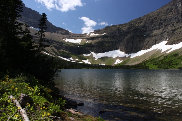
Old Man Lake – Glacier – Aug 6, 2011
Old Man Lake in the Two Medicine area – Img 4077

Old Man Lake – Glacier – Aug 6, 2011
Old Man Lake from above heading for Pitamakan Pass – Img 4092

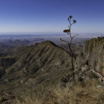
Pitamakan Pass – Glacier – Aug 6, 2011
A view back at Pitamakan Pass on the way to Dawson Pass. This trail from Two Mecidine, over Pitamakan Pass, around Dawson Pass, and back to Two Medicine is 18.8 miles, 2900 feet elevation rise and travels for miles on the Continental Divide. Was a good day hike. Img 4121

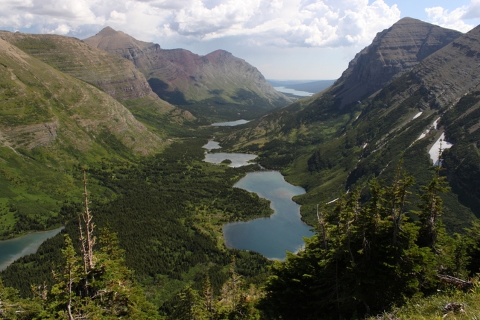
Pitamakan Lake – Glacier – Aug 6, 2011
Pitamakan Lake viewed from the Pitamakin Pass – Img 4111

Sunrise at Two Medicine – Glacier – Aug 7, 2011 – Img 4203

Swiftcurrent Lake – Glacier – Aug 7, 2011
Swiftcurrent Lake on the way to Grinnell Lake. Short easy day hike (7.8 miles) Img 4277

Lake Josephine – Glacier – Aug 7, 2011
Lake Josephine on the way back from Grinnell Lake – Img 4360

Highline Trail – Glacier – Aug 8, 2011
Looking back at Logans Pass (where we started) from Highline trail near the Haystack Saddle. About 8 miles and 830ft elevation rise to Granite Park camp. Img 4546

Highline Trail – Glacier – Aug 8, 2011
Curt crosses the snow on Haystack Saddle of the Highline trail Img 4565

Highline Tail view – Glacier – Aug 8, 2011 – Img 4569

Bear Valley – Highline Trail – Glacier – Aug 8, 2011
Bear Valley – Getting close to Granite Park campground along the Highline trail. Glacier Lilies in bloom. Img 4610

Granite Park- Glacier – Aug 8, 2011
Campground at Granite Park – rained on us that night – Img 4611
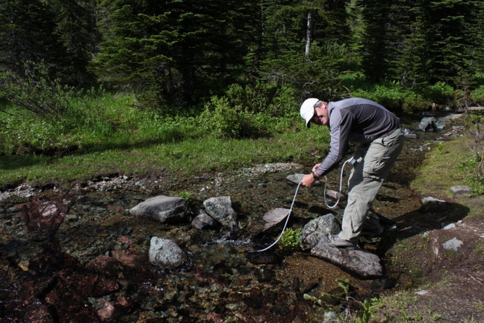
Curt Filtering Water – Glacier – Aug 8, 2011
Curt filtering water at the Granite Park campground – Img 4631

Swiftwater Pass – Glacier – Aug 9, 2011
Heading up to the Swiftwater Pass. 700 feet rise in 0.9 miles then about 6 miles all downhill back to the car at Many Glacier. Img 4672

Randy & Curt – Glacier – Aug 9, 2011
Randy & Curt on Swiftwater pass trail heading for Many Glacier – Img 4708

Swiftwater Trail – Aug 9, 2011
Trail down from Swiftwater pass to Many Glacier – Img 4717

Redrock Falls – Glacier – Aug 2011
Redrock Falls – Img 4946

Moss Campion
Moss Campion on Swiftwater trail – Img 4794
Bullhead Lake – Glacier – Aug 9, 2011
Bullhead Lake from Swiftwater trail – Img 4816

Swiftwater trail falls – Glacier – Aug 9, 2011 – Img 4858

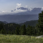
Glacier Sunset – Aug 9, 2011
Around St Mary’s area. Not much color in the sunsets because the air is so clean. Img 4985
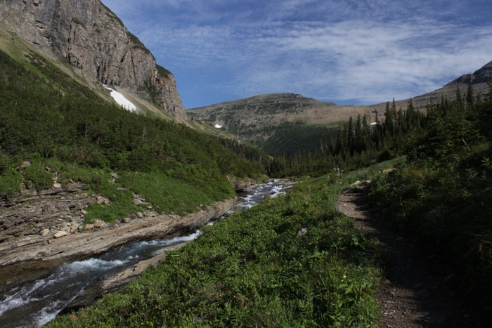
Trail to Piegan Pass – Aug 10, 2011
Peigan Pass is out of sight around the left side of the photo. Nine miles round trip with 1670ft elevation rise. Img 4995

Piegan Pass Trail – Aug 10, 2011 – Img 5026

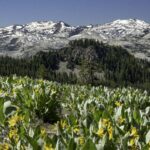
Alpine pond – Glacier – Aug 10, 2011
Alpine pond in Preston Park on the Siyeh Pass Trail. A side trip off of the Peigan Pass trail. Img 5125

Akokala Lake Camp – Glacier – Aug 11, 2011
Our campground at Akokala Lake in western Glacier Nat Park. The hike was about 6 miles in with about 1000ft elevation rise. Img 5263

Lake Akokala – Glacier – Aug 11, 2011
Lake Akokala near Lake Bowman on the west side of Glacier – Had the campground to ourselves – Img 5266

Bowman Lake – August 12, 2011
Bowman Lake on the west side of Glacier Nat Park – Img 5500
Beautiful!! (“Old Man Lake – Glacier – Aug 6, 2011” photo)
Beautiful!!!!! You take awesome pictures. As always…thanks for sharing. (“Old Man Lake – Glacier – Aug 6, 2011” photo)
This is so powerful. When i opened it I could feel the energy I certainly would love to go and sit by the water and just be! (“Old Man Lake – Glacier – Aug 6, 2011” photo)