Karin and I decided to visit and hike in Big Bend National Park area before the closure of the basin to replace the lodge and infrastructure project scheduled for the spring of 2026. This part of the park is scheduled to be unavailable for visiting for 2 (or more) years. We first visited Big Bend in 1987 and I have hiked there 13 times over the years. We also hiked a bit in Big Bend Ranch State Park.
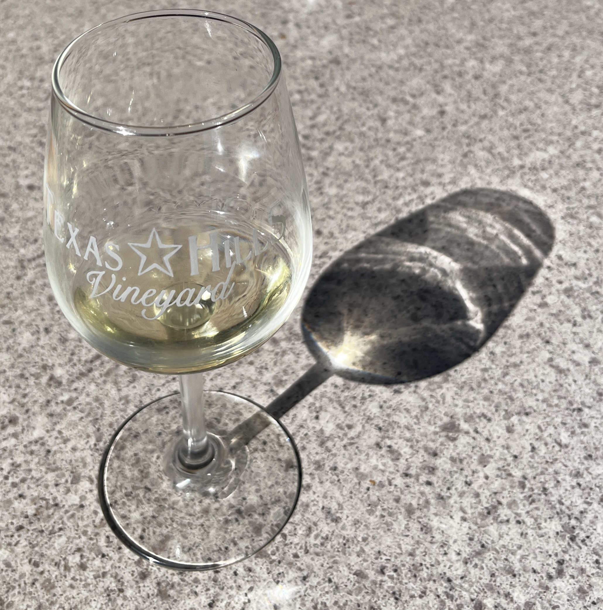
In my “youth” we would drive the 11 hours one way to Big Bend in a day. Now we stop in the Texas hill country and take 2 or more days to travel there. We stopped in Fredericksburg this time and visited a couple of wineries and met up with some family at the Texas Hills Vineyards for lunch and some wine.
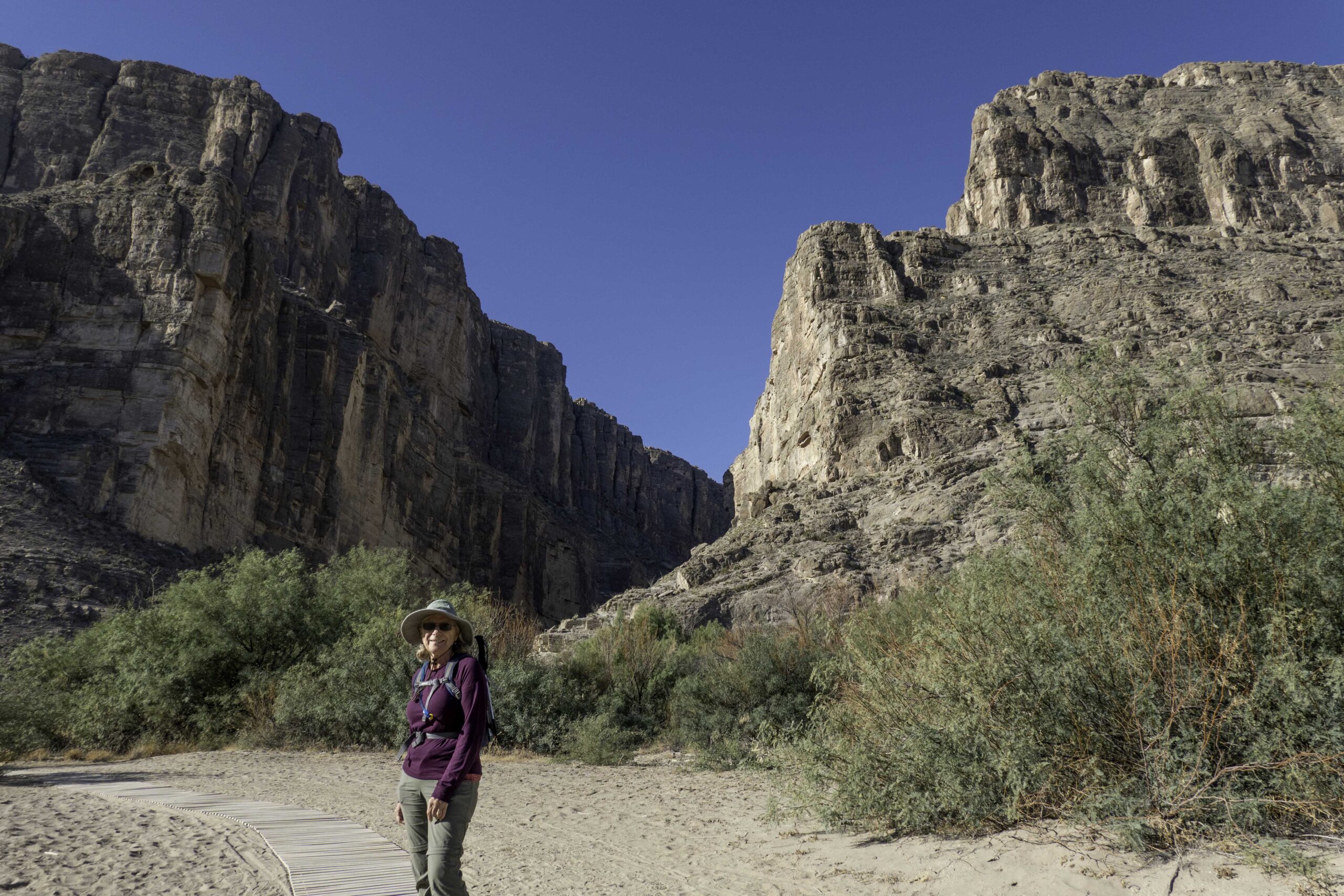
Our first hike in Big Bend this year was the Santa Elena Canyon trail. This short hike is along the US border with Mexico along the Rio Grande River. The river has cut a 1200+ft deep canyon that opens up into the desert. The turbid water of the Rio Grande has so much fine sand suspended in it that the water is often referred to as “liquid sandpaper” which carved the deep canyon. We were not able to hike this popular trail the last time we came to Big Bend because there had been unseasonal rain in the area, and the trail was not accessible. The left side of the canyon is Mexico and the right side is the USA.
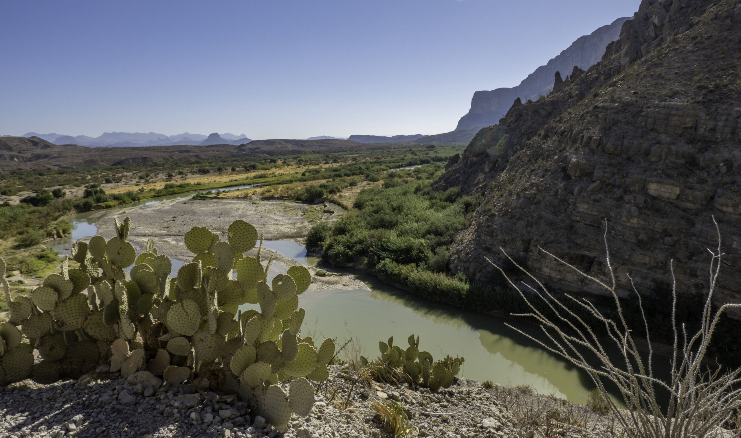
This is a view looking back towards the desert and the Chisos mountain range some 20 miles from the mouth of the Santa Elena canyon.
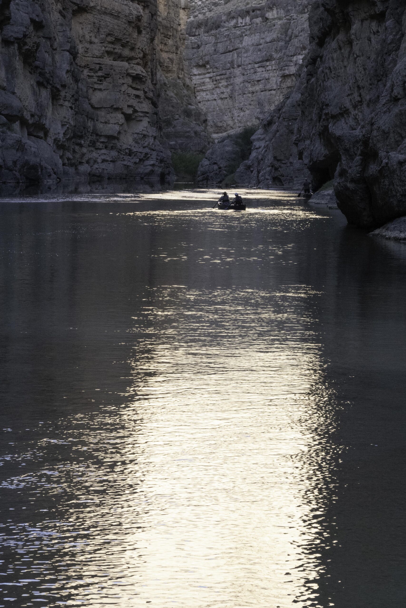
While we were hiking up the trail, there were two guys in a canoe paddling upstream on the Rio Grande.
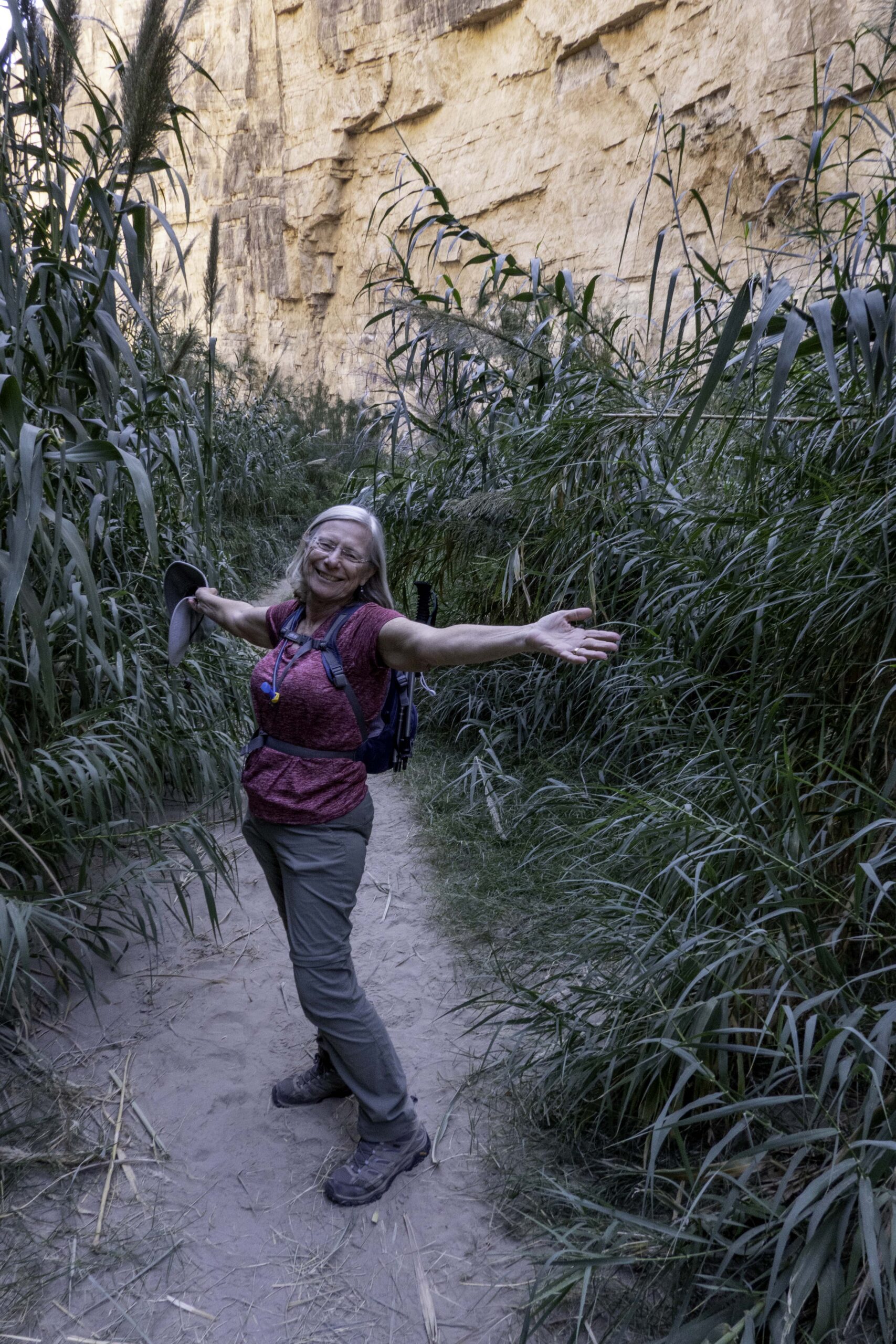
Karin is enjoying the cool shade of the canyon with the sandy trail through the patch of cane along the river. It was warmer than we would like in Big Bend this year.
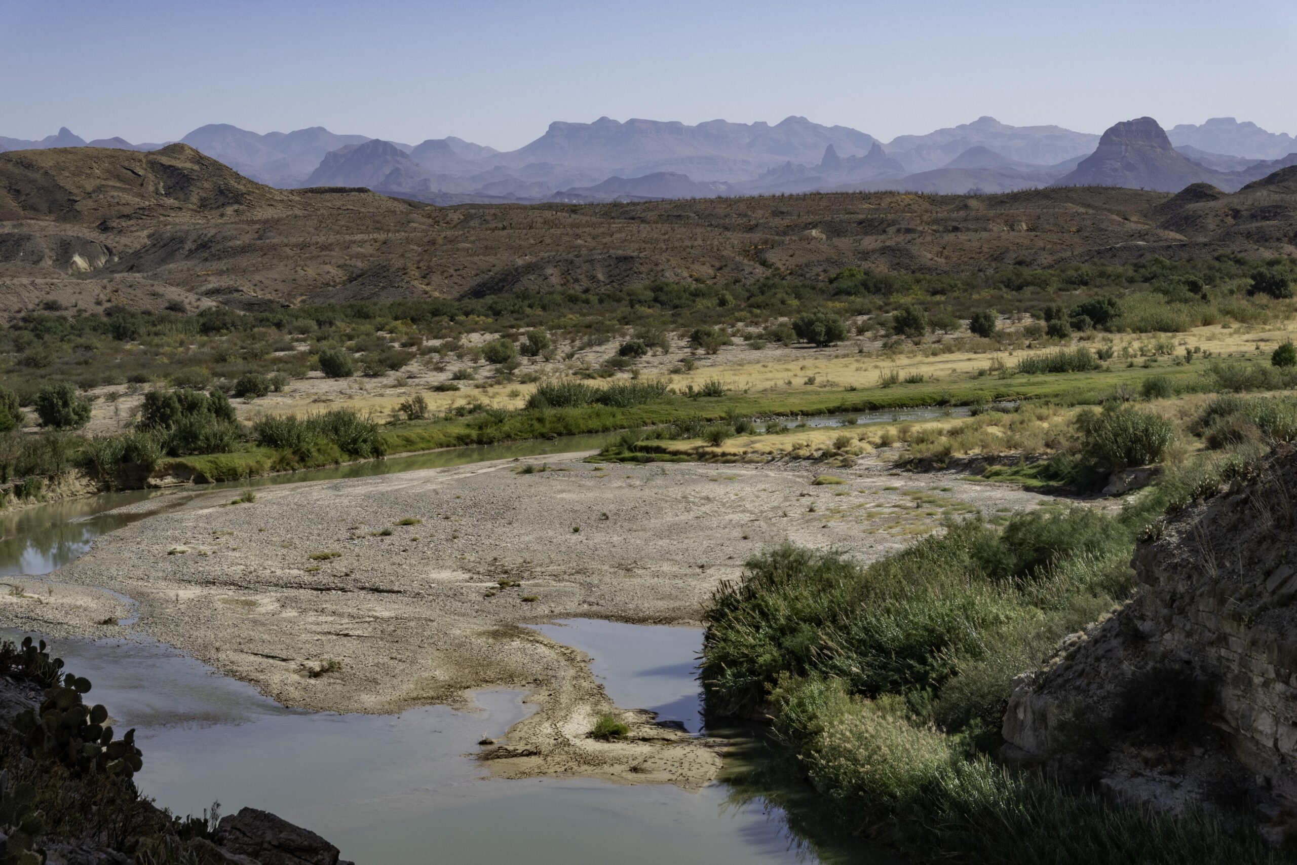
Another view from the mouth of the canyon. The almost flat peak on the right in the foreground is Cerro Castellan close to the site of an old settlement of Castolon. To the left of that you can see the twin peaks called Mule Ears where there is a trail and a spring. The mountain range in the middle is the Chisos Range and the highest point on the right side of the range is Emery Peak, the highest point in the park at 7825ft. (The highest point in Texas is Guadalupe Peak in Guadalupe National Park at 8,751ft). We had planned to also visit Guadalupe National Park this trip but the road to McKittrick Canyon was closed due to the government shutdown.
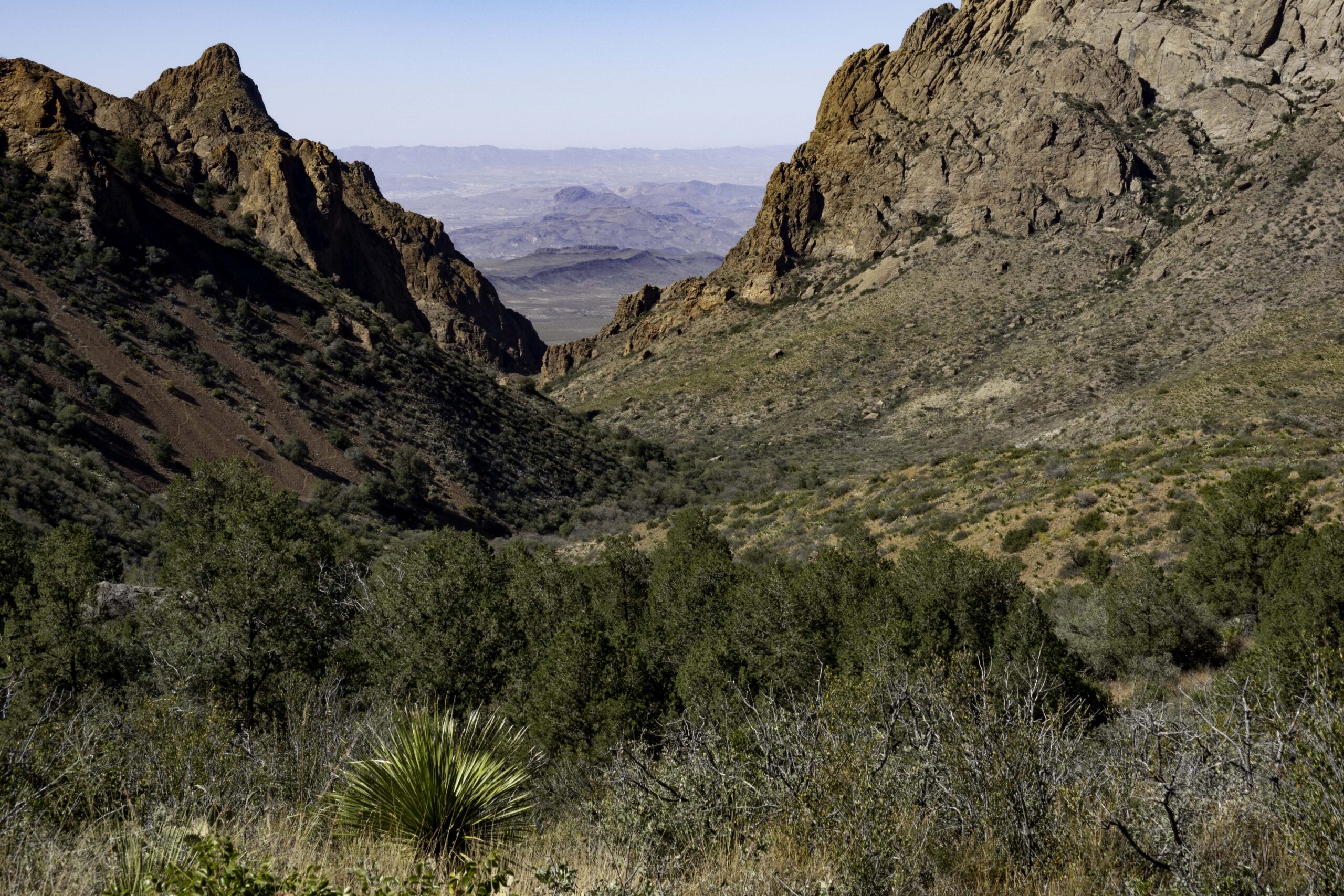
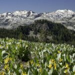
On the way to the South Rim of the Chisos you get these views of the Window of the Big Bend Basin. This one-mile-high basin surrounded by mountains drains to a v-notch called the “window” where any rain drains to an occasional waterfall (called cattail waterfall). Below you can see the Chihuahuan Desert floor surrounding the small isolated Chisos range.
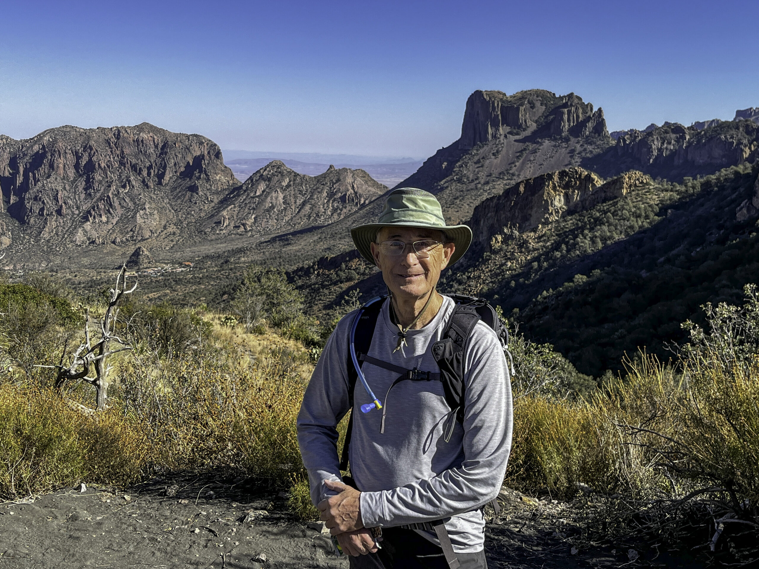
On my way up to the South Rim, I met a couple of other hikers at the pass that leads out of the basin. They were the first people I encountered on the trail that morning. We exchanged taking photos and talked a bit before they headed back down (they were not going further toward the rim). You can see the red roof of the lodge in the basin (left of my head) where the trail begins about 1500 feet below.
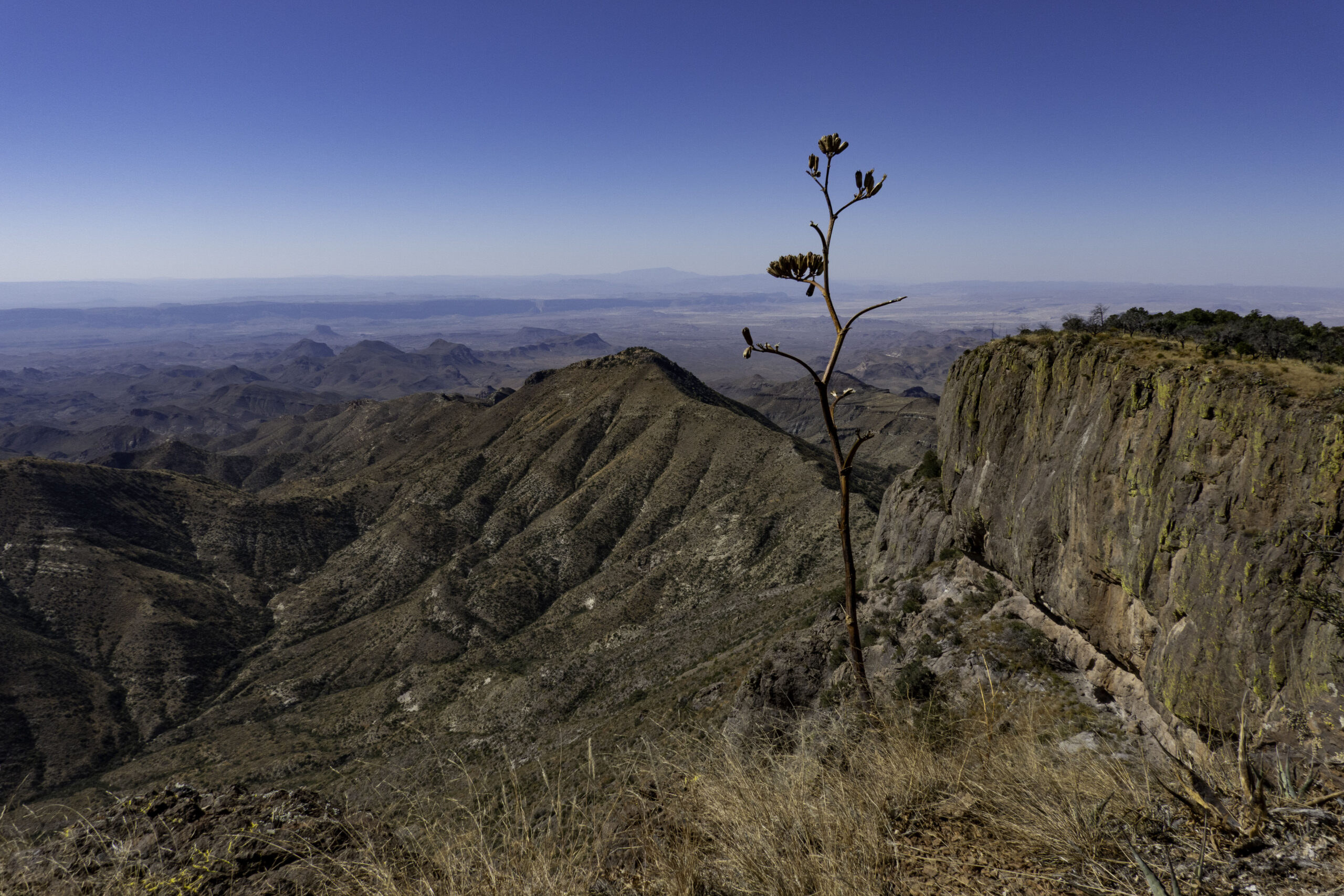
This view is from the Big Bend South Rim on the south edge of the Chisos range with an almost vertical drop of 2000ft to the Chihuahuan Desert floor below. It was my lunch spot and the destination of the hike. I have hiked this trail 10 times over 40+ years and it never disappoints (but the trail seems to get longer and a higher climb as time passes?). The trail I followed is about 13.5 miles round trip and about 2,400ft elevation rise but there are several different paths one can take. Along the top of the photo is a dark horizontal cliff below the horizon that has a “v-notch” just left of the center of the photo: that “notch” is the 1200+ft deep Santa Elena Canyon from the previous hike that is almost 20 miles away. On this day the sky was a bit hazy but still there was a great view.
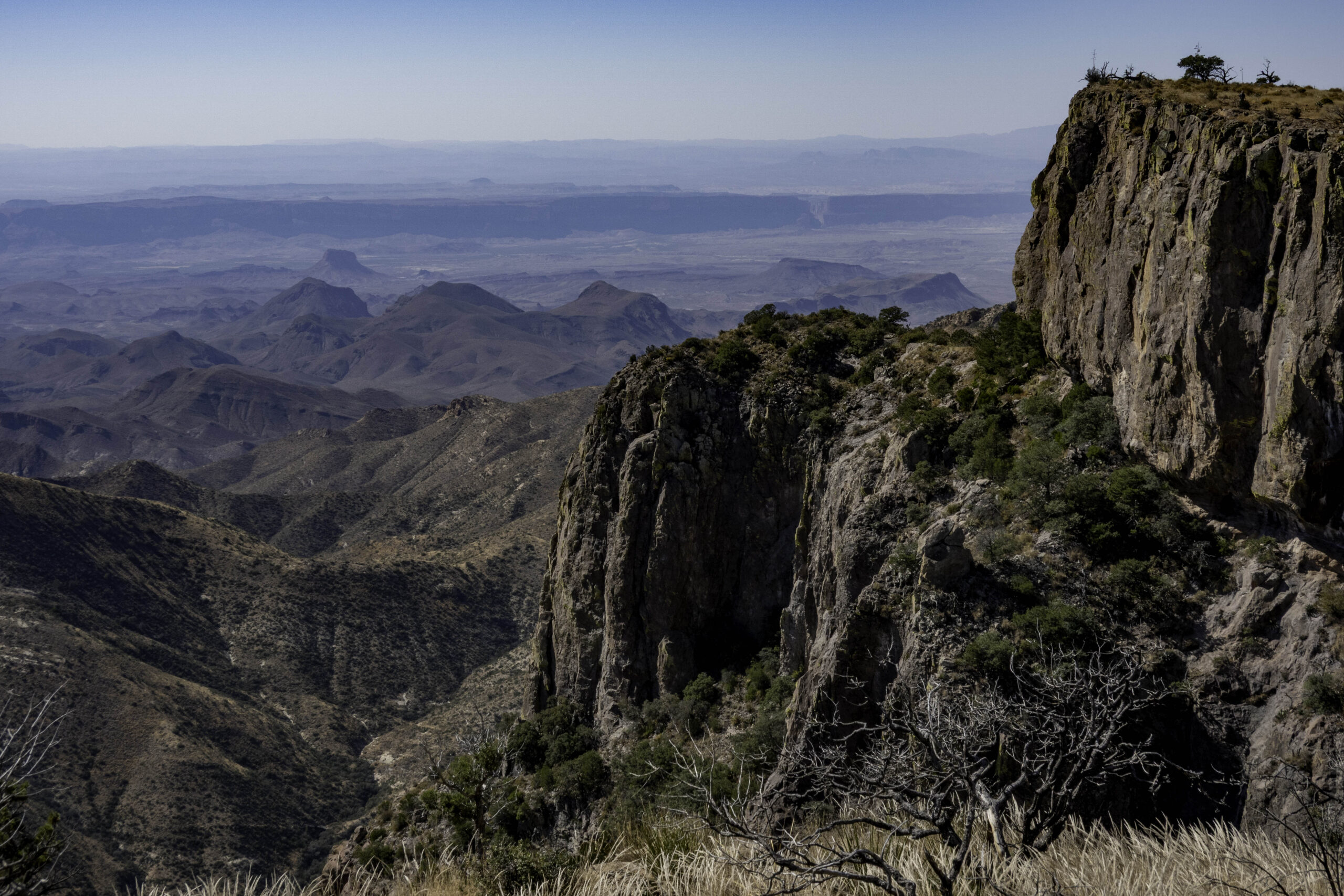
Another view from the South Rim more toward the southeast with the Sierra del Carmen range in Mexico in the distance.
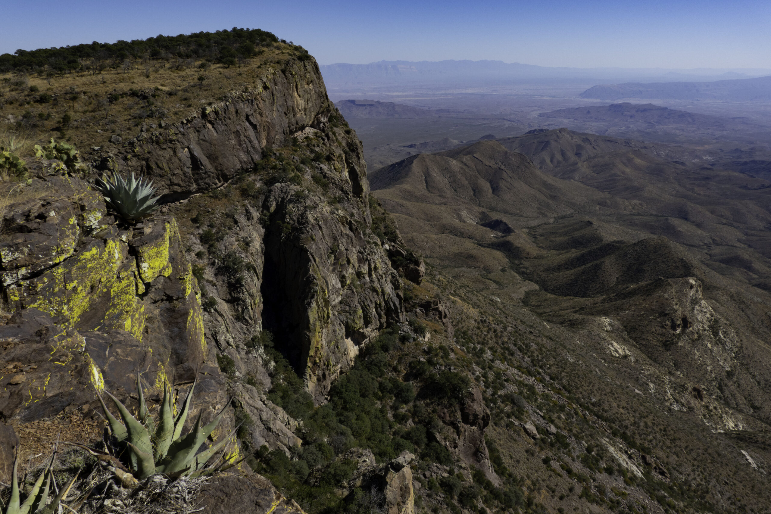
My South Rim lunch spot was under the tree on the top edge of the rim. You can see Santa Elena Canyon in this photo also.
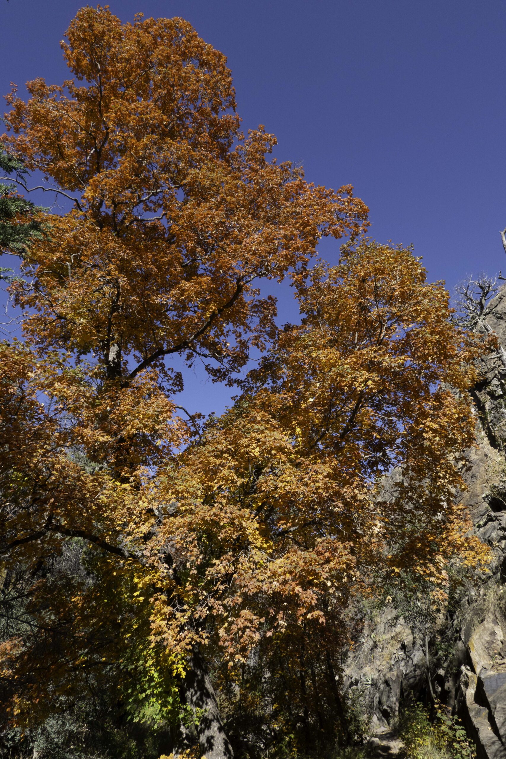
One of the reasons I like to do the South Rim hike in the fall is the unexpected burst of fall color from the Texas Bigtooth Maples in Boot Canyon. The Canyon collects enough runoff of the sparce rain to foster these maple trees and provide this unexpected flush of fall color not found in many places in Texas.
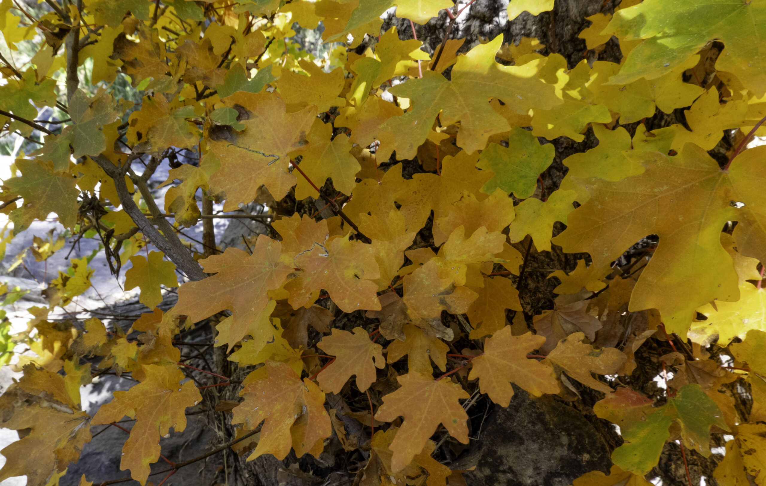
The Texas Bigtooth Maple leaf is actually fairly small but the indented edge of the lobes is deep hence the name “bigtooth”. The tree is found in a few places in the Texas hill country and at higher elevations in west Texas.
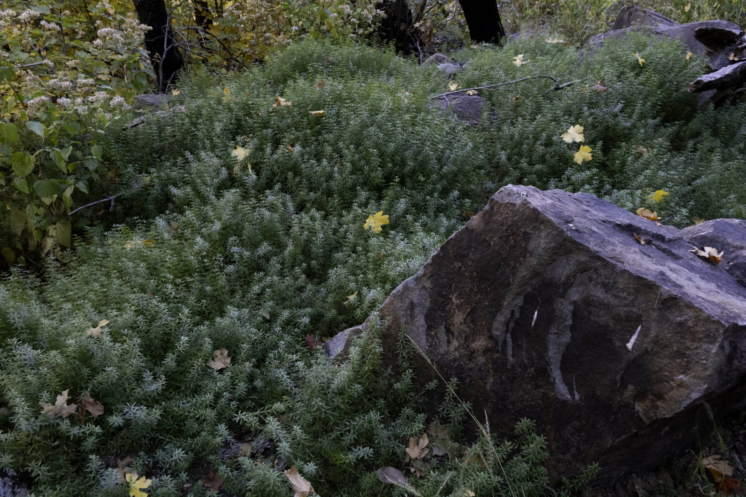
With just a bit of rain, Boot Canyon can have some green that is not found in this dry mountain area. Often you can find deer, birds, and other animals in this area. This time I only saw a ribbon snake.
The lava chimney shaped like an upside-down boot provided the name for Boot Canyon.
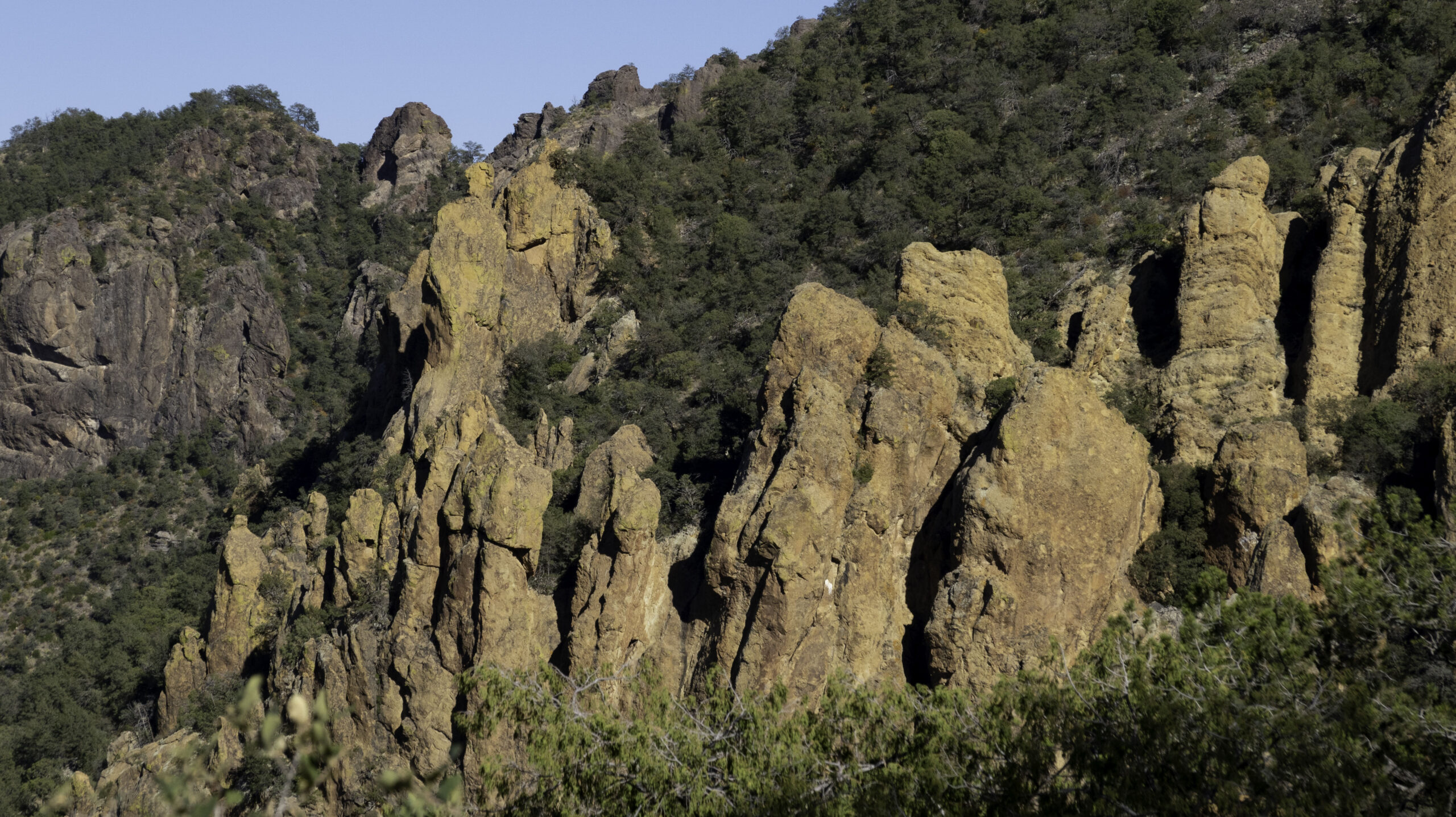
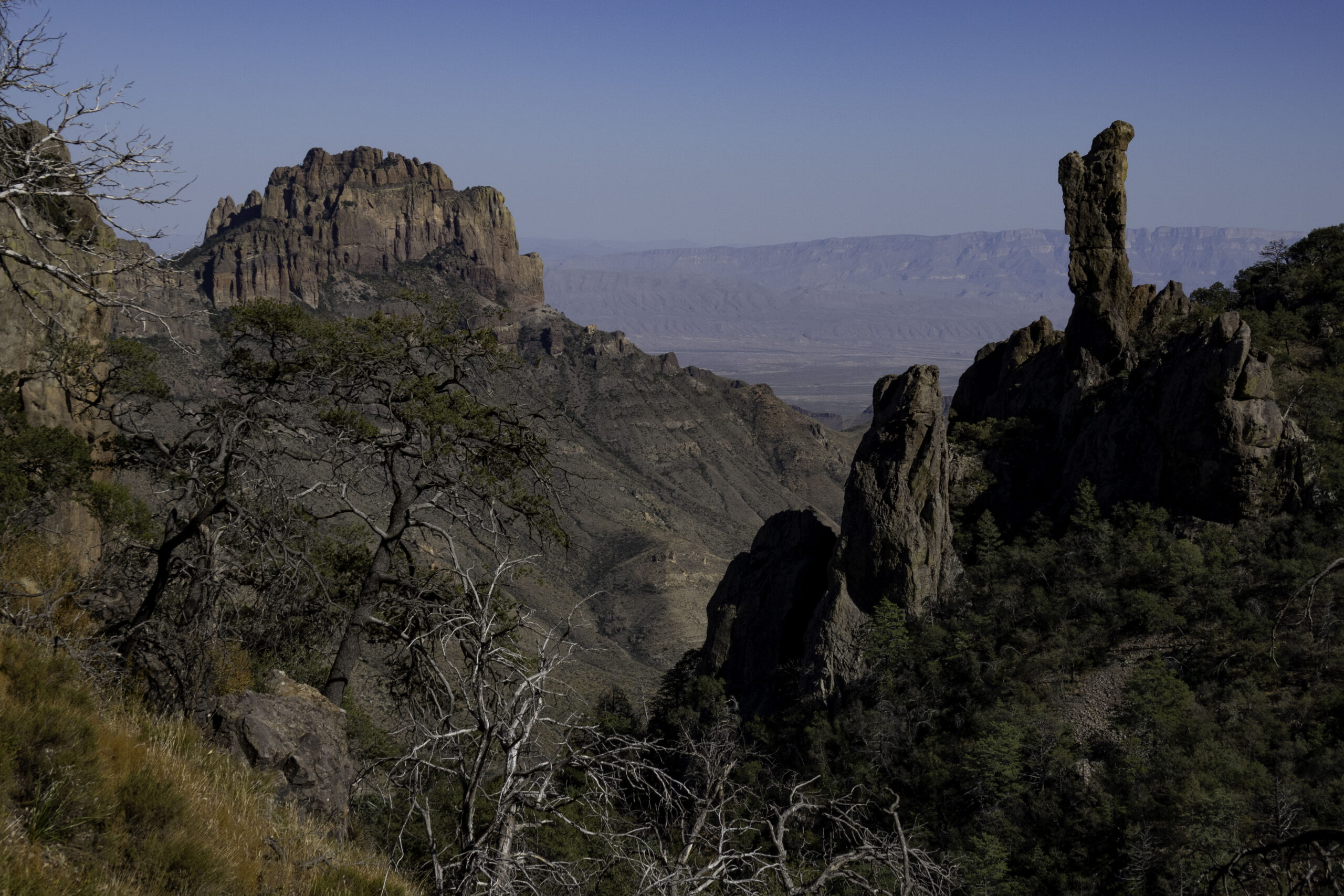
The near vertical rock formations were glowing orange in the late sunlight as I descended the steep Pinnacles Trail coming down from Boot Canyon and the South Rim.
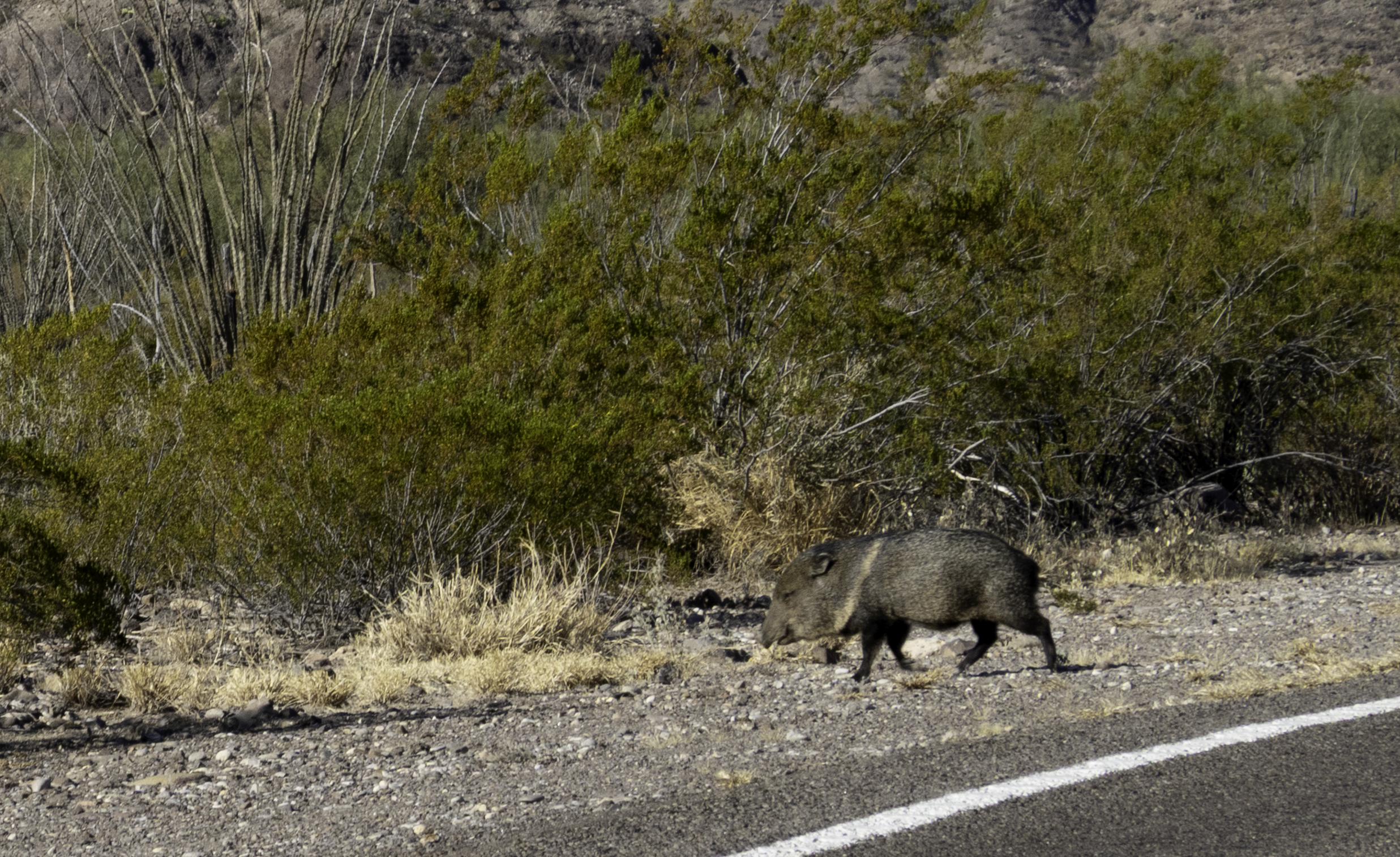
I managed to photograph the last Javelina in a herd that was crossing the road. A Javelina is neither a rodent nor a pig, but a peccary, a type of hoofed mammal that is only distantly related to pigs. They are omnivores and eat roots, grubs, and a variety of other foods.
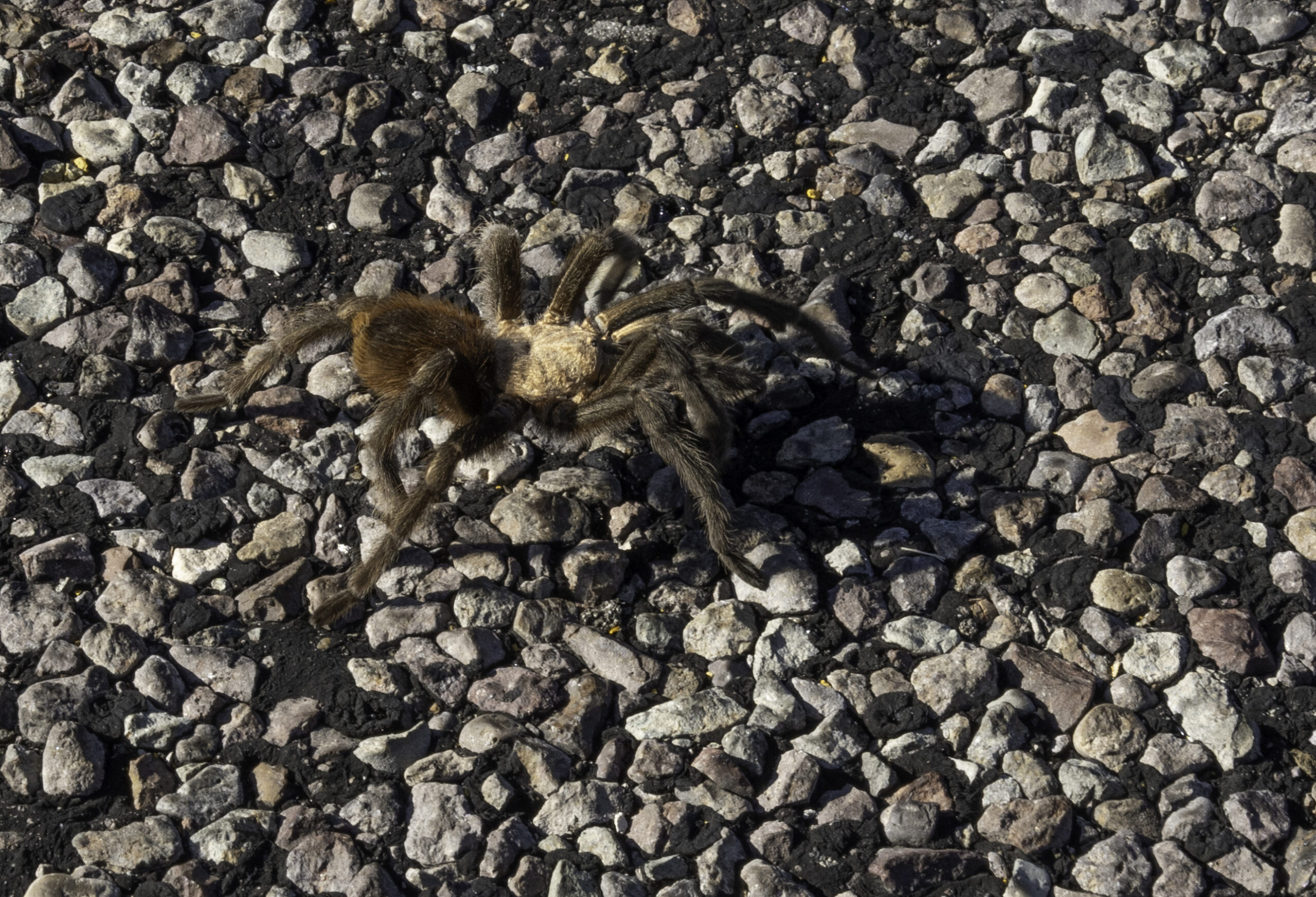
On the very same road I spotted several male Texas brown tarantulas. They emerge from their burrows and begin wandering across the landscape in search of a mate. Texas brown tarantulas (Aphonopelma hentzi), is one of the largest spider species in North America, with 12cm legspans and hairy brown bodies built for survival in the desert.
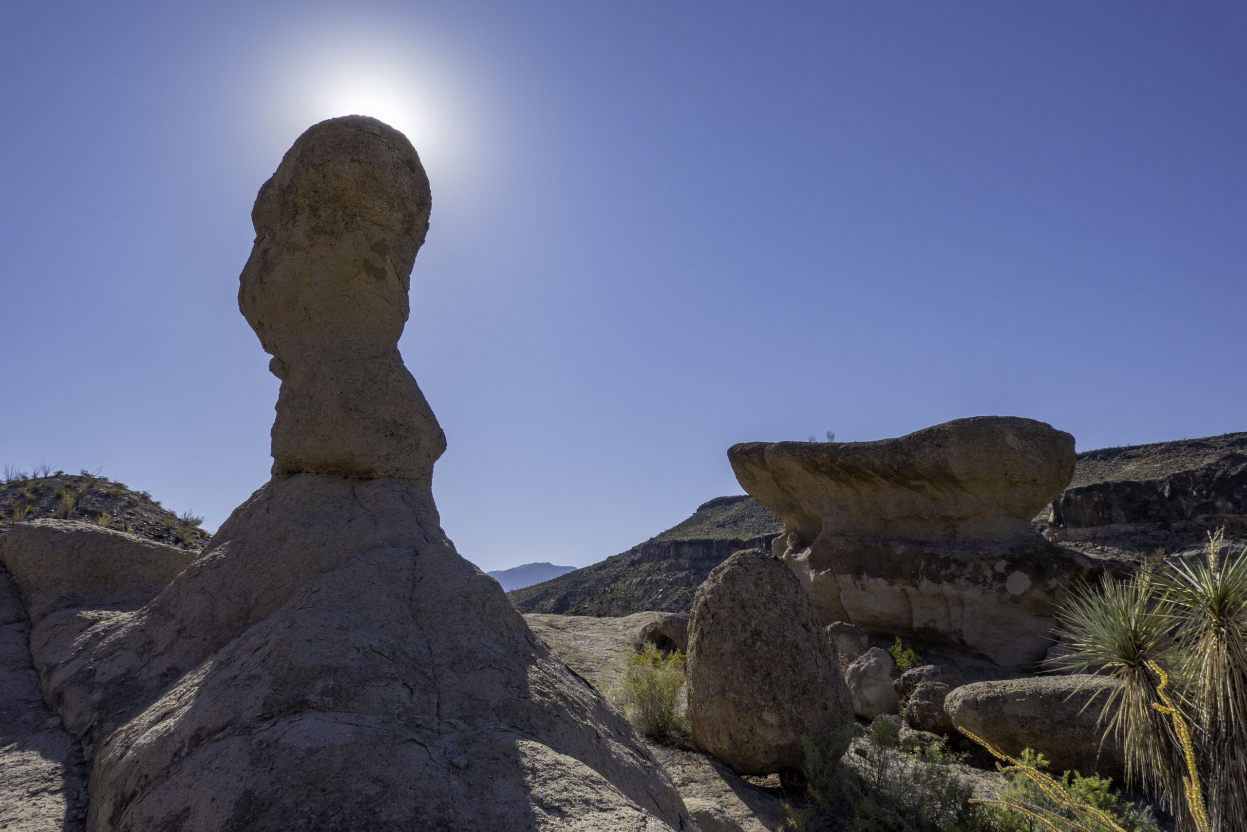
In Big Bend Ranch State Park, we did two short hikes, the first was the Hoodoos Trail that has several hoodoo formations along the Rio Grande River.
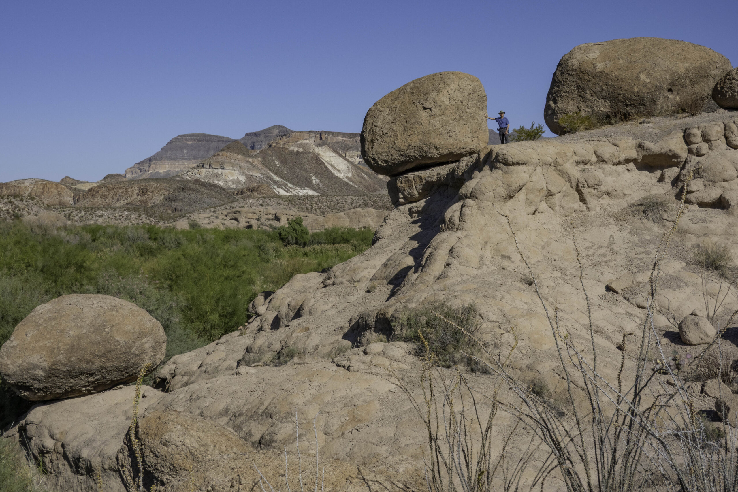
Karin took this photo of Randy climbing around the Hoodoo formations. The Rio Grande river separating Texas from Mexico provides the water for the green plants on the left.
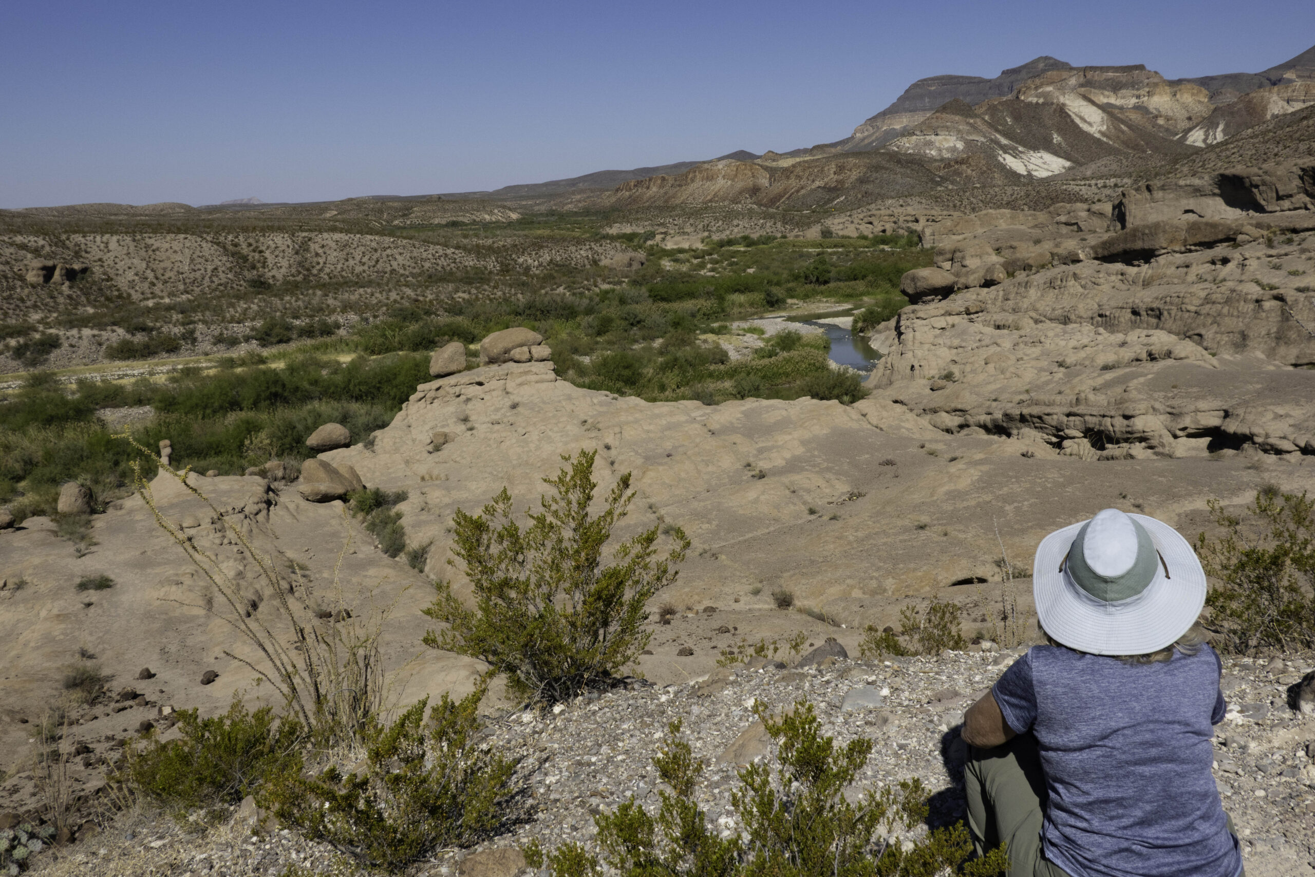
Karin is enjoying the view overlooking the hoodoos and the view of a small section of the Rio Grande River.
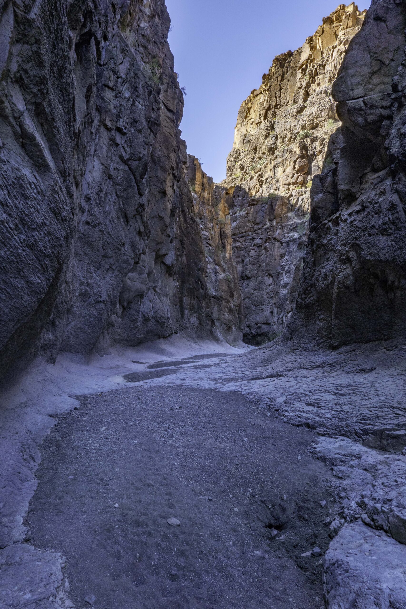
Our last hike before heading back home was the Closed Canyon trail in Big Bend Ranch State Park. This short trail follows a deep but wide slot canyon down to a point where it becomes a more technical climb down to the Rio Grand River.
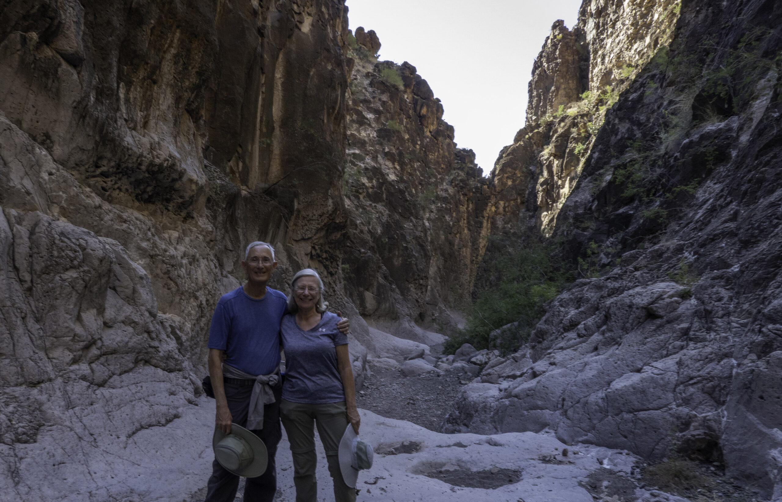
Randy and Karin in Closed Canyon. The next day we started our way back home.

Great photos and trip report! I really enjoyed this. This park is on my life list.
Thanks for sharing your photo journey! Awesome photography and explanations.
Randy – Those are some beautiful photos. I’m glad you and Karin are enjoying retirement. Thanks for sharing.
Looks like a great trip Randy. Glad you got out there before that part of the park is closed.
Great pictures Randy. It’s been a while since we were there and hope to go back again. I love the cane section of the Santa Elena hike. I’ll never forget hiking there and we came upon 2 copperheads curled up directly across from each other, watching for prey we guessed. We moved very slowly past them and luckily they weren’t interested in us!