At the beginning of the second week in August, I made my first visit to Alaska for a 3 week hiking trip. I had planned this trip with Tom but unfortunately, Tom sustained a leg injury a month before the trip that prevented him from going. Luckly, Jim, a hiking friend of a friend was both available and interested to step in. Jim and I met in person for the first time at the airport for our flight to Alaska. We both had a great time exploring a small portion of the massive state of Alaska. I hiked a total of 104 miles of trails with a bit over 19,000 ft of elevation over 3 weeks. Jim did 2 more days of hiking while I rested a troubling Achilles tendon issue.
Denali National Park was our first destination after arriving in Anchorage. Our 4 hour drive to Denali was mostly sunny and cool. At the time we did not realize that it would be one of a few days where we saw the sun most of the day. It also gave us a great view of Mount Denali during the drive to the park.
There are quite a few photos in this posting. I took over 1000 frames, narrowed that down to about 250 that I kept, and there are about 60 photos posted here.
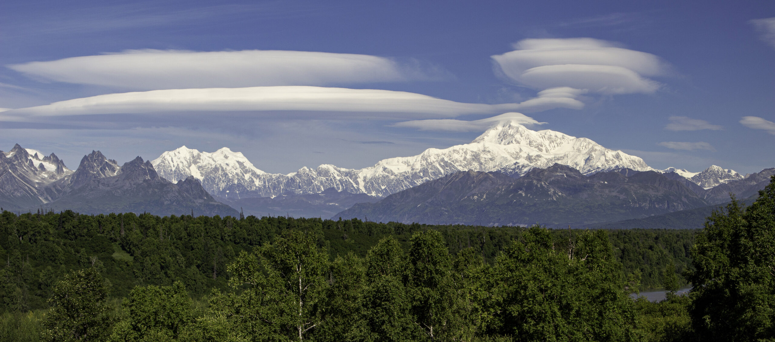
We were getting views of Mt Denali as we approached the park and stopped as the South View Point to see the highest mountain peak in North America at 20,310 ft above sea level. Denali is the tallest mountain in the world as measured from the base to the peak – over five thousand feet taller than Mt Everest (even though Mt Everest peak is higher). We were very lucky to get this sight as Denali is only visible about 30% of the time. In addition, there were several lenticular clouds formed around the peaks. These saucer shaped clouds are formed by the air eddies caused by the wind swirling after passing the mountain peaks.
Here is Jim on the trail up to the Mt Healy Lookout, our first hike in Denali Nat Park. This was supposed to provide a view of Mt Denali, but it was partly obstructed by other mountains and not as good as the view from the South Viewpoint.

This is a view across Horseshoe Lake in Denali Nat. Park with the more typical Alaskan grey sky. This lake was created by beavers with a couple of dams on the opposite end of the lake. You might notice on one of the shoreline extensions into the lake on the left side in the distance is a person that was about to take a dip in the frigid waters. By the time we hiked around to that side of the lake, they had completed their very short dip and were trying to warm back up.
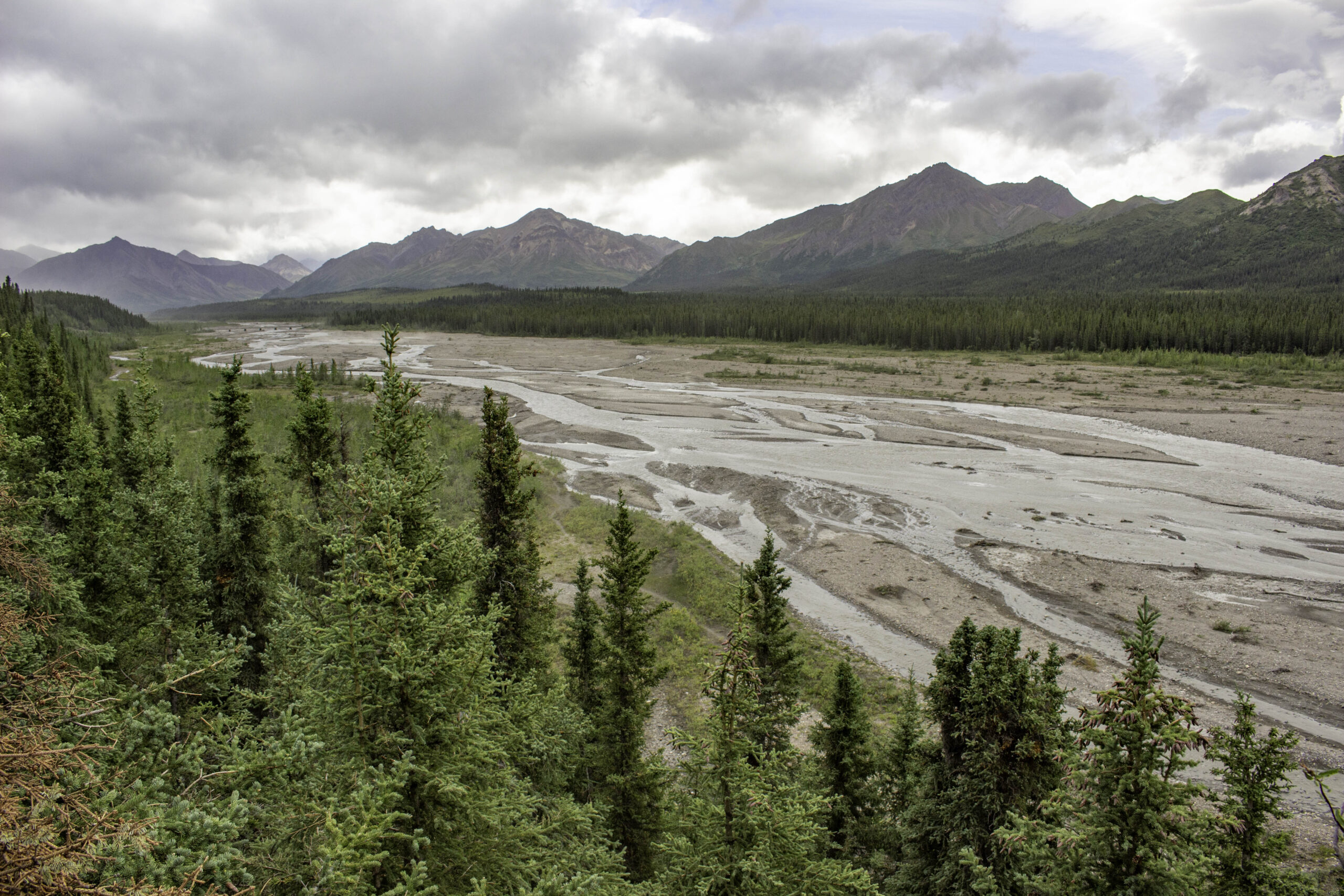
The Teklanika River in Denali is a typical glacier fed braided river. The braided path is constantly changing as the sediment from the glaciers drops out and diverts the flow. The slow movement of the glacier breaks, grinds, and moves the rock in its path. There are so many suspended fine particles that the water has a milky turquoise color.
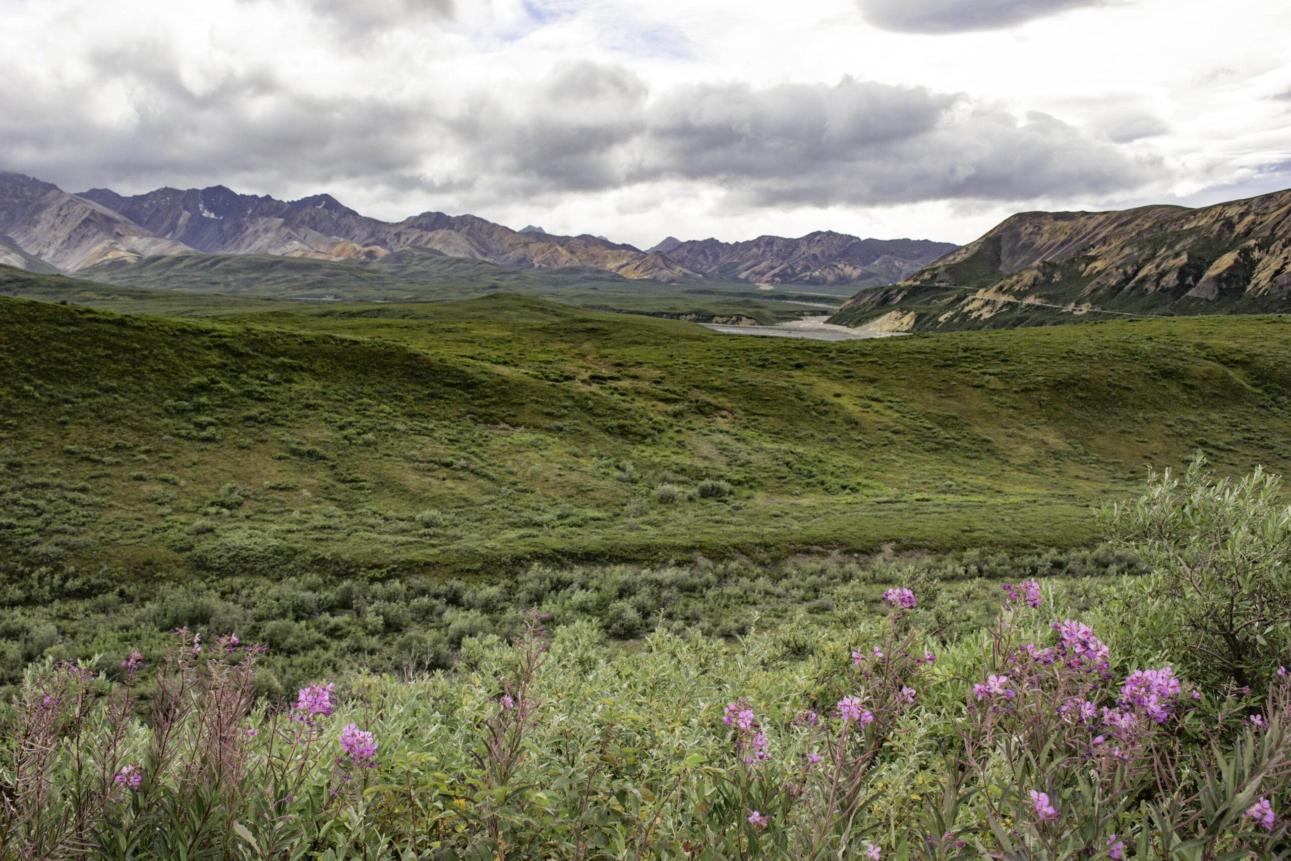
This view with the pink Fireweed (Chamerion angustifolium) in the foreground and the Polychrome/Pretty Rocks area on the right side is at mile 43. This is as far as you can currently go on the 92 mile road through the park, the only road in the park. If you look closely at the road crossing the Pretty Rocks area you can see the landslide that disrupted the road. The area contains permafrost that is beginning to melt out and is no longer stable. The current plan is to build a bridge across this area to reconnect the road, but it will take years. The area of the park further down the road is closed until the bridge opens the road again.
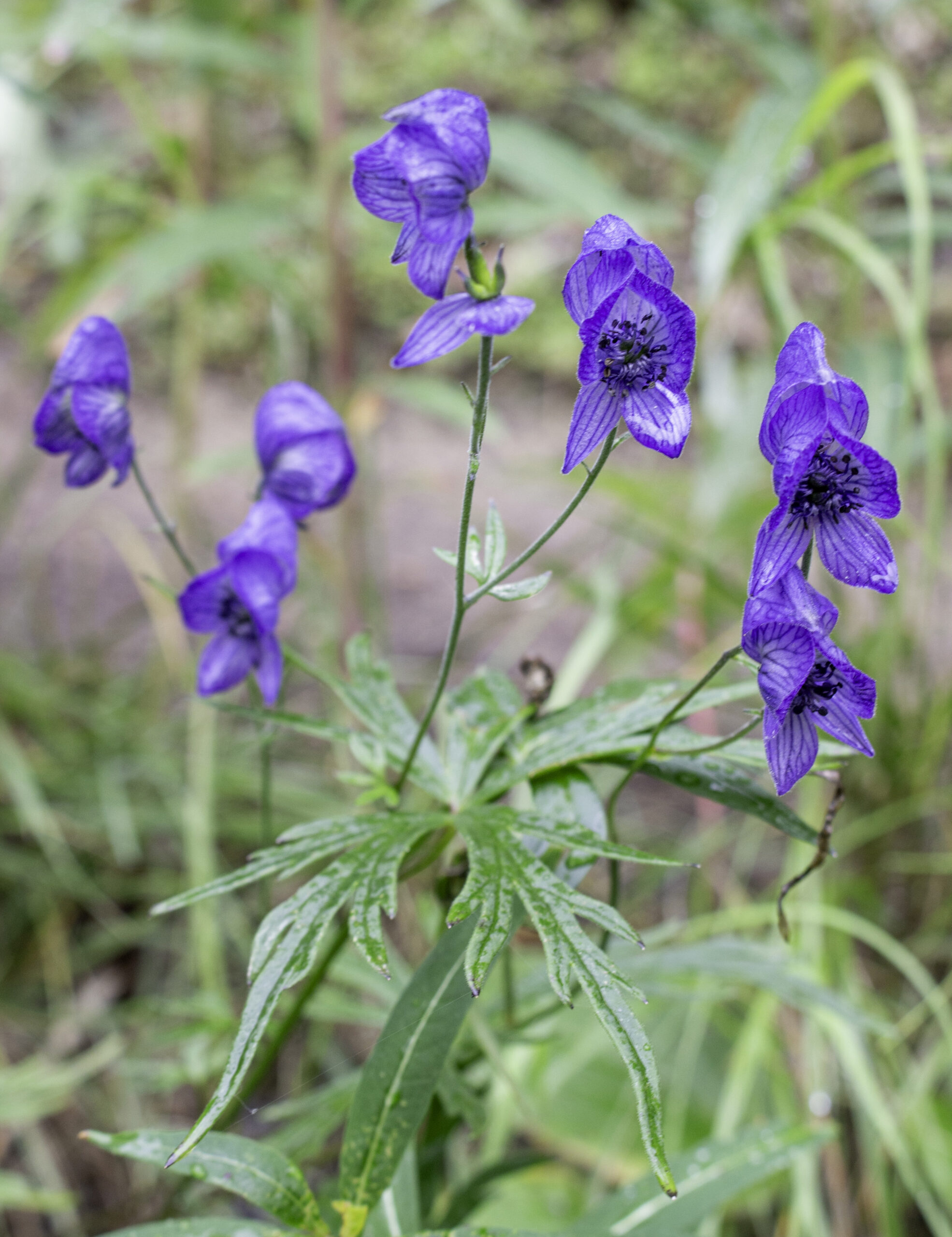
Photo of Monkshood (Aconitum delphiniifolium), also known as wolfsbane, was one of the few flowers still blooming. The plant is very toxic but very pretty.
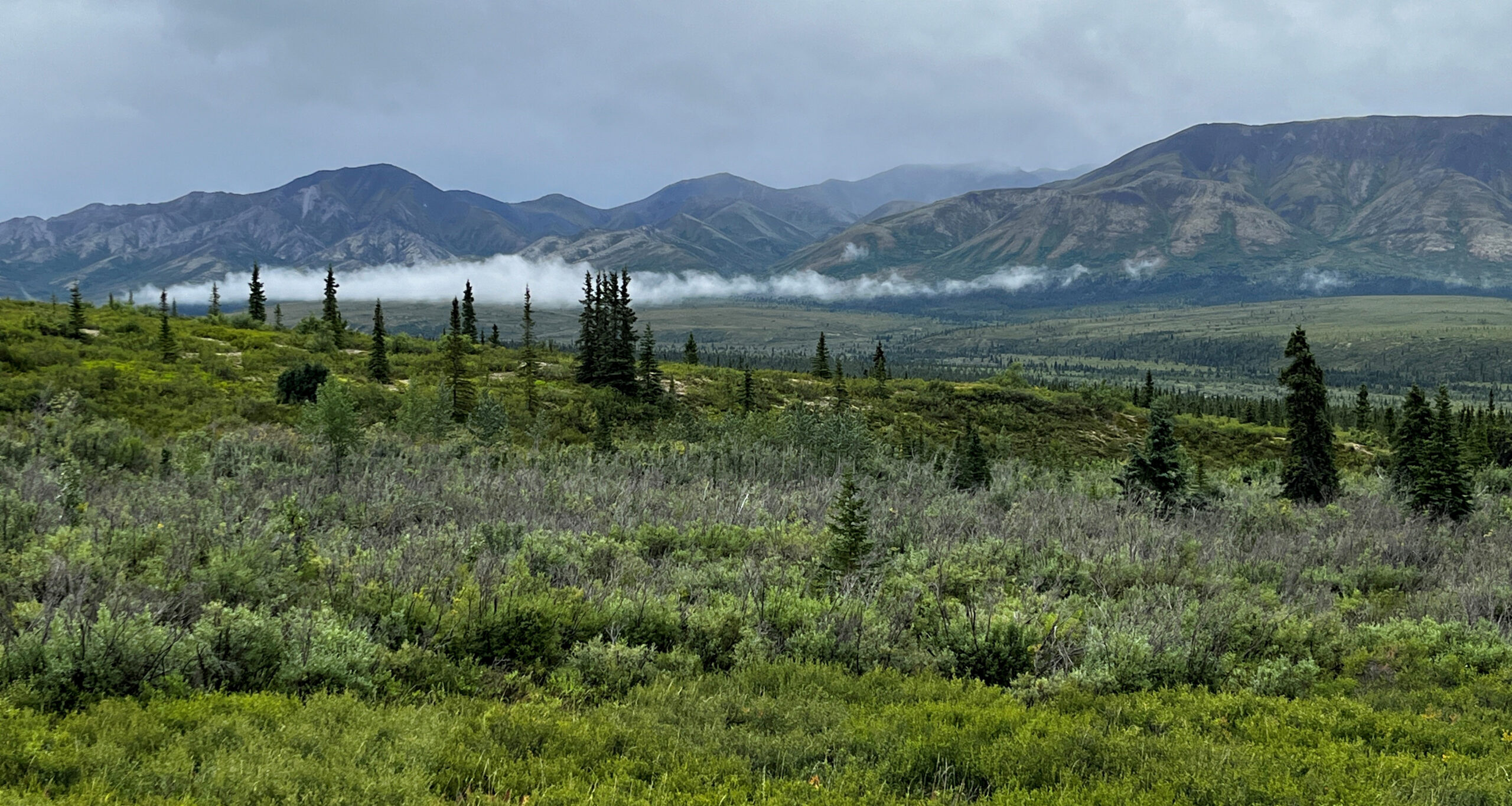
We did a couple of trails in the Savage River area in Denali along the park road. The trees in this tundra area were all small and spread out. The trees can be 80-100 years old but grow very slowly due to short growing season.

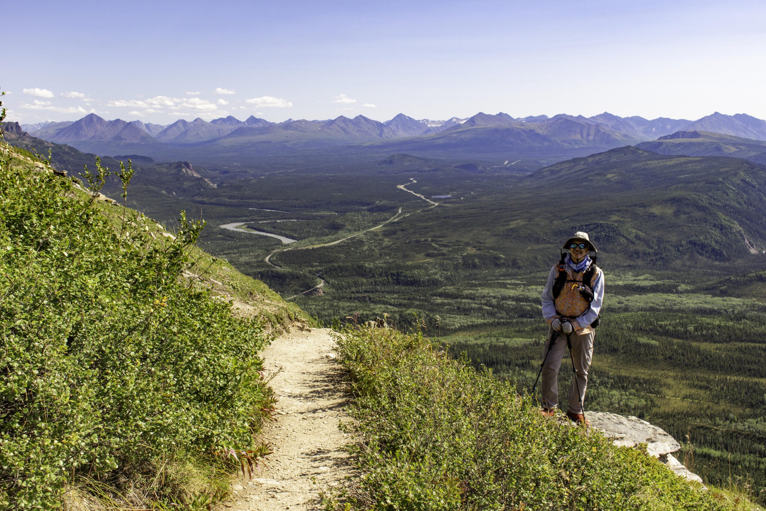
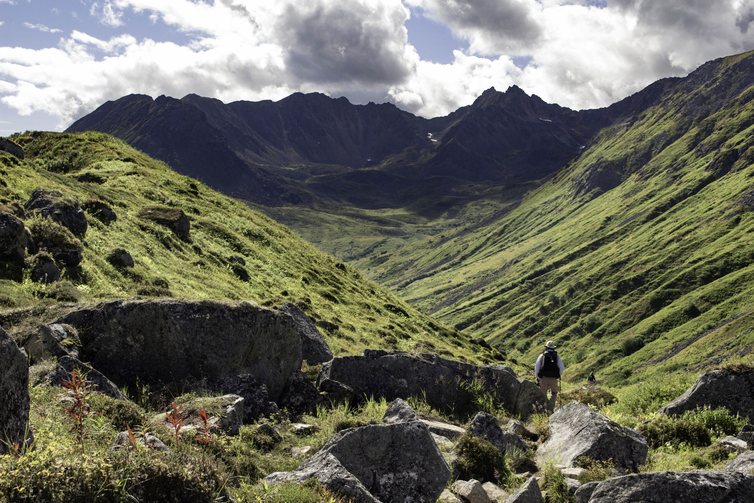
Jim is at the peak of the Savage Alpine trail looking out over the Denali valley and the Alaskan Range beyond.

Fireweed and the Alaskan Range from the Savage Alpine trail in Denali
 .
.
Jim took this photo of me enjoying the view of Denali from the Savage Alpine trail in Denali.
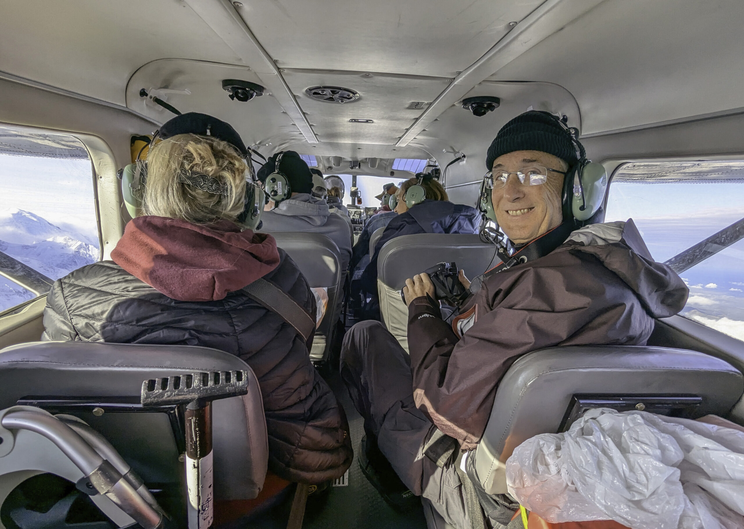
Jim and I took a small airplane excursion with Fly Denali to land on a glacier below Mt Denali. Our original time was canceled due to bad weather/rain (a common situation) but we were able to reschedule for our last day in the Denali area. There were 9 seats in the plane, including the pilot. Jim took this photo from the rear of the plane.

We could clearly see the twin peaks on Mt Denali, the highest mountain in North America. The weather was great for the morning of our rescheduled Fly Denali flight. It had rained most of the days we were in Denali, which had provided a fresh coat of snow on the mountains and glaciers. In this photo you can see several of the glaciers combining into one. There are at least 40 named and hundreds of unnamed glaciers in Denali National Park.

In this photo you can see the clouds spilling over the mountain tops from the valley beyond, unfortunately, the same valley where our flight was supposed to land on the glacier. Aircraft are only allowed to land in certain areas since much of Denali is a wilderness, The pilot correctly decided not to land where they could not see but instead, we flew through multiple valleys and passes around Mt. Denali.
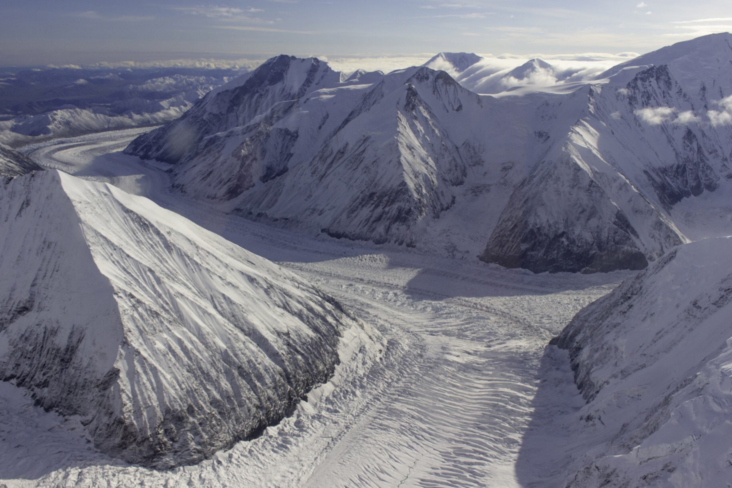
More views of the glacier-carved valleys around Mt Denali. The “ripples” on the glaciers are cracks called crevasses that are 2-10 feet wide. This helps to realize the massive scale of the glacier.

As we headed back to the landing runway, the clouds were overtaking the Alaska Range and Mt Denali disappeared back into the clouds that normally surround it. We were lucky with the timing for the views even if we did not get to land on a glacier (we will have plenty of time later on this trip to climb around on glaciers).

Sunset and moonset over Kachemak Bay from Lands End in Homer, AK. Our next stop was to tour/hike in Kachemak Bay State Park with Backroads.

I took this early morning photo of the Kenai Range across Kachemak Bay while on a water taxi from Lands End to Kachemak Bay State Park.
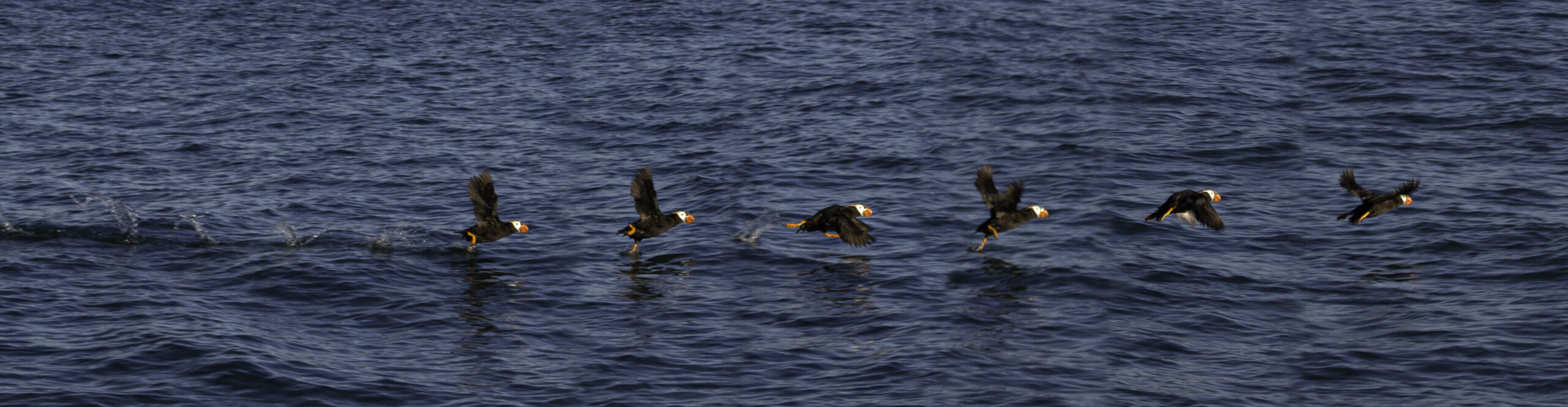
While on the water taxi, this Puffin took flight from the water by “walking” on the water as it flapped its wings. This is a combination of multiple photos (edited in Photoshop).

The water taxi dropped us off on a beach in Kachemak Bay State Park, Jim is on the left on the boat and Cara, one of our Backroads guides is on the boat on the right. The taxi would come back to pick us up later in the day.

We hiked out to Grewingk Glacier Lake in Kachemak Bay State Park and had lunch on the beach/shoreline of this glacier lake.
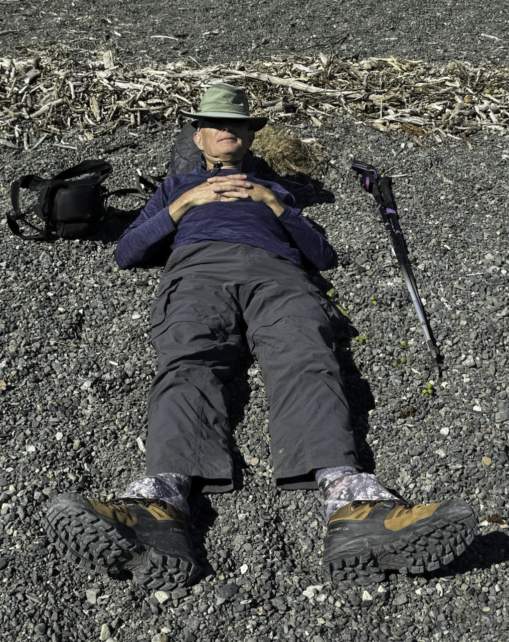
After a nice lunch and since this was one of the few sunny days, I took a rest on the beach. Carolyn took this photo at a rare moment of me standing still.
View of Kachemak Bay where we would meet our water taxi to return to Lands End. It was a great sunny day for a change.

Here is Jim working his way up one of our most challenging hikes, the Harding Icefield End of Trail in Kenai Fjords National Park: 10.5 round trip miles with 3477ft elevation rise. The trail starts in temperate rain forest, then up to tundra, then alpine, then finally to barren rock and ice/snow. The flowers along the trail include Cow Parsnip and White Burnet.
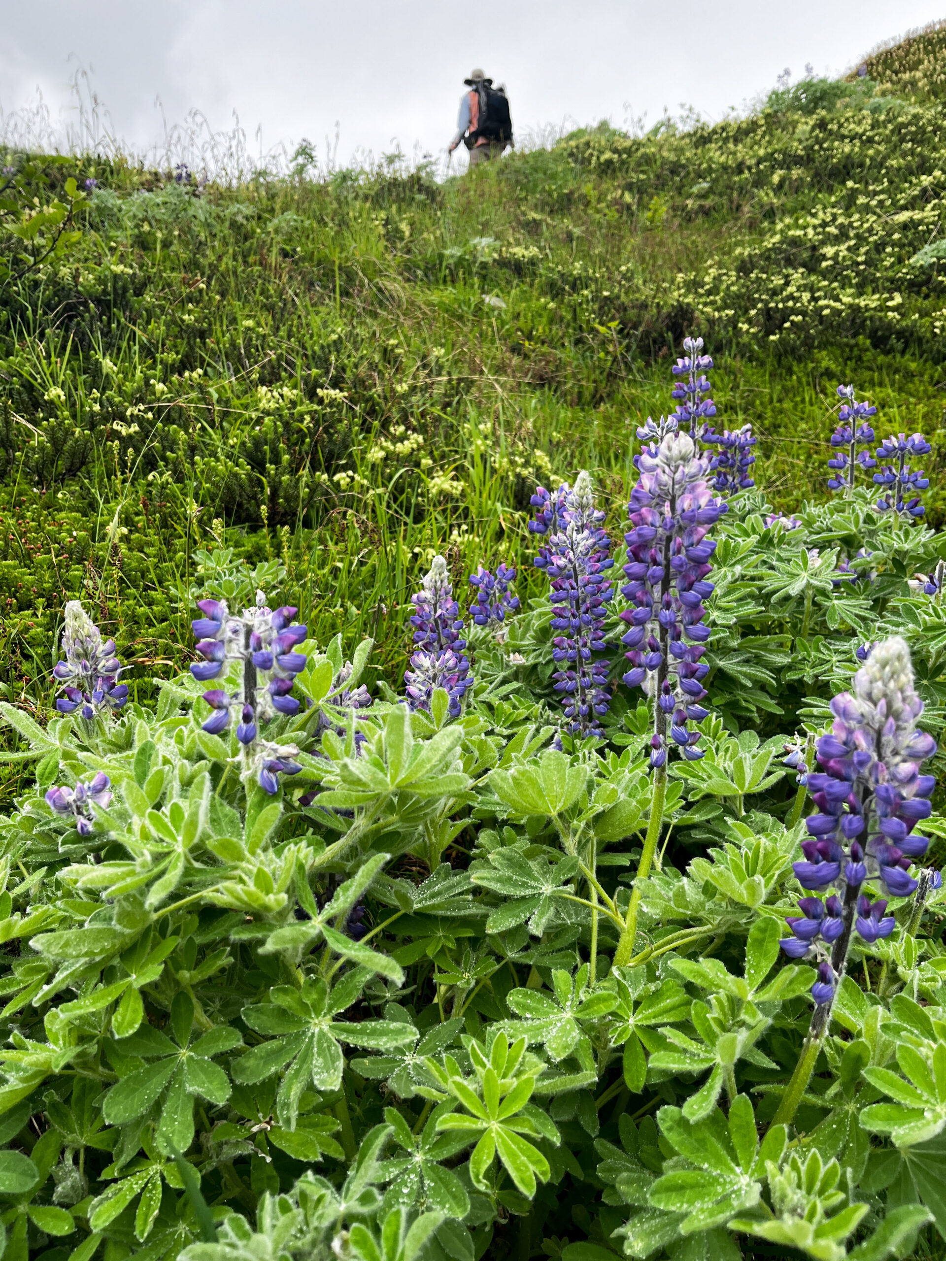
As we climbed in elevation on the Harding Icefield trail, we began to find late blooming flowers that had finished up on all our other lower altitude trails. Here are some Arctic Lupine (Lupinus arcticus).
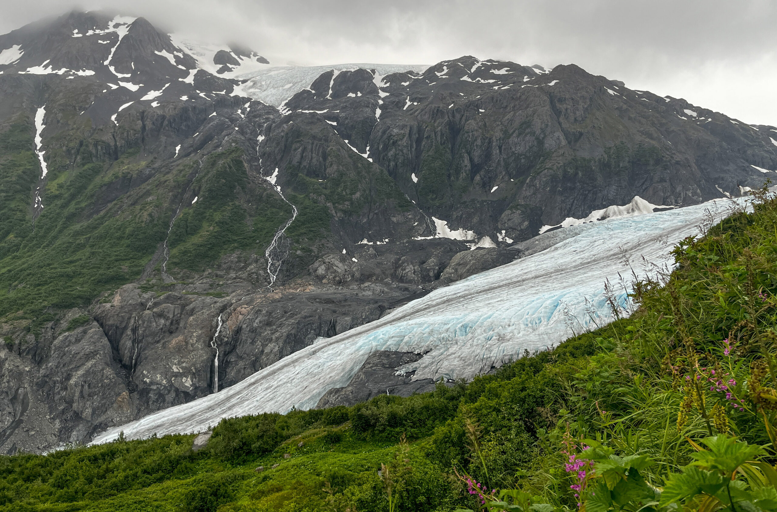
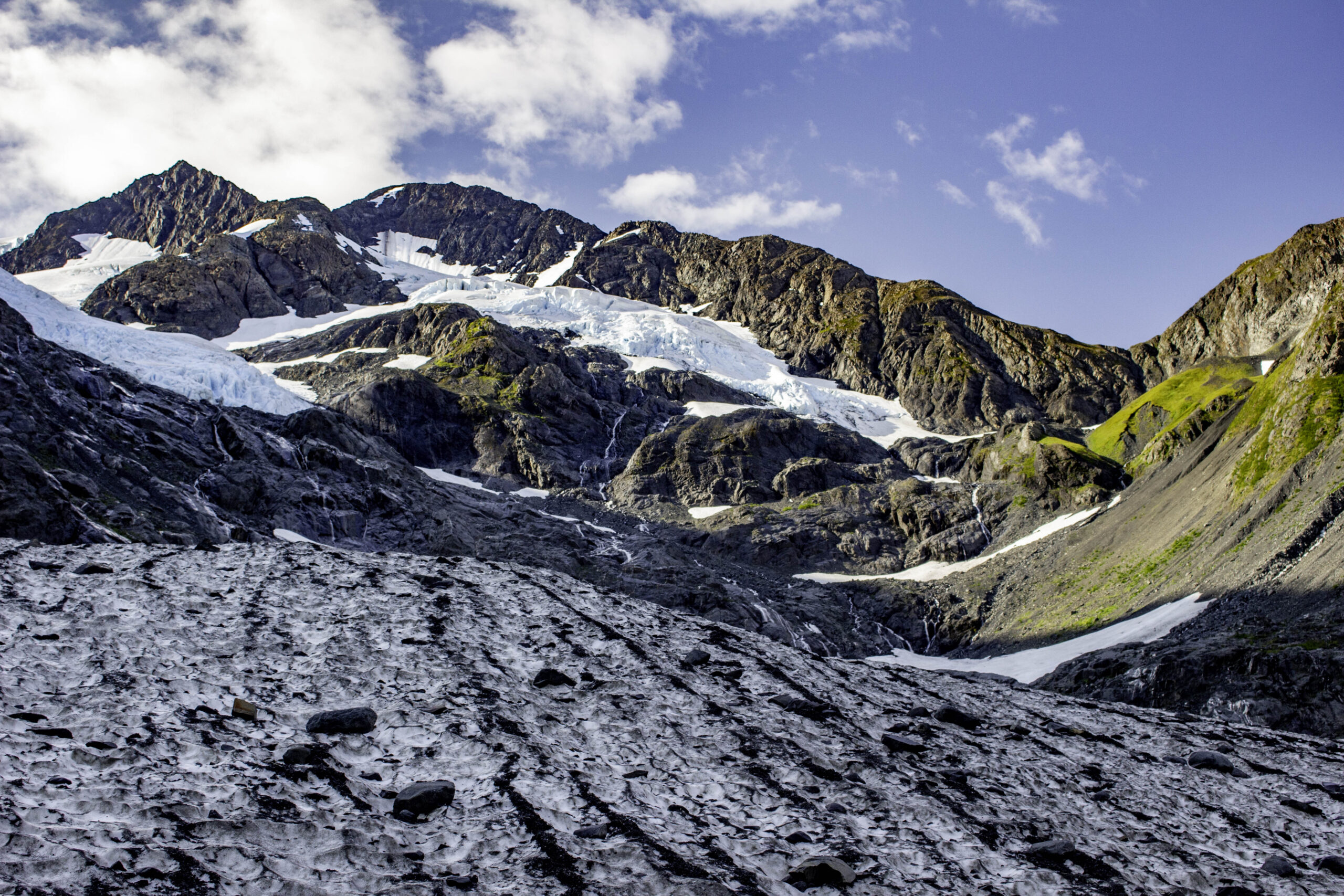
About halfway up the trail we had views of the bottom portion of the Harding Glacier. The photo does not do justice to how massive the glacier is.

The last part of the trail was above the vegetation line; nothing but rock and snow. Jim here is carefully hiking across the snow.

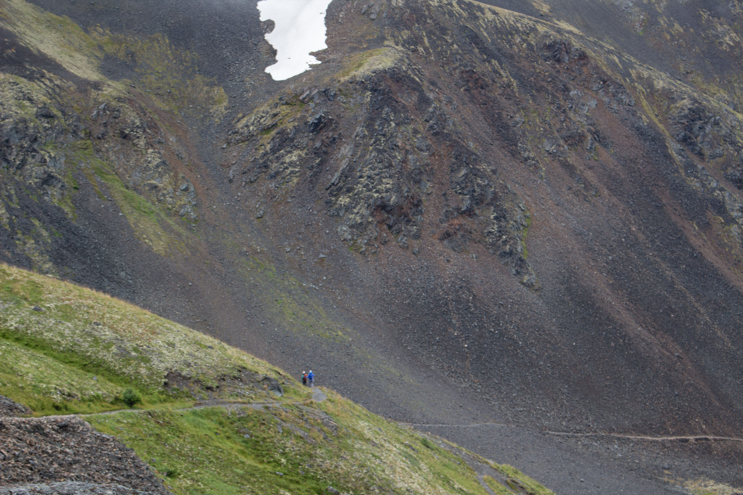
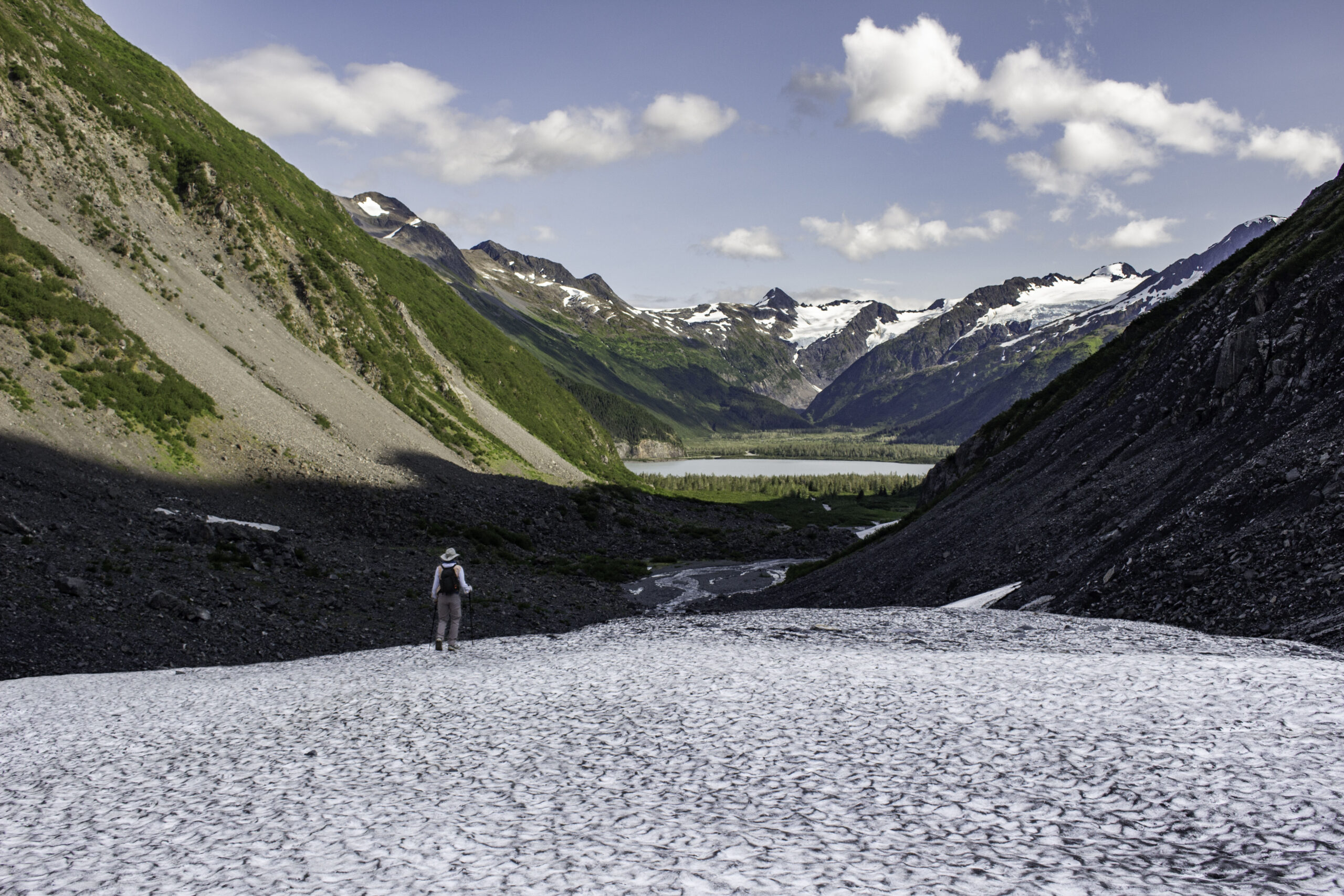
Near the end of the trail, we could see a group of four people with the glacier behind them (about 1/3 of the frame from the left on the black horizon). The end of the trail is still a good distance from the massive Harding Glacier.
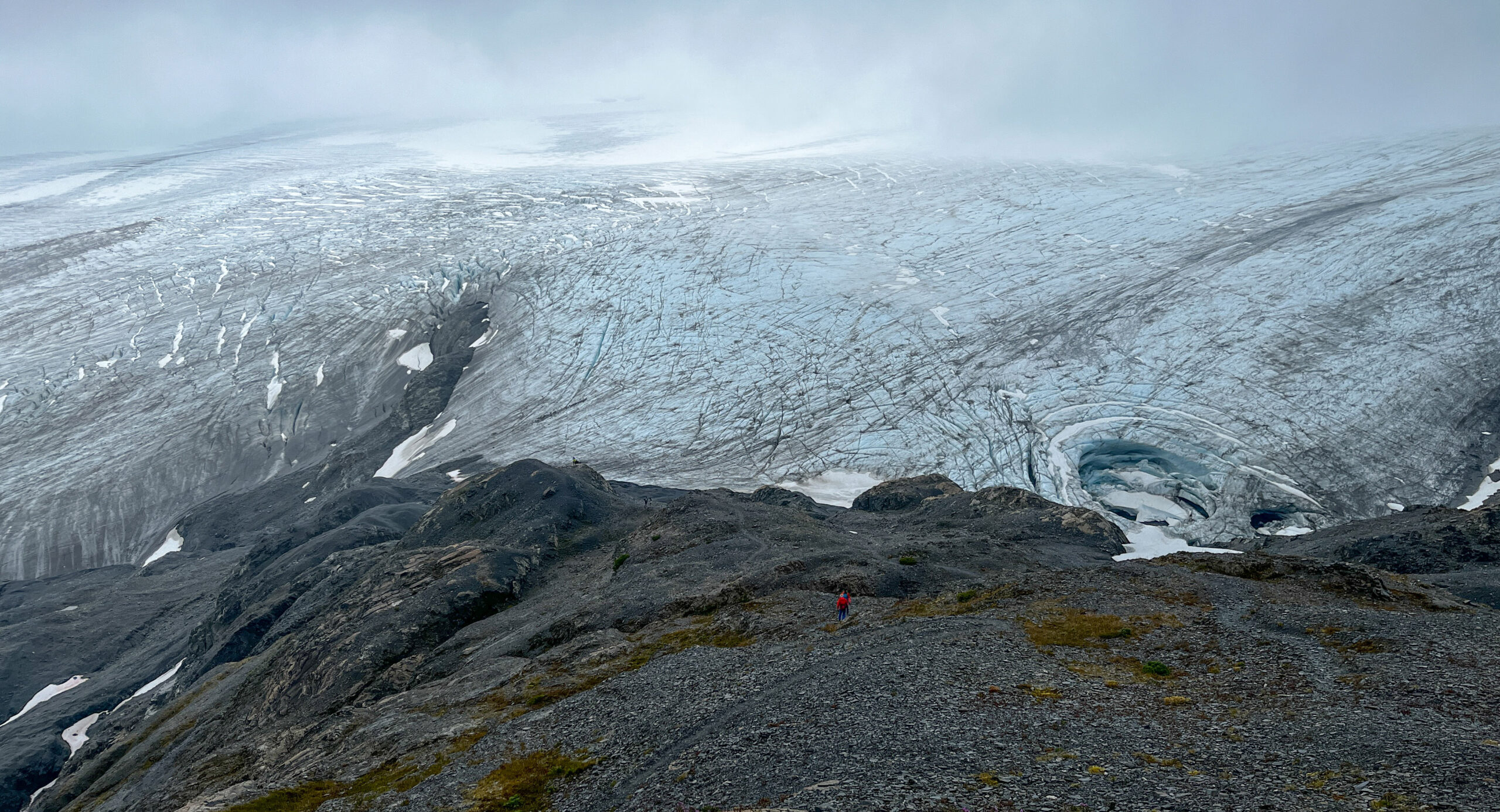
A closer look at the Harding Glacier. We wondered what caused the circular depression in the glacier on the right and wondered how much longer the ridge of rock on the left would “survive” the steady push of the glacier.
Another challenging hike was the Crow Pass / Raven Glacier hike. Some of the challenge was the high winds and low temperature especially at the pass. Here you can see our guide Cara and Carolyn on the trail.
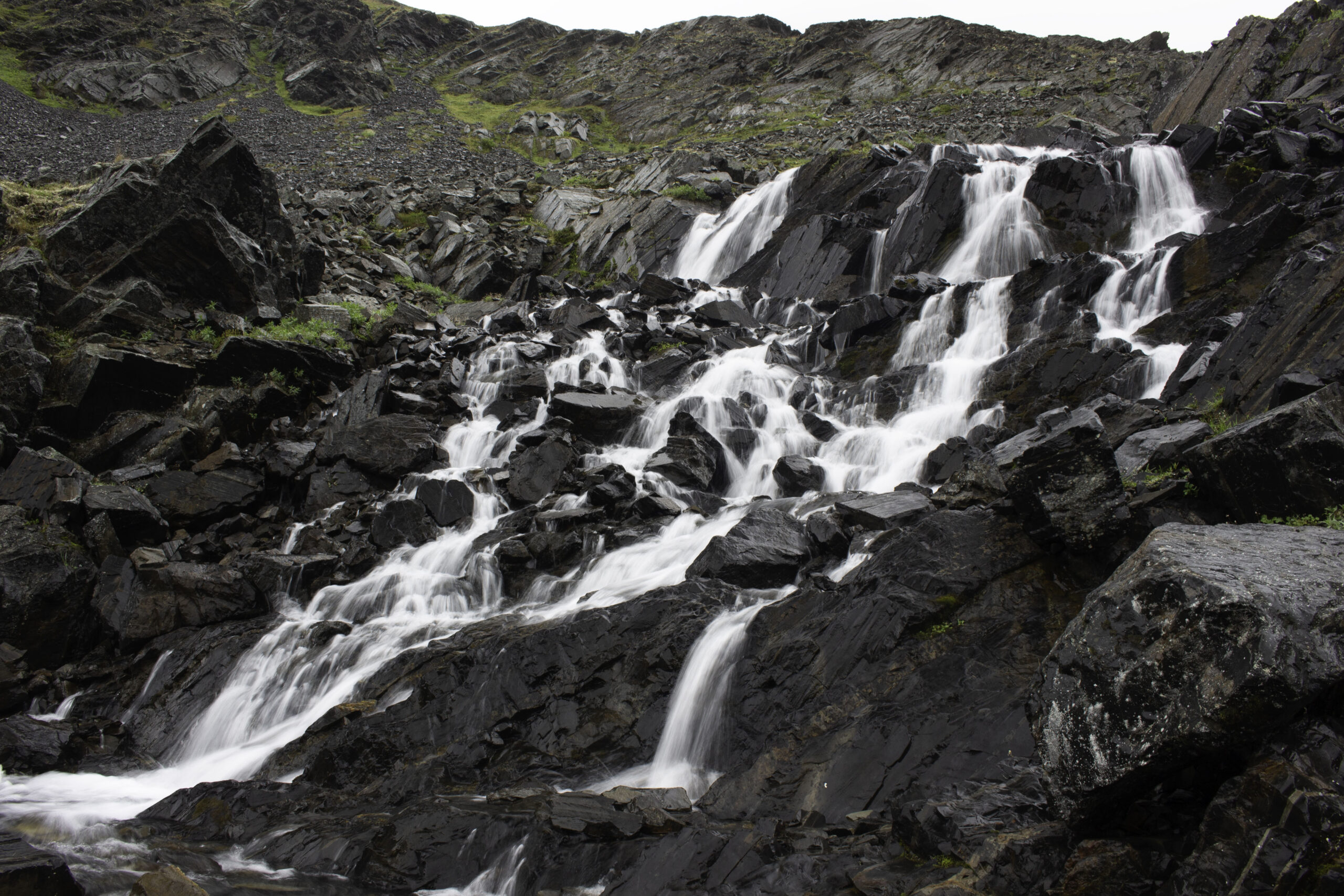
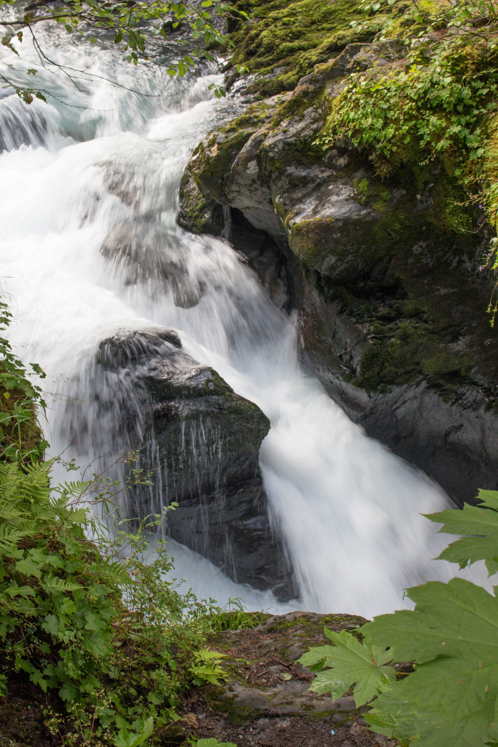
Nice waterfall on the Crow Pass to Raven Glacier trail. I was happy to see the water level was manageable as sometimes it can be a deep-water crossing.

Jim, Carolyn, Cara and I found a depression out of the wind for a lunch after visitng Crow Pass where the cold wind was not as inviting. I think everyone had 4-8 layers of clothing on. The next day it was sunny and calm and would have been a completely different hike.
Blue-water Gorge on the Winners Creek trail near Girdwood.
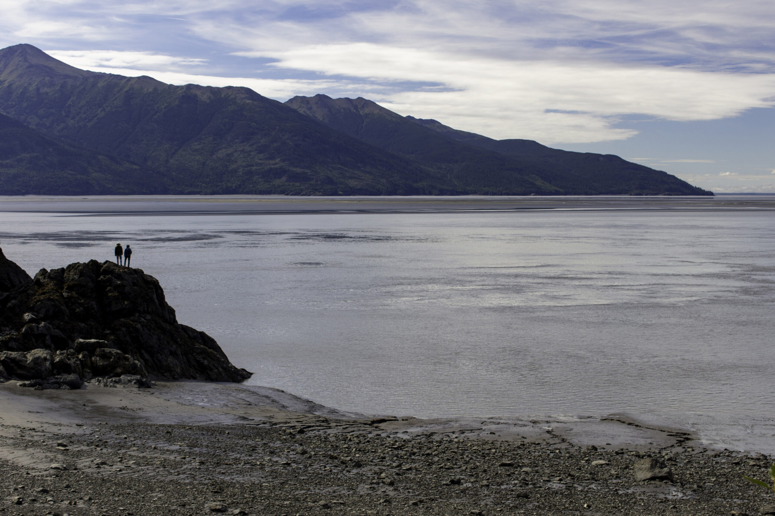
Turnagain Arm is named after British explorer Captain James Cook, who was forced to “turn again” when in 1778, he discovered that this waterway did not lead to the non-existent Northwest Passage he searched for. In some areas the waterway is up to 4 miles wide. On another day we got to see a guy attempt to surf on the wave that rolls in as high tide approaches.
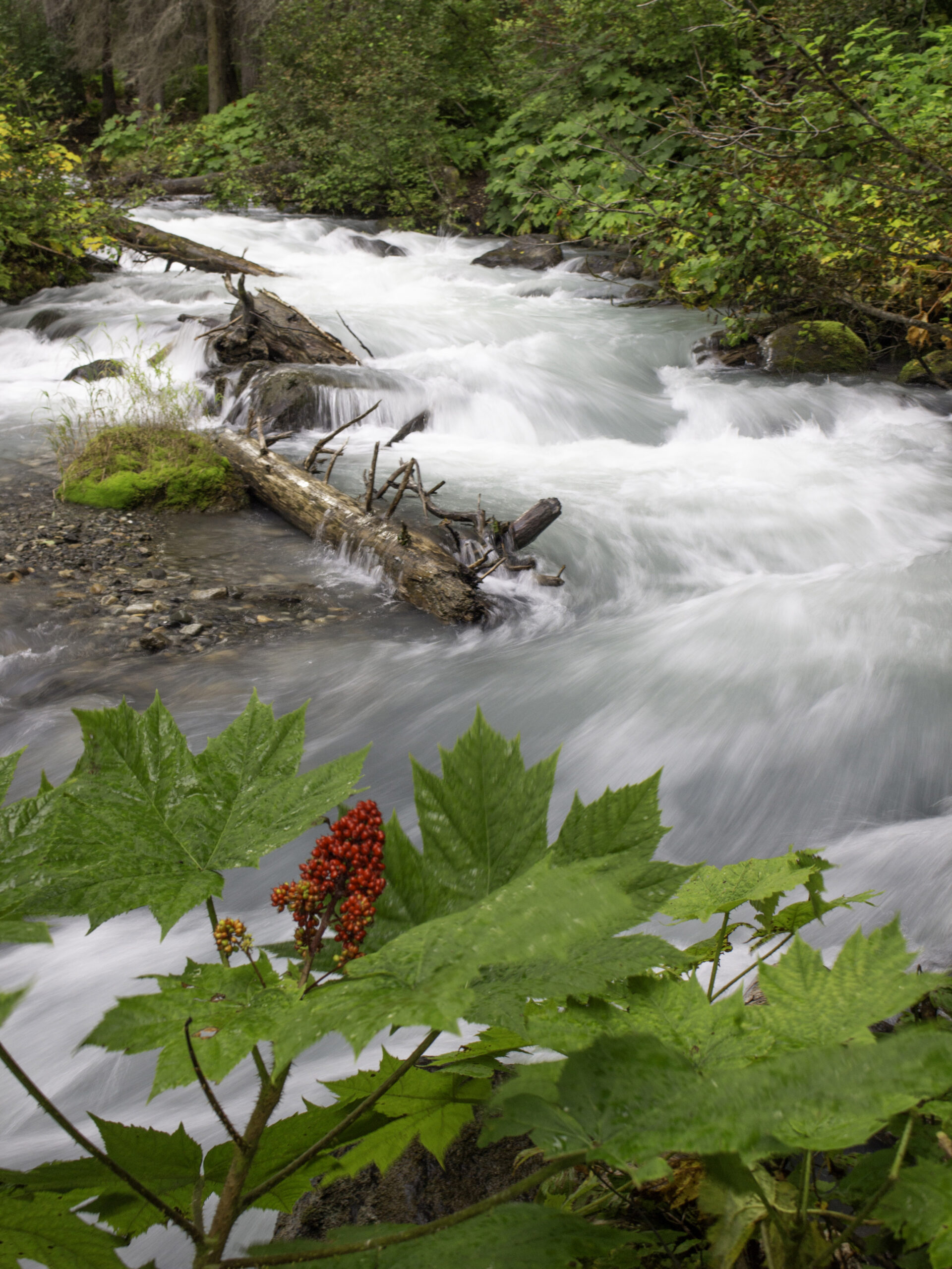
Jim and I hiked up to a waterfall on the South Fork. The plant with the red berries is call Devil’s Club (Oplopanax horridus) and can be found frequently along the streams. Devil’s club is armed to the teeth. The spines of devil’s club cover every exposed surface of the plant except for the roots and berries. It is notable in that even the leaves are covered with numerous spines. It has had a broad variety of uses to Native Americans, ranging from fishhooks and lures to using its charcoal as a base for tattoo ink. There was a variety of traditional medicines made from this cousin of Panax (ginseng) from arthritis and tuberculosis to deodorant and to treat lice.

Jim is getting some good photos of the South Fork Falls.
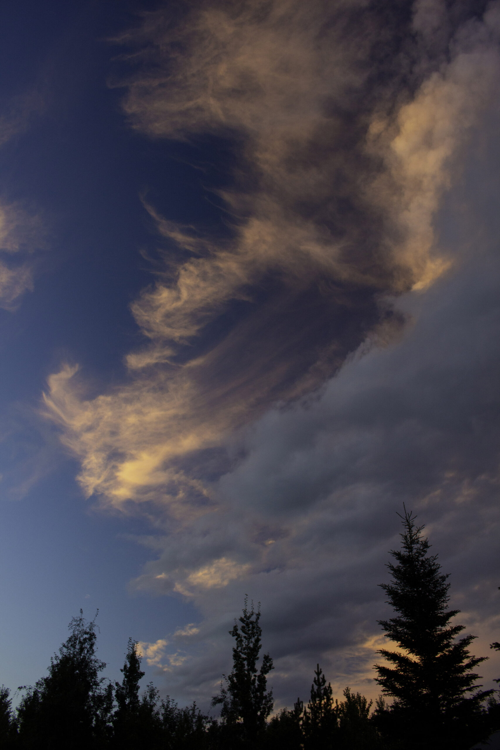
I encountered this great sunset in Anchorage while taking out the garbage at our rental at about 10:30PM – long days in the summer.
We hiked beyond the end of the Byron Glacier trail to get up onto the glacier.
Here is Jim carefully making his way off the Byron Glacier back to the trail.

On the same sunny day we visited Byron Glacier, we booked a river float starting “near” the Spencer Glacier. The float began at the lake created by the receding Spencer Glacier. The glacier was 2 miles away and was massive. The float then went down the river.

Here Maddie, our raft guide, is piloting us to shore to catch the train back to civilization.

Nice rainbow in Anchorage – we knew with all the rain, there had to be at least one rainbow!
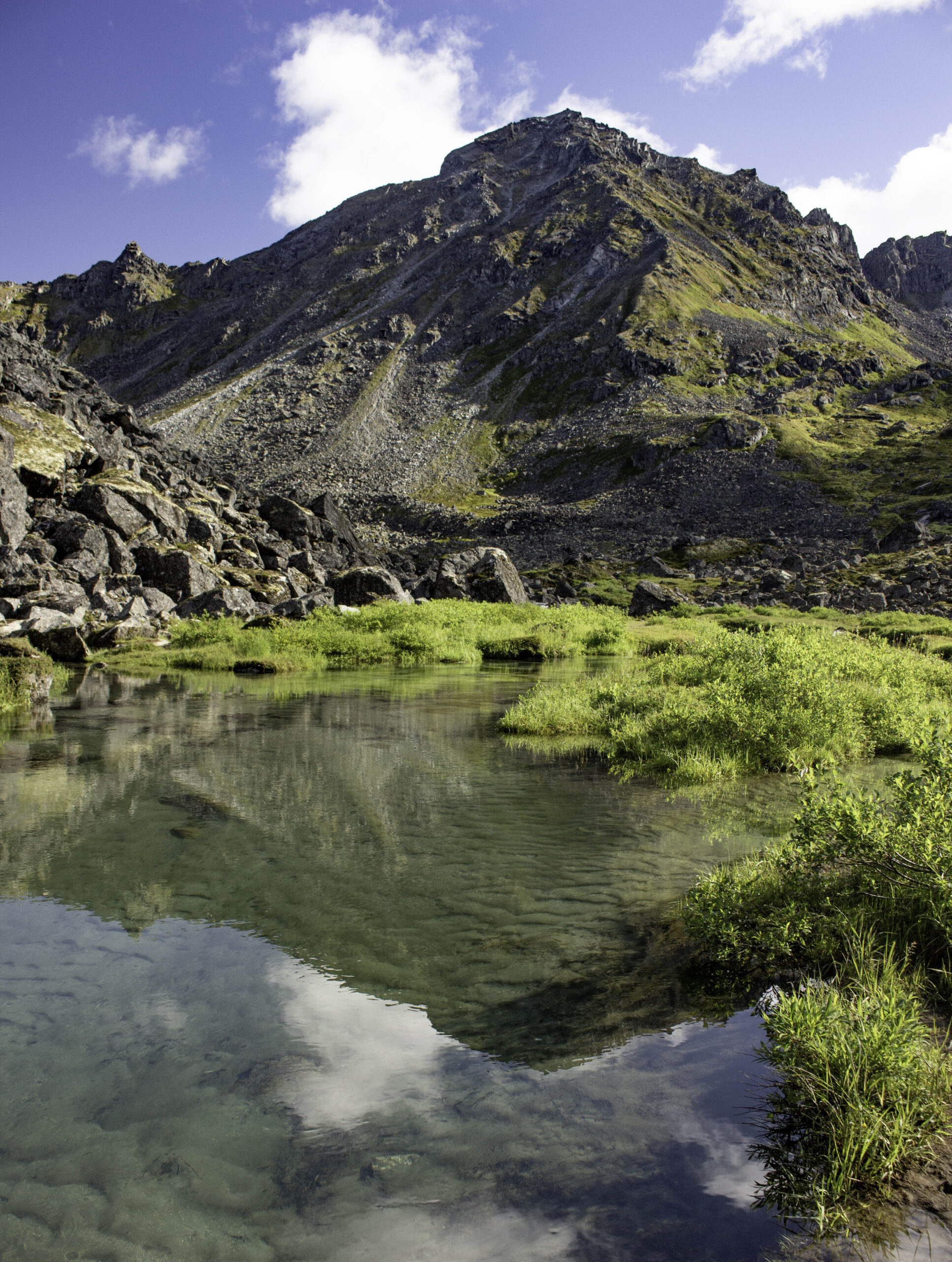
The Reed Lakes and Bomber Glacier trail near Palmer AK started as a remote but well groomed trail and shortly became a boulder hopping and muddy rut trail up to some beautiful water falls and two alpine lakes.

The two waterfalls from upper Reed Lake were unusually flat and broad and very pretty.

The upper waterfall from Reed Lake.

Upper Reed Lake was a nice turquoise color. Jim had wanted to also continue up the trail to Bomber Glacier which climbed steeply another 1300ft up the left side of the lake through a bolder field (and then further across a glacier to an old bomber crash site) but we decided it was a bit too much for this trip.
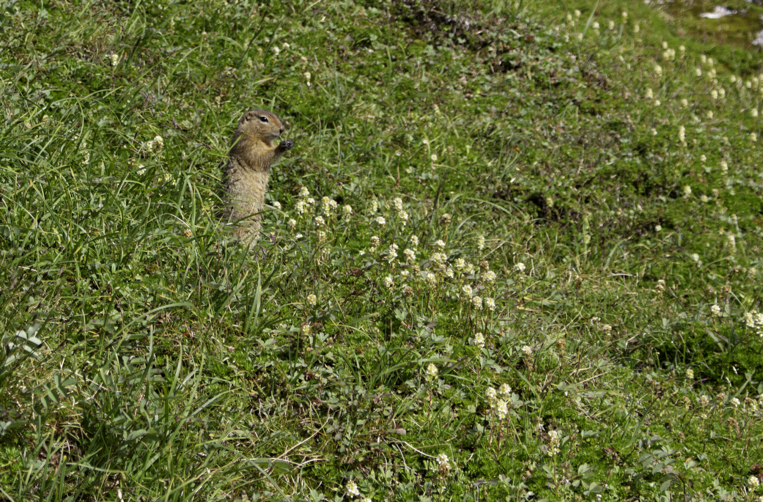
At upper Reed Lake this Arctic ground squirrel was foraging for food. After all our hikes, squirrels was the most abundant wildlife we had seen. For the whole trip we did see seven moose (mostly crossing roads) one porcupine, 2 marmots, 2 caribou & 7 Dall Sheep (both the caribou & sheep at a great distance) but not a single bear.
Jim is heading back out of the Reed Lakes trail. When we got to the trailhead there were 30+ cars – people were coming in to pick wild blueberries along the first part of the trail.

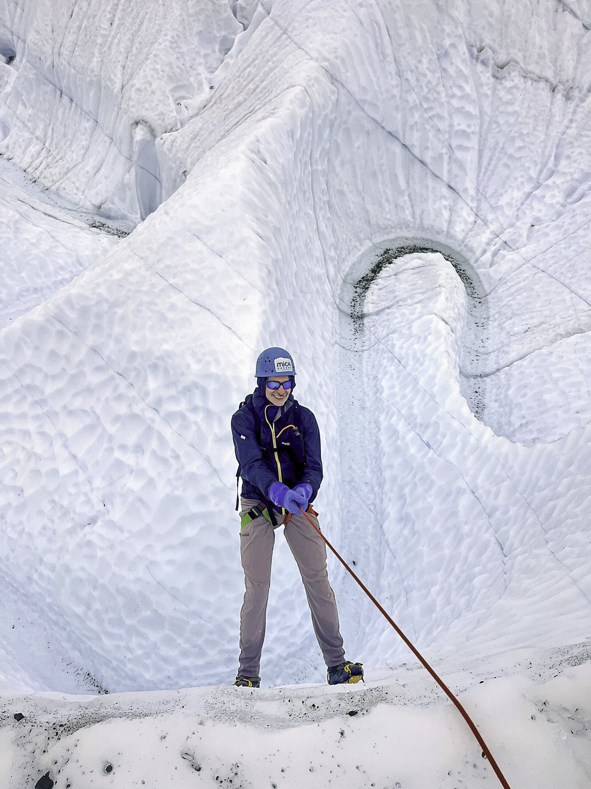
Our last excursion was an “advanced trek” on the Matanuska Glacier. This photo is of the current terminus of this 27 miles long glacier that once extended to the Pacific Ocean. We were paired with 2 guides from MICA to explore some of the slot canyons and crevasses of this glacier.

Jim (blue hat) and I (red hat) are both wearing crampons for the first time walking through the narrow channel that the frigid water is flowing through and deepening the channel. Our support guide, Swede, took this photo.
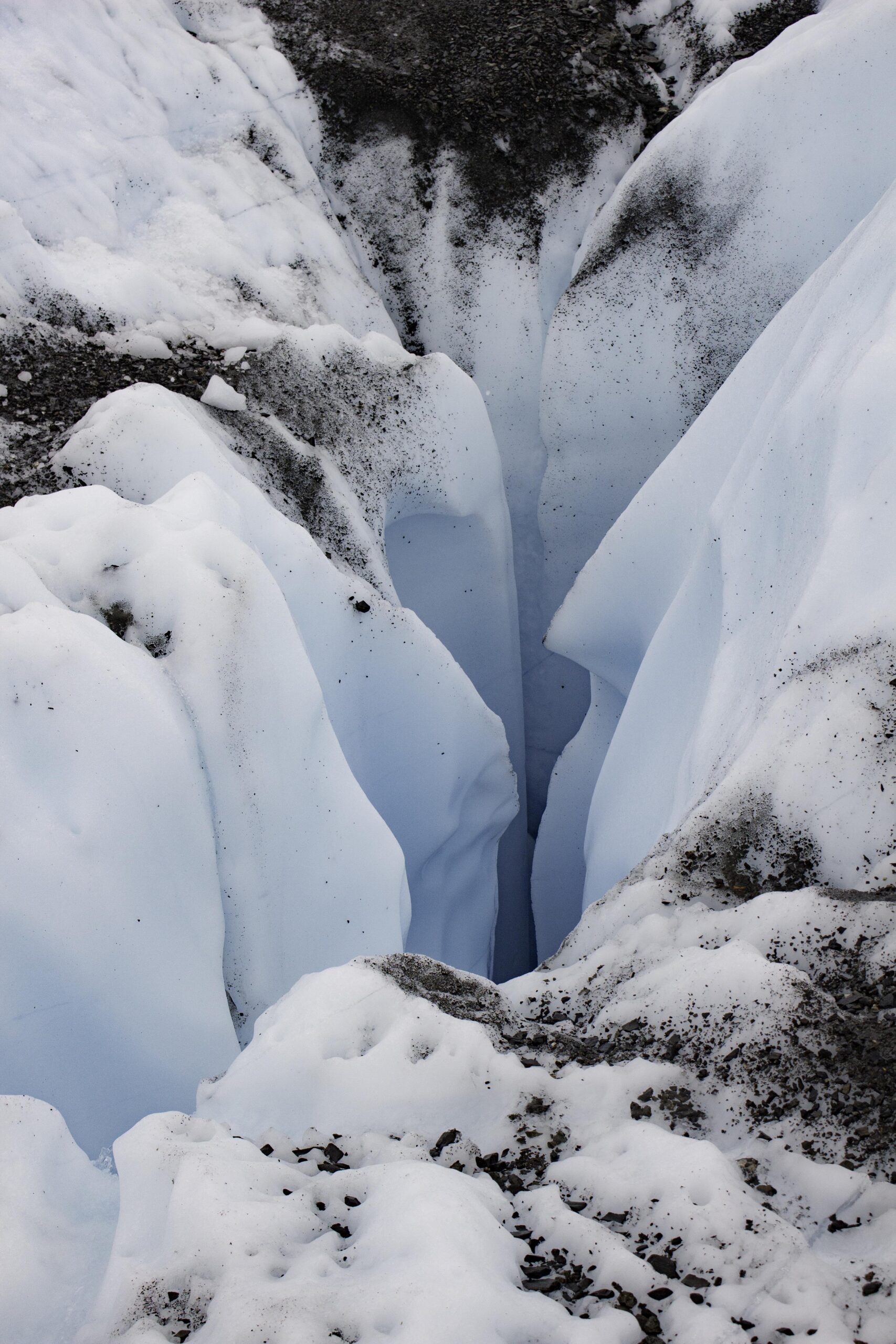
The first crevasse we saw on the Matanuska Glacier.

We were safely tied off when we closely examined the deep crevasse while our lead guide, Hawk, monitored. These guys knew their stuff and took great care of us but allowed us to explore some really cool stuff. This crevasse looked to be greater than 30 feet deep.

The glacier was crisscrossed with these transparent blue lines. The strains and stress on the glacier as it moved downhill leads to cracks that can fill with water that slowly freeze with minimal trapped gases. This makes the ice in the crack clear vs. white. The blue color is from the transmitted and scattered blue light (vs. other absorbed light waves), just like deep lakes or the ocean.
This photo, taken by one of the guides, is looking straight down. Jim is horizontal – you can see the water path below flowing through the ice slot canyon. Jim is using the spikes on his crampons to walk horizontally down the vertical wall of ice to get into another ice canyon. Our guide is controlling the rate of Jim’s descent with the rope attached to his harness. We dropped into several ice canyons doing this.

Exploring another Ice Canyon.
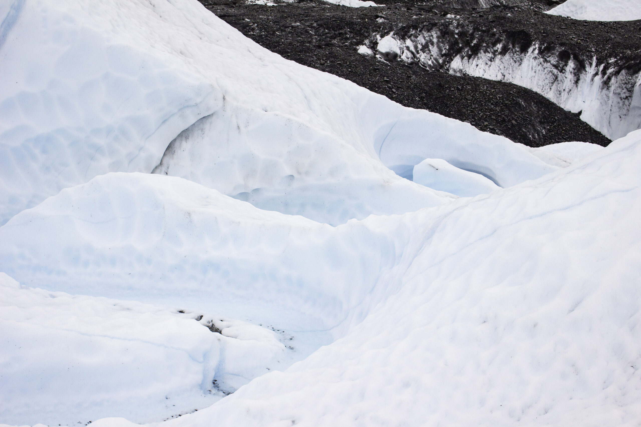
The ice melt water flows in a serpentine path cutting the ice canyons, just like water does on rocks or soil.
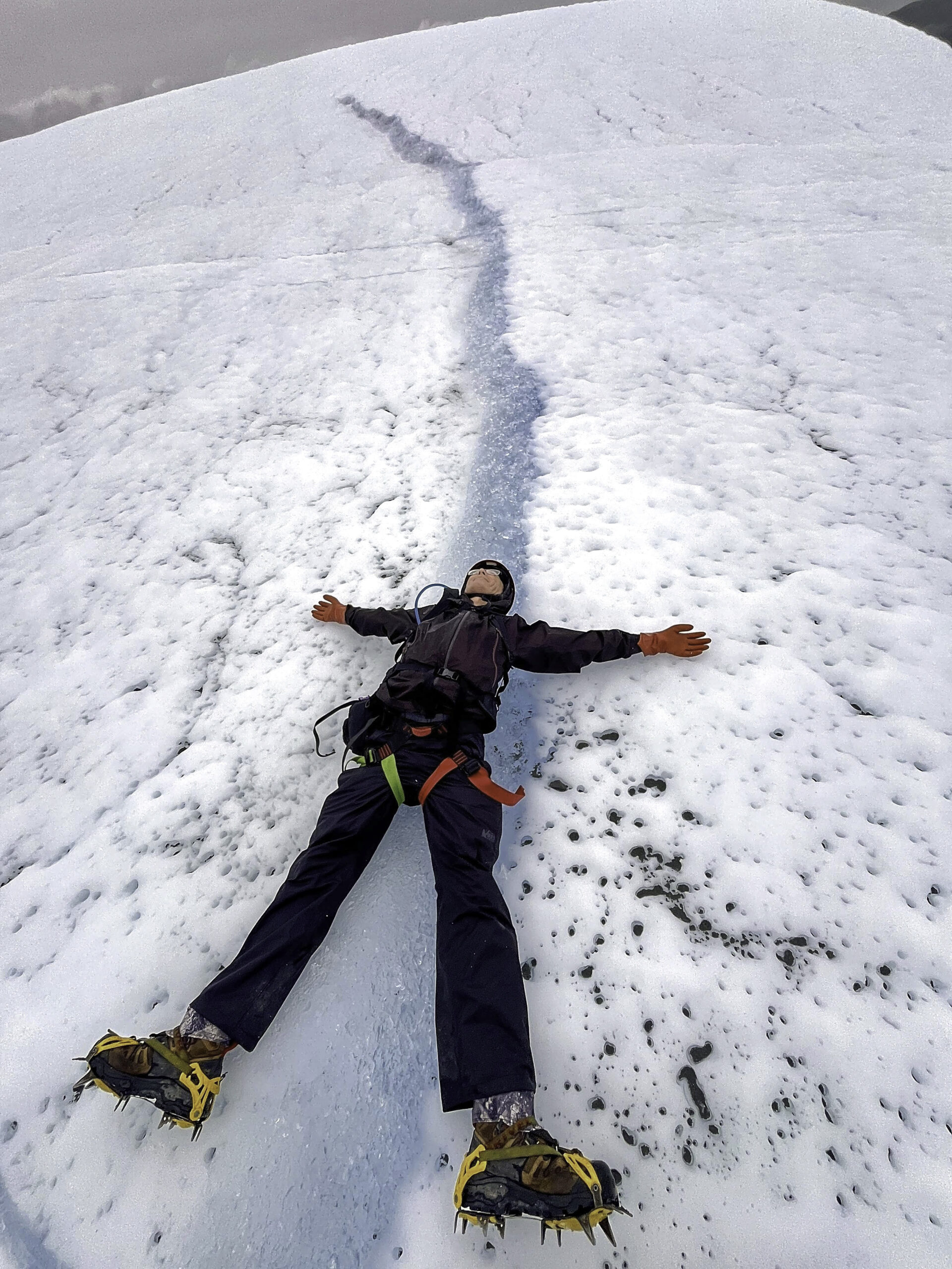
Here I am again taking a brief rest on a very large blue ice streak while the guides prep for our next descent.
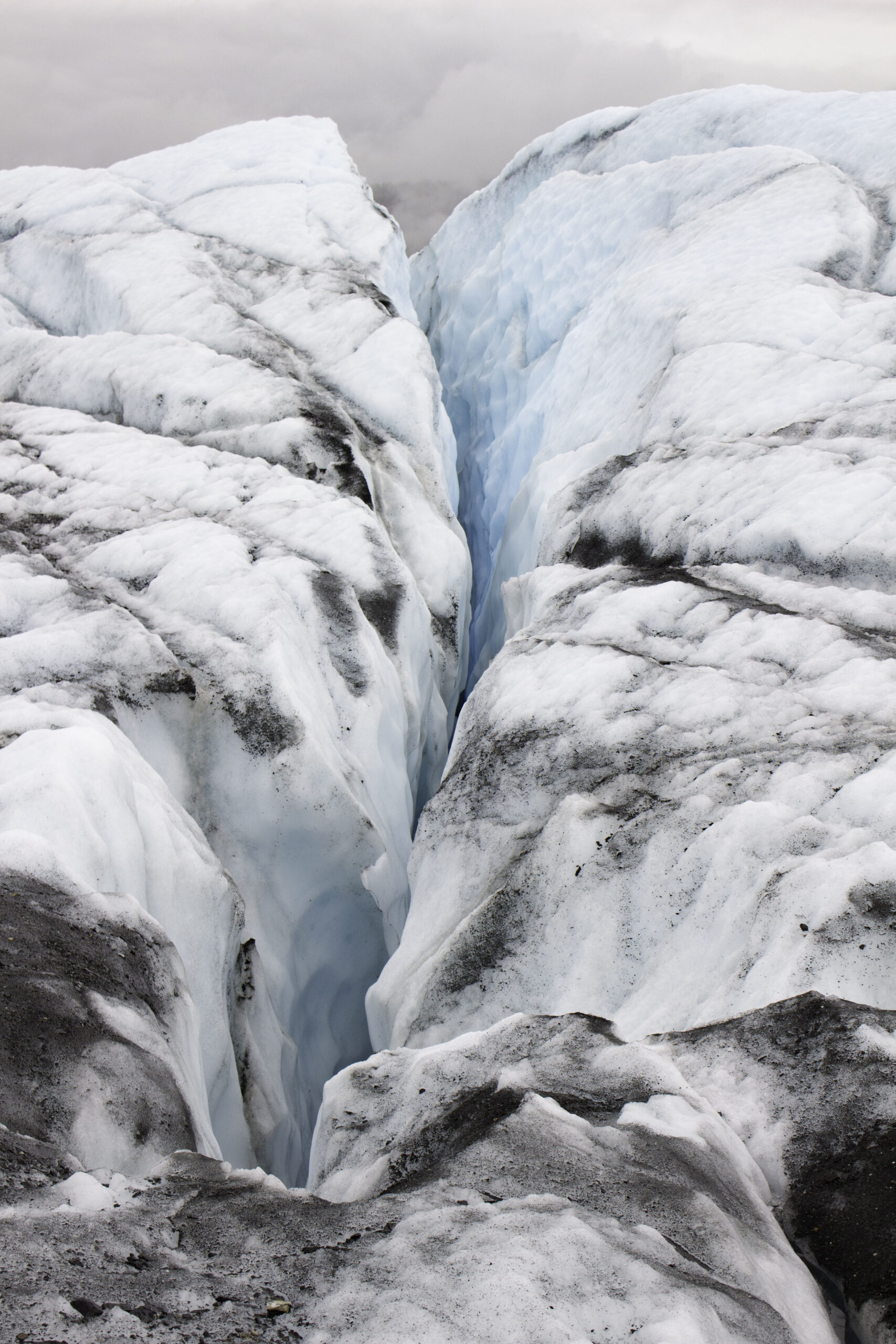
Nice blue crevasse on the Matanuska Glacier.

One last Matanuska crevasse

Leave a Reply