Tom, Oscar, and I spent 21 days on 4 islands of Hawaii in September 2023 as our annual hiking trip. We hiked about 80 miles with 18.5k+ elevation rise on 23 hikes. The hikes ranged from coastal to dense forest to volcano craters. Elevations ranged from sea level to almost 10k feet above sea level. We also toured some of the sights of Hawaii. Tom planned the trip and did an excellent job. This was the second time that I had been in Hawaii but the first time was 40 years ago and was before hiking became a hobby. I have over 260 photos from the trip – A few are shared below.

Our first hiking was on Oahu and we were lucky to have two of Oscar’s hiking buddies, Alan and Bob, that are residents in Oahu to both guide and hike with us. Really great guys! Here we were at the Pauoa Lookout, on our way to Manoa Falls. This photo was from Oscar’s iPhone, courtesy of another hiker.

This combination of trails to Manoa Falls had a wide variety of terrain from brushy overgrown, to open ridges, to being under canopies of high trees.

The trails to the falls also had a wide variety of trail surfaces including easy passages of evenly compacted soil, roots (like above), slippery clay, and rocky sections. Unfortunately, the waterfall was just a trickle because of minimal recent rain but the blessing was that there was minimal mud on the trail.
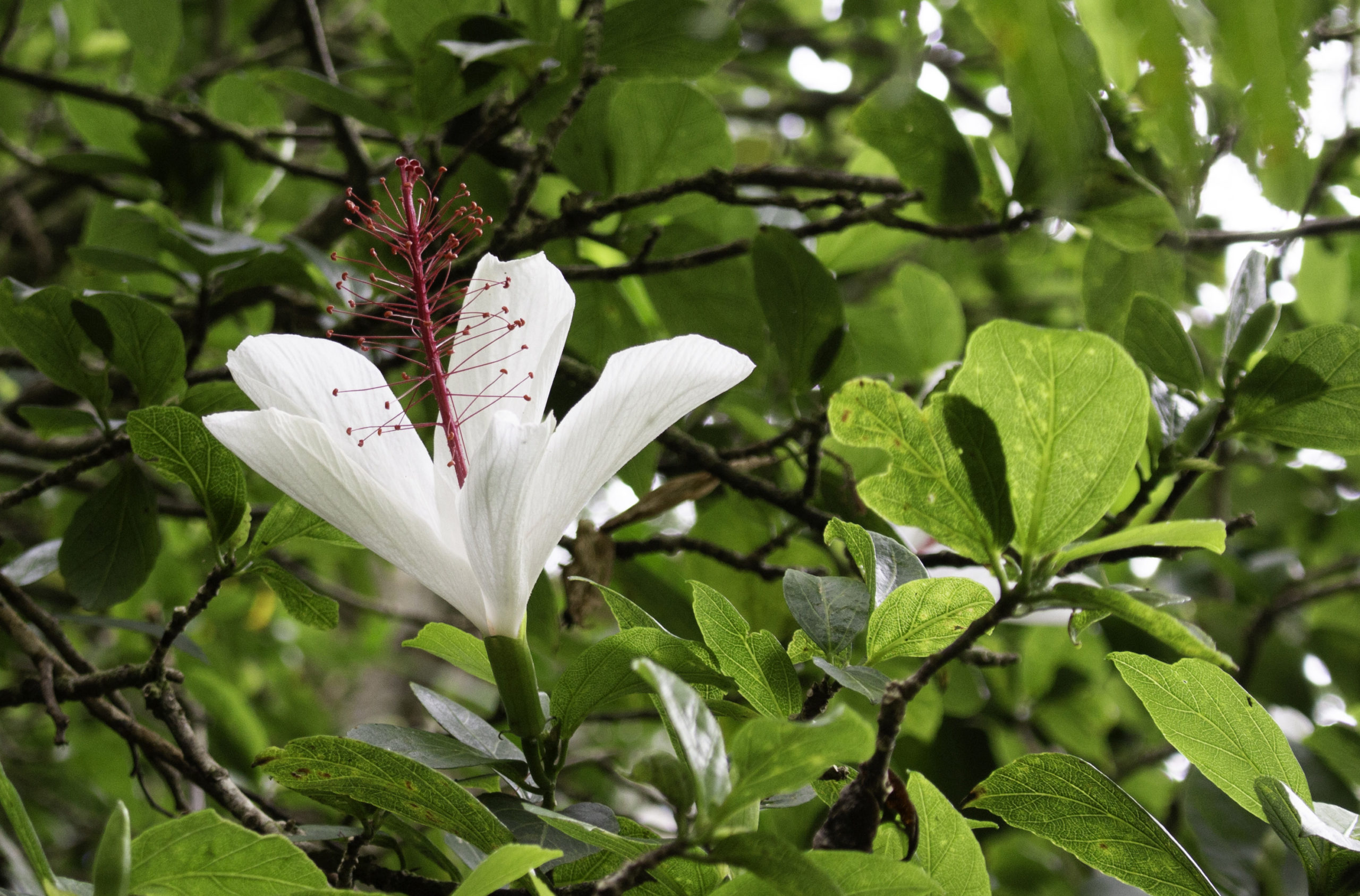
Many of the native plants in Hawaii have been displaced by plants brought in by people. This White Kauai Rosemallow (Hibiscus waimeae) is a native hibiscus species we found along the trail. It is indigenous to Kauai but now can be found on the other islands as well. While we were hiking on the Manoa Cliff trail on Oahu, we encountered a guy that was cutting down some of the invasive trees under a contract with the authorities to make room for replanting native trees.

The photo is of Tom on the ‘Aeia Loop Trail on Oahu that mostly followed a ridge with great views of both the dense forest and views out over the landscape. It rained quite a bit while Tom, Alan, Oscar and I hiked this trail.

Sunset on Waikiki beach.
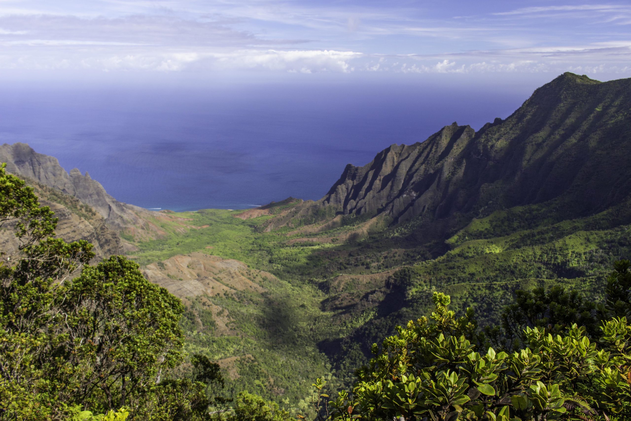
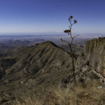
Our first hike on Kauai was the Pihea Vista Trail “upstream” of the Waimea Canyon near the north coast. The trail follows a ridge above the Kalalau valley with no roads and not accessible by car. It is the beginning of the rugged and wild Na Pali coast. The trail is about 4,000 feet above sea level looking down into the valley.
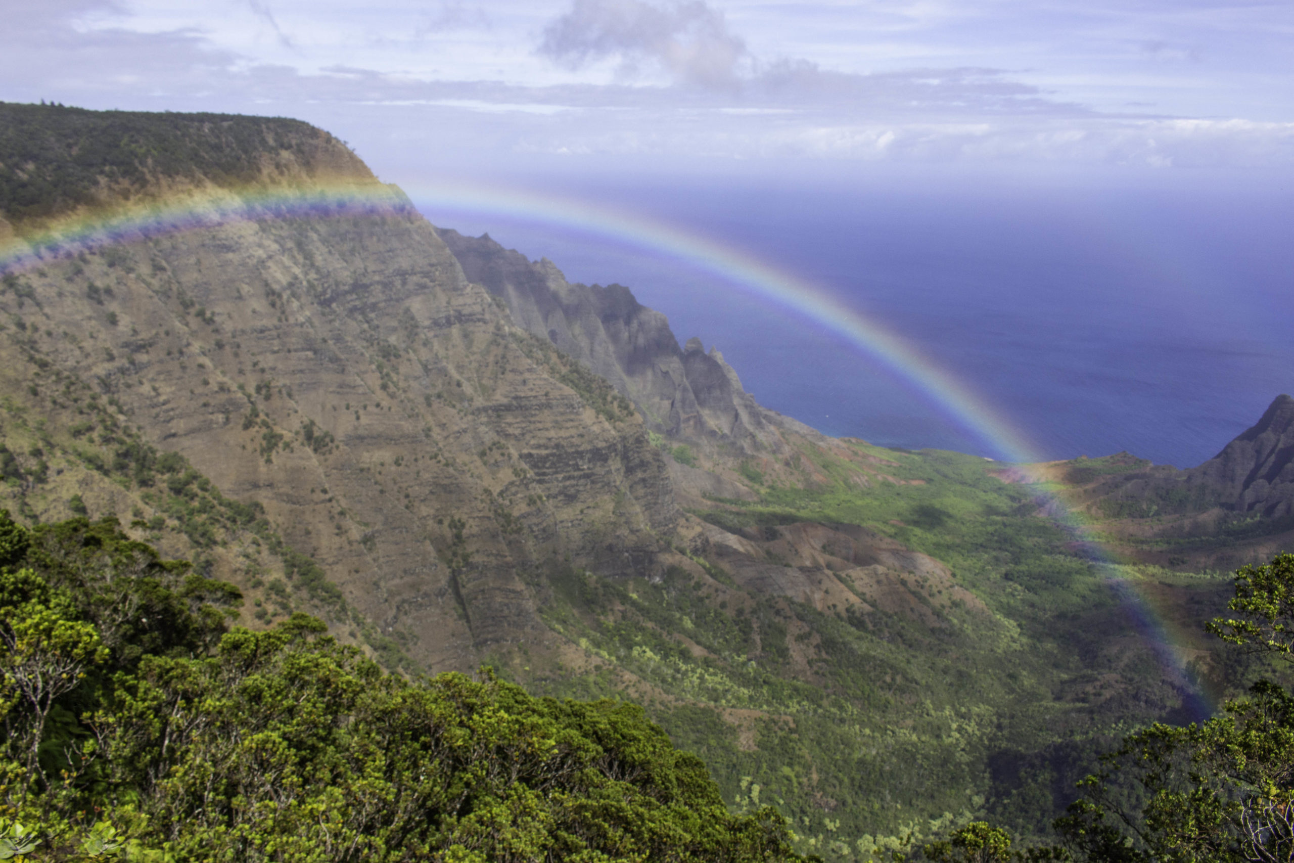
While we hiked the Pihea Vista Trail in Kauai, a light rain passed over us and once the rain moved out over the valley, we were treated with a really nice rainbow. You can just barely see the partial second rainbow above and to the right. We were very lucky as the rainbow only lasted a short while and we did not see another one the rest of the trip.

Parts of the Pihea Vista Trail were relatively level and easy – other parts were steep and had slippery wet clay that required a bit of care to transverse (and dirty hands, boots, pants, etc.). Going up was fairly easy – coming back down (controllably) was a bit more work. This trail is known for the great views (and the abundance of mud).

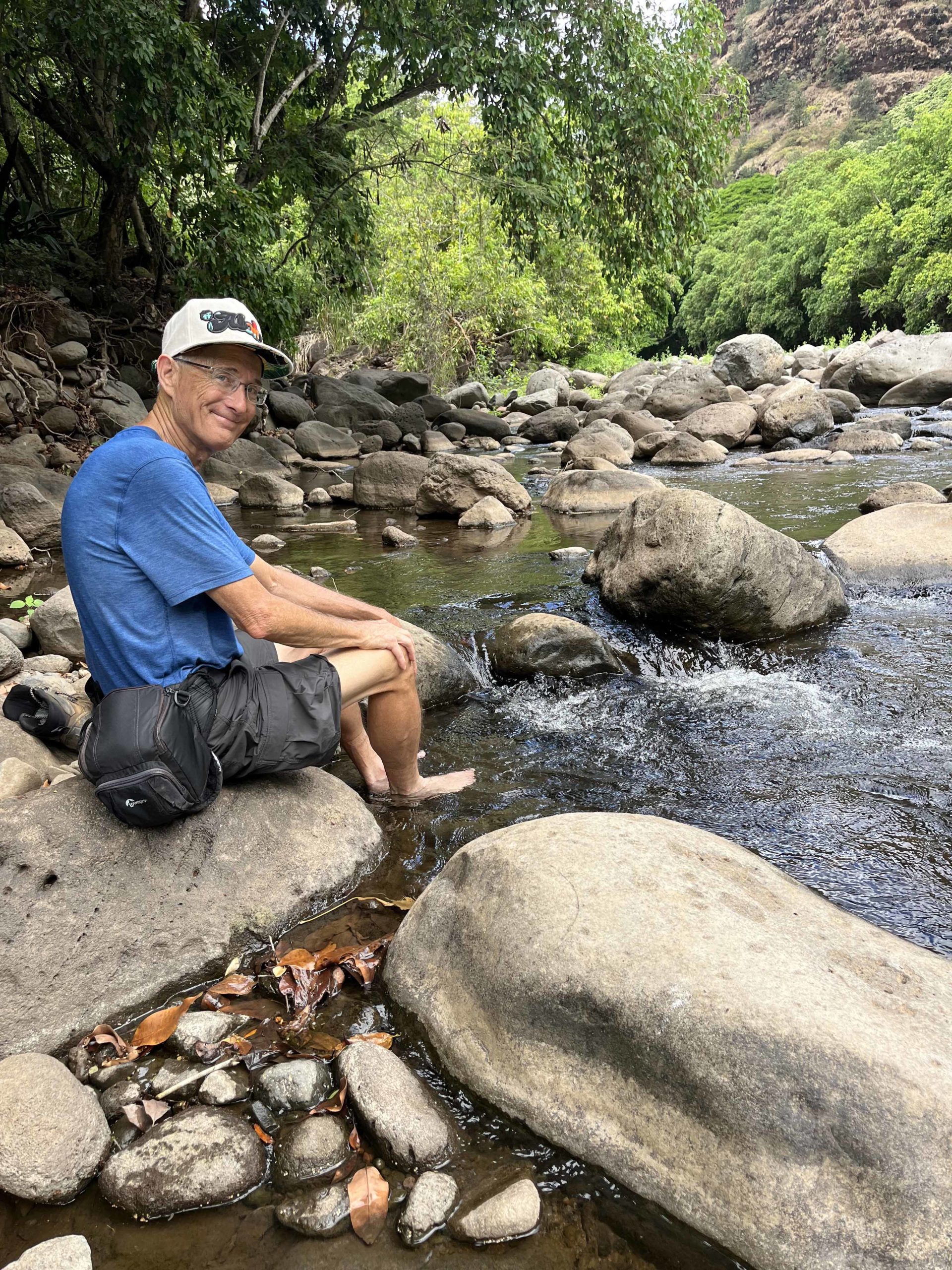
The second trail we did in Kauai was the Kalalau Trail to Hanakapi’ai Falls Trail. This was also on the Na Pali coast but approached from the northeast side of the island. The journey began with a 6 mile shuttle to Hāʻena State Park to the trailhead. The Kalalau Trail is a great 11 mile trail that goes along the steep rugged Na Pali shoreline but requires permits and backpacking. We hiked along the first 2 miles of this shelf trail before connecting to the Hanakapi’ai Falls trail to go inland to the falls. There are 4 water crossings along the two trails. the photo above is the first crossing on the Kalalau trail right at Hanakapi’ai beach and the beginning of the trail to the falls. Oscar and I “hopped rocks” on this crossing because it was easy and we had hiking poles but later we put on our water shoes and crossed through the near waist deep streams which was safer. We saw 4 people slip and fall trying to hop rocks across.

Hanakapi’ai Falls is a 300ft waterfall. The falls were flowing well because it was raining most of the time we were hiking to the falls.

Because of all the rain, most of the hikers had cleared out of Hanakapi’ai Falls by the time we got there. There is a nice pool at the falls and Oscar took a dip but I only went in partially because it was too cold for me. Both of us were soaking wet from the rain and stream crossings anyway.

The rain stopped on our way back from Hanakapi’ai Falls and I was able to take a couple of photos. There are stands of bamboo on many of the trails in Hawaii (bamboo is an introduced invasive plant)
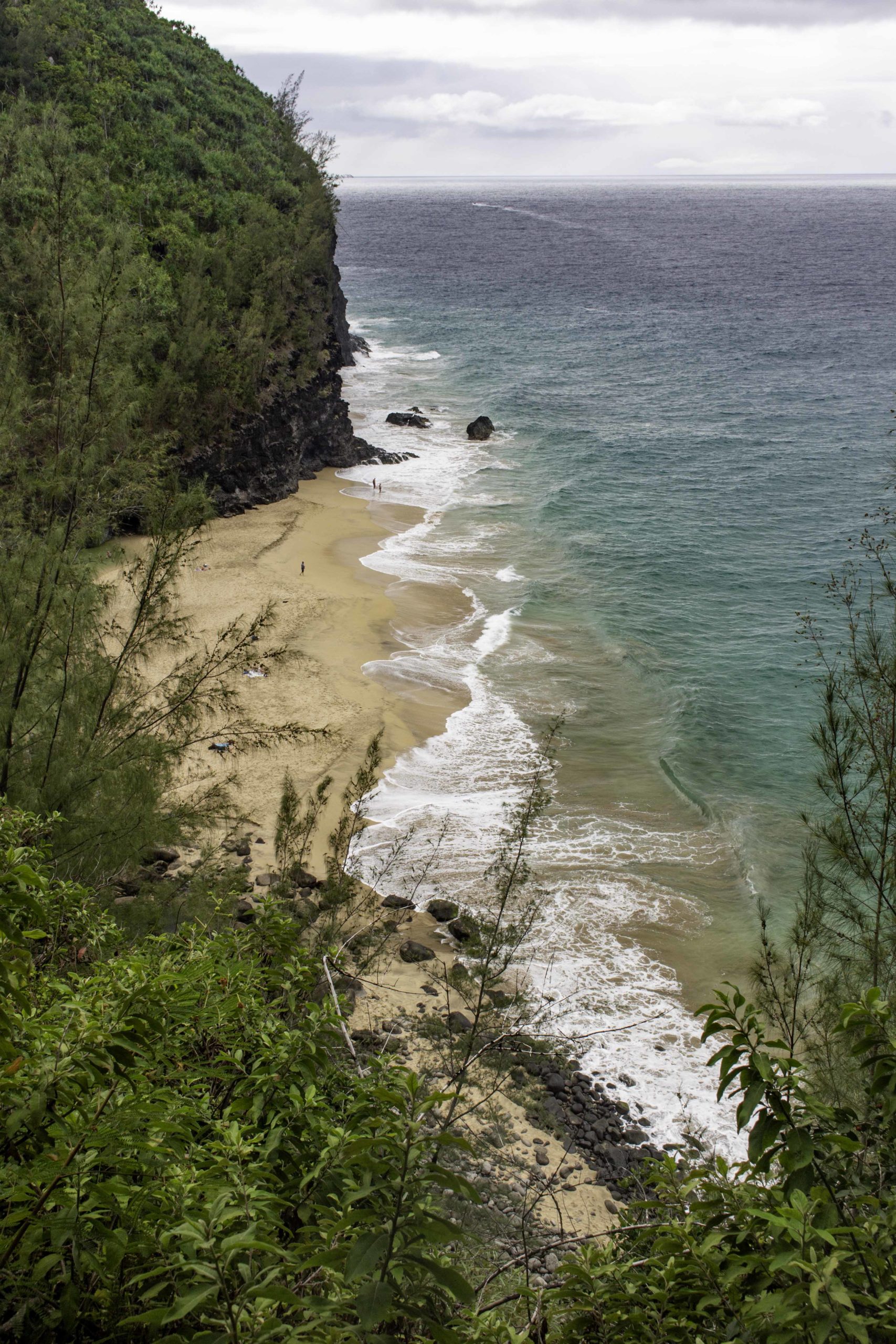
A view of Hanakapi’ai Beach on our way back on the Kalalau Trail on the north shore of Kauai.
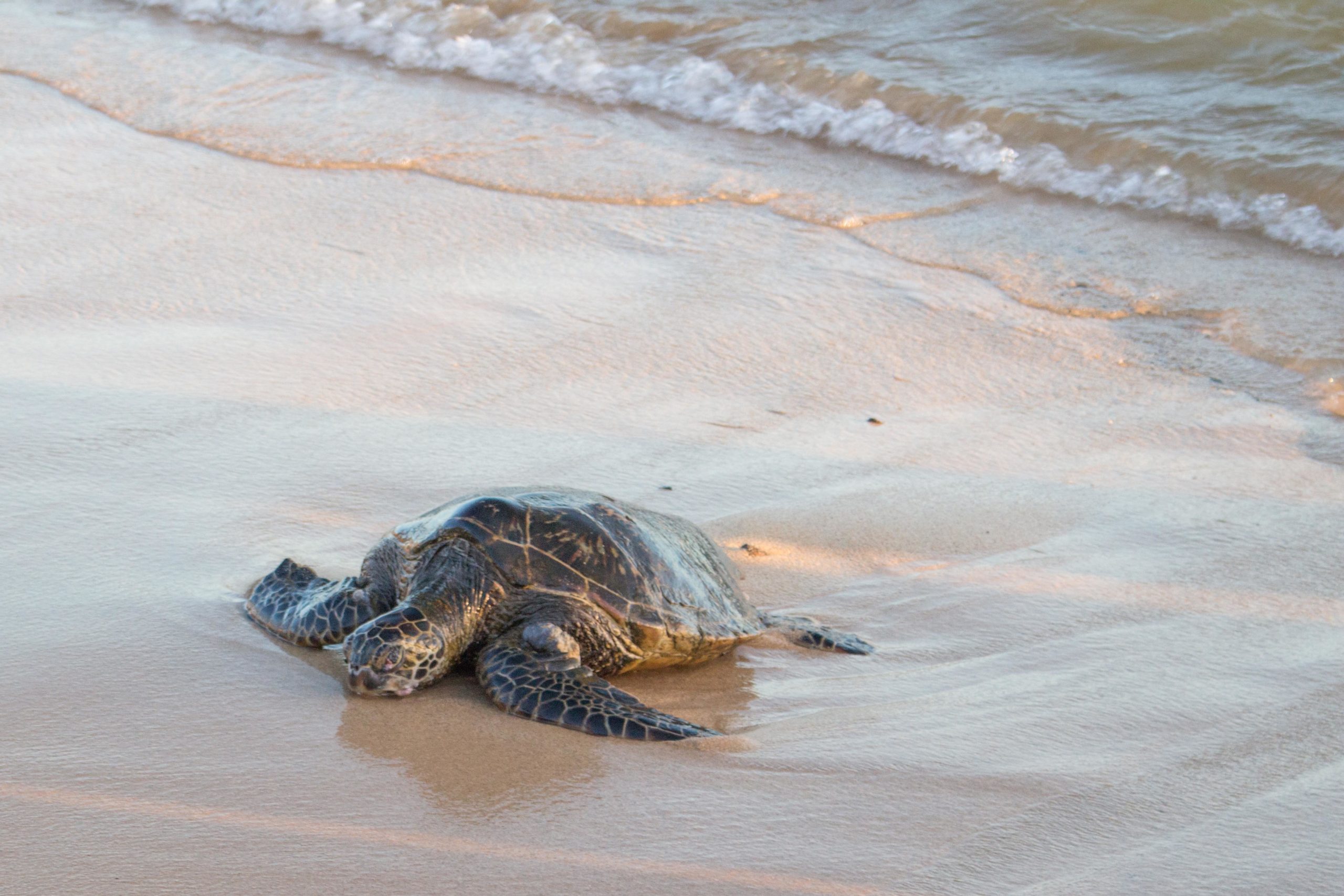
Very near our rental house on Kauai was Poipu Beach where every evening, endangered Hawaiian Green Sea Turtles come ashore to sleep. The turtles remain at sea for three days with only short sleeps. They then come to the same beach that they have imprinted on to catch up with a night’s sleep on shore. The turtles vision in the air is so poor that if you are 10 feet away they cannot see you and therefore you do not disturb them if you keep your distance. The volunteers that make sure the tourist keep their distance provided information about the turtles including their “names” and approximate ages. They indicated typically about 50 will be on the beach each night. We did return later one evening and with a red light (which disturbs them less) we could see a lot of turtles.

More turtles arriving.

The west side of Kauai has the Waimea Canyon where it is dryer. We hiked down several trails into the canyon. The photo is from the Kukui Trail which was about 4.5 miles round trip and a drop down and back up of about 2200ft. Waimea Canyon is sometimes called the Grand Canyon of Hawaii.

Oscar took this iPhone photo of me coming down the Kukui Trail into Waimea Canyon.
This is what you do for your feet after hiking down into Waimea Canyon…..

Our last hike on Kauai was a coastal hike, Poipu Cliffs trail, that started near our rental. Other than the nearby Poipu Beach, most of the shoreline is too rugged and dangerous to swim from.

Our first hike in Maui was the Waihe’e Ridge Trail that climbed up and along a ridge going away from the shoreline. There were low hanging clouds that gave the landscape a mystical look.

Oscar is moving down the Waihe’e Ridge Trail back to the trailhead.

After the ridge trail, we drove the narrow, curvy road to the northeast side of Maui to hike the short trail to see the Nakalele Blow Hole. Afterwards we drove around the east side of the island and passed by the devastation from the recent fire on Maui. Except for the windward wet side of all the Hawaii islands, the vegetation was golden/brown from not enough rainfall. It was easy to see how quickly a fire could get out of hand.
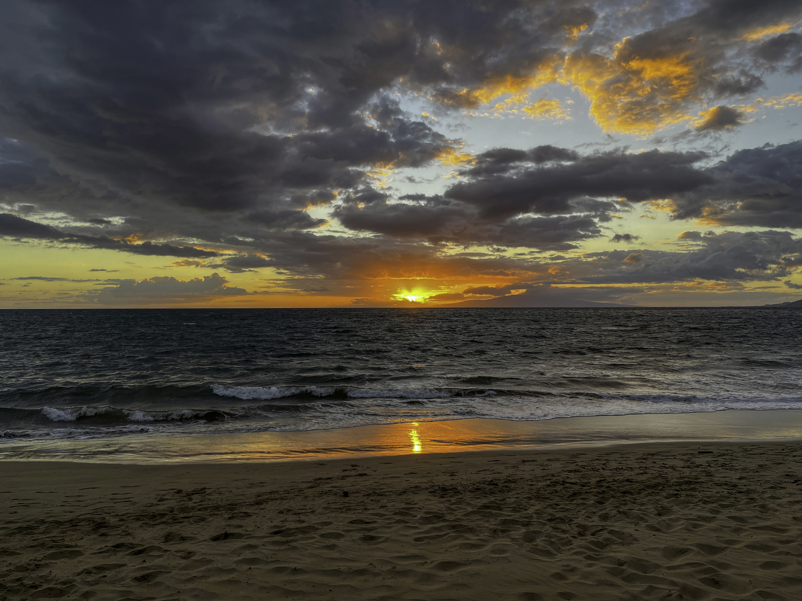
We were staying in the small coastal town of Kihei while in Maui and the top restaurant was a food truck. (and it was good!) We grabbed a takeout dinner there and crossed over to a beach to eat where we were entertained by a nice sunset. There was also a great BBQ place in the town (Fat Daddy’s BBQ).
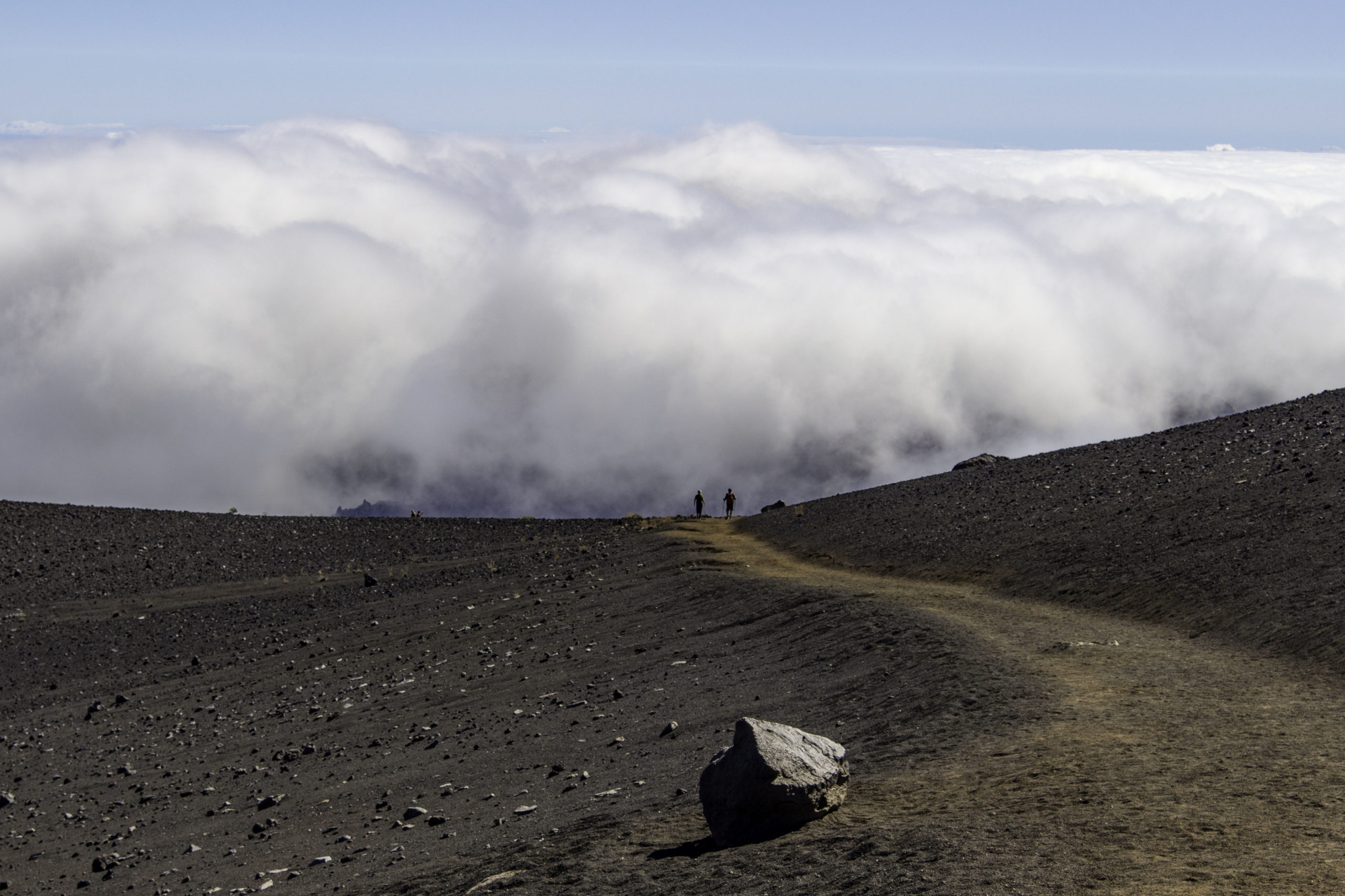
Our next hike in Maui was the Sliding Sands trail down through the volcano crater of Heleakala National Park. The trail starts at 9757ft, then over 11 miles, drops about 3kft in elevation then climbs out another crater wall up the Halemauu trail. When we started clouds obscured most of the inside of the crater but the clouds dissipated as the day progressed. There were very few other people on this “moonscape-like” trail.

We were happy to get to see the endangered Haleskala Siversword (Haleskala ‘ahinahina). This flowering small genus of plants are only found in the crater of this volcano on Maui. It is a close relative to another distinct Silversword only found in Mauna Loa volcano on the big Island of Hawaii. The plant flowers once sometime when it is between 5 and 90 years and then it dies. The “flattened clumps’ behind the flowering plants are dead plants that have flowered and died. The sword-like leaves have small tricomes (hair like appendages) that help protect the plant from the frigid conditions in the crater.

A close up of the flower of the Haleakala Silversword.

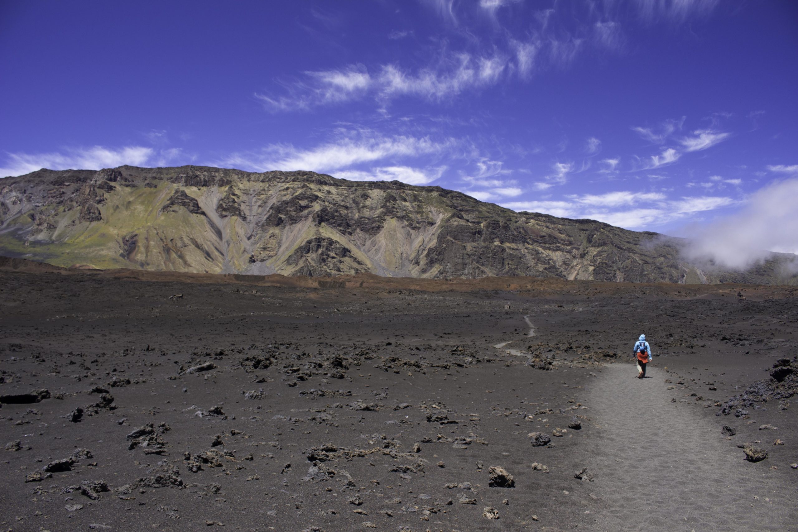
You could see a long way on the Sliding Sands trail in Haleakala crater. The “dots” where the trail splits are 3 hikers following us down the trail.
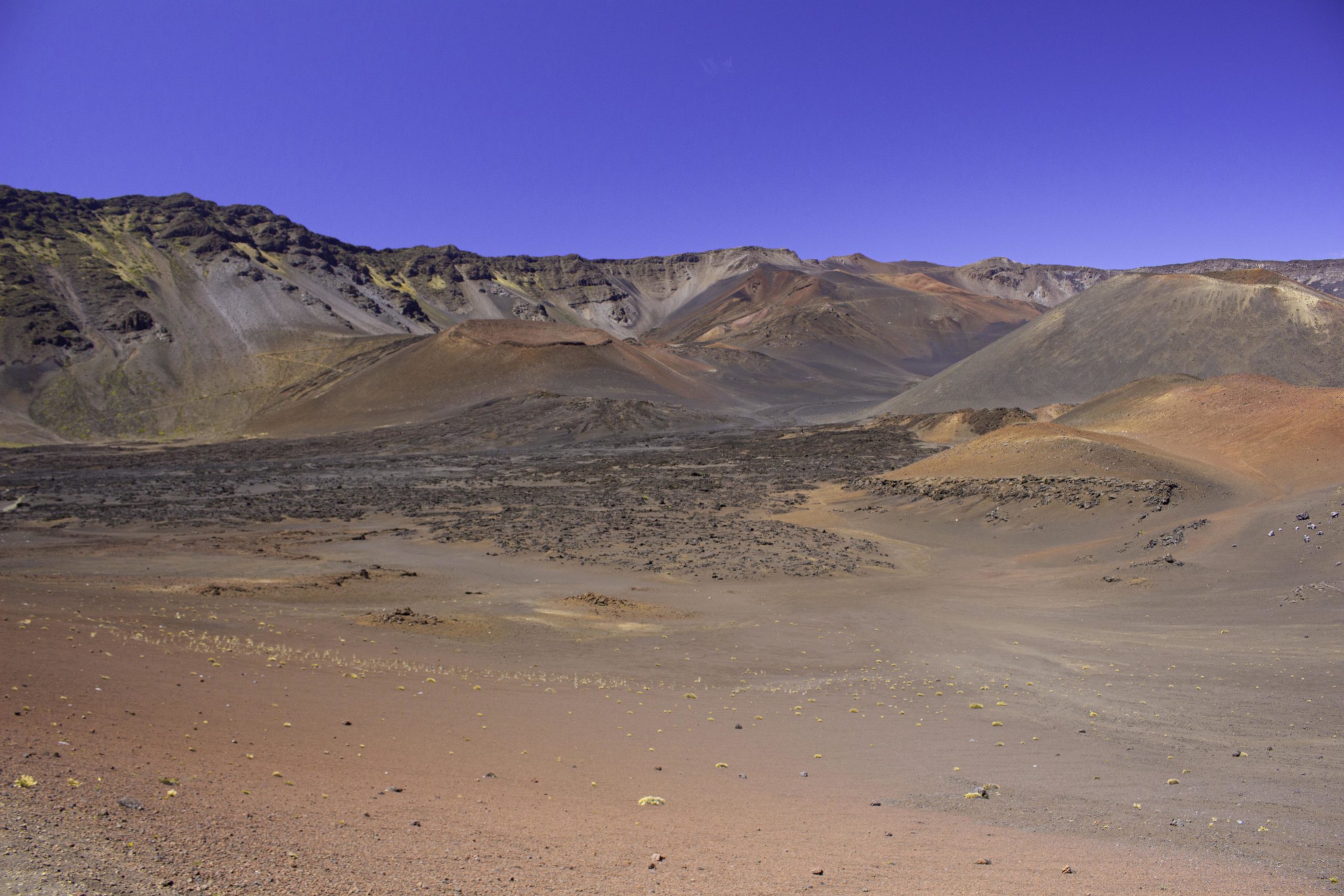
Colorful cinder cones rise above the crater floor in Haleakala.
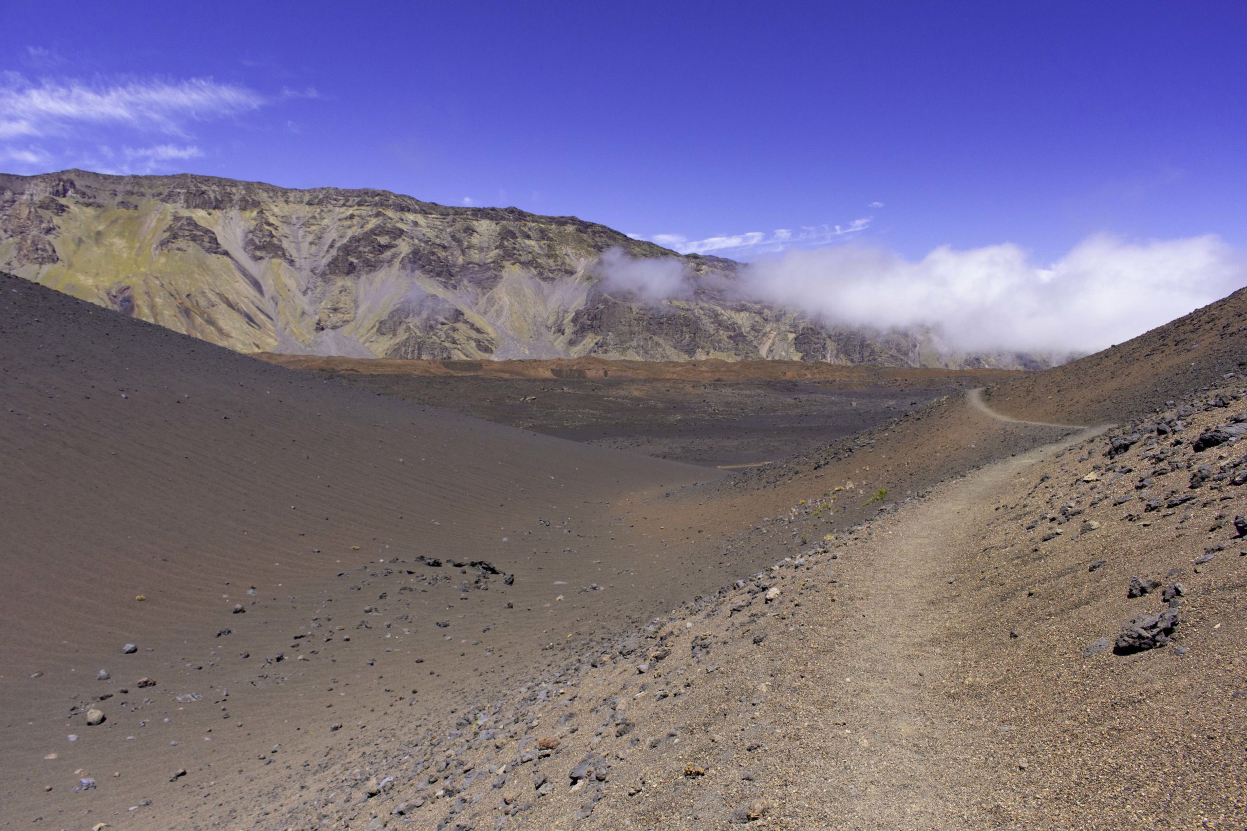
The last of the clouds in the crater disappearing.
After a lunch along the side of the trail (sorry, no trees to sit under or grass to sit on…), Oscar heads down the trail toward the ridge we must climb to get back out of Haleakala.

You can see the switchbacks in front of Oscar that begin the climb out of the Haleakala crater. Surprisingly, this side of the crater had grass and small bushes growing on the crater floor.

Our last day in Maui we drove the road to Hana and stopped off at Wai’anapanapa State Park to hang at the black beach there.

Oscar is out for a swim but Tom gave up – the waves were really rough. We saw more than one person get knocked around in the surf.
Our last hike in Maui was a short walk along the Seven Sacred Pools after the trip down the Road to Hana.

Banyan trees can be found all over Hawaii (and the pacific to India and Australia). The seeds of this fig tree relative are spread by birds. The tree then grows around an established tree using it as a scaffolding. The banyan drops down roots from the branches to help support the weight as it grows. As the banyan envelops its host tree, it eventually applies considerable pressure to the host and commonly kills it. Then the banyan continues to grow without the “scaffolding”.

We went to the Hilo Farmer’s Market upon arriving on the Big Island and sampled lots of stuff.

Our first hike on the big Island was Kilauea Iki and Crater Rim Trail in Volcano National Park. The trail started as a level path along the rim of a crater in the tropical forest.
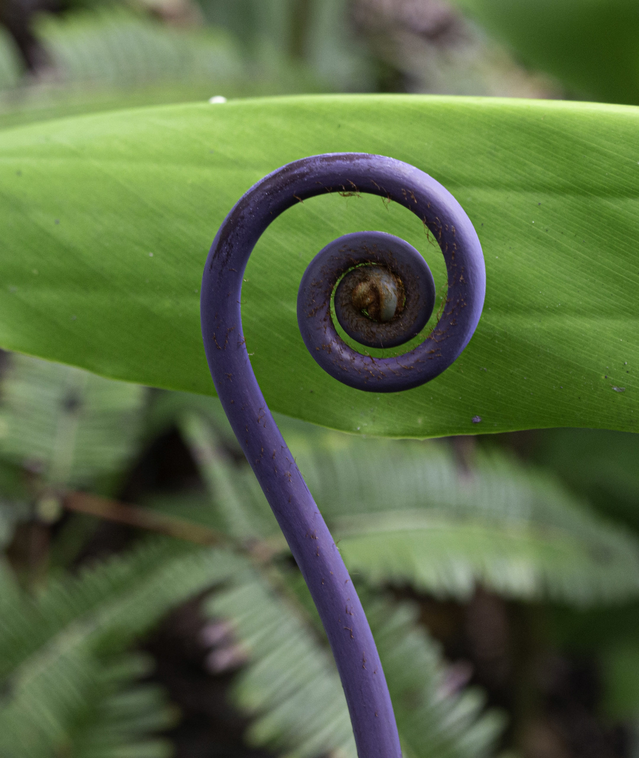
The native Uluhe Fern begins as this purple coil that uncurls and sprouts leaves. The fern is a keystone species in Hawaiian ecosystems because it can colonize bare sites such as lava flows, talus, and abandoned roads. The fern also has medicinal properties and can kill bacteria.

The Kilauea Iki and Crater Rim Trail eventually provided a vista of the hard crater floor that we descended into. The stripe across the crater is the trail and you can barely see the specks that are hikers crossing the crater on the trail.
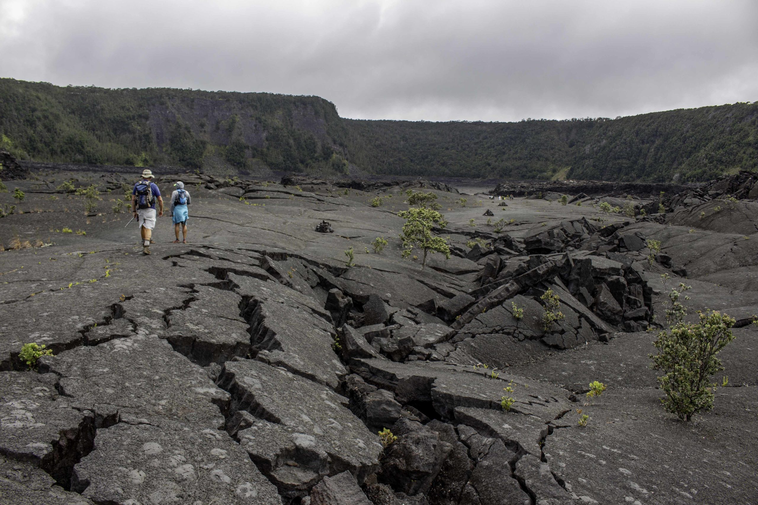
Tom and Oscar were hiking across the crater floor of the Kilauea Iki and Crater Rim Trail looking for a lunch spot. The ground was hardened lava with some vegetation trying to become established.

We hiked out Devastation Road to a vista overlooking the active Halemaʻumaʻu crater on the Kīlauea volcano. The black layer at the bottom of the crater is from recent lava flows. At the time we were there was no lava flowing but just stream/gasses being released. Devastation Road was closed to traffic in 1959 when the crater expanded and swallowed part of the road. Kilauea is considered to be Earth’s most active volcano.
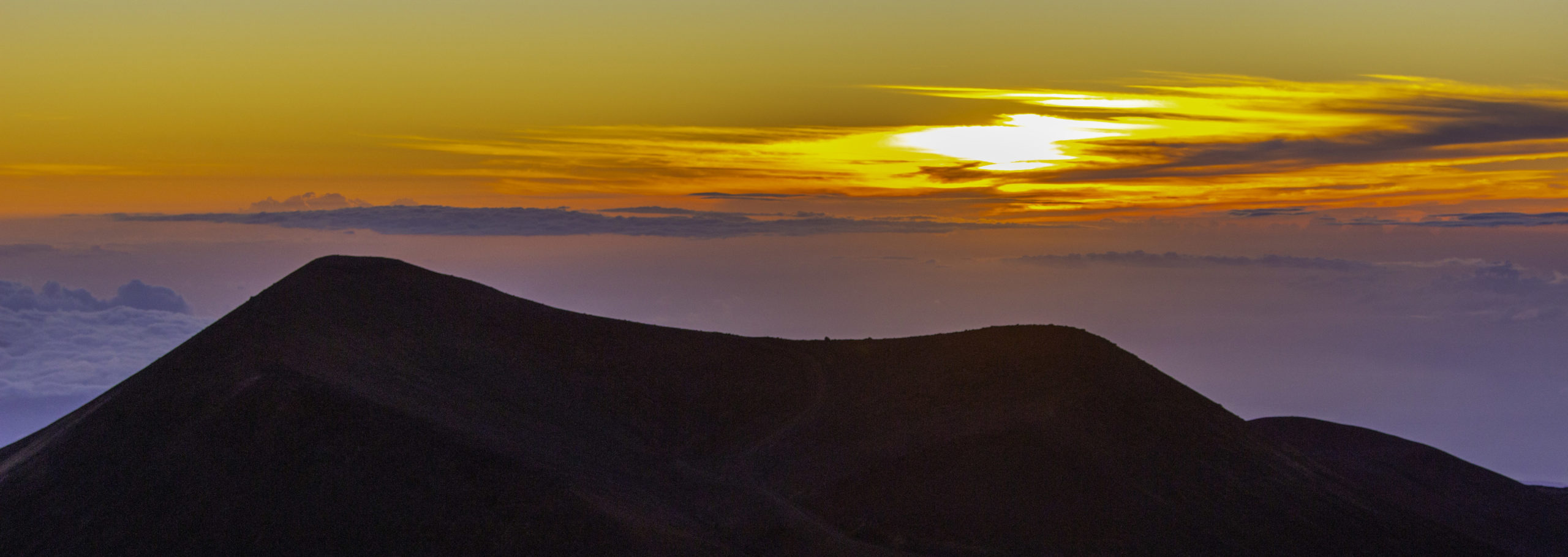
We did not hike the Mauna Kea Summit Trail (13.4mile, 4757ft elevation rise to near 14,000ft) but we did go to the summit for the sunset and to stargaze. Surprisingly, the total cloud cover below us still allowed for a nice sunset.

Another sunset view from Mauna Kea with some of the 13 observatories and the layer of clouds below.

Tom, me, and Oscar bundled up in the cold looking at the stars.

View of the milky way from Mauna Kea. I set my camera to a delayed shutter with 30 seconds open, put it on the ground so it would be steady and took this photo of the stars.
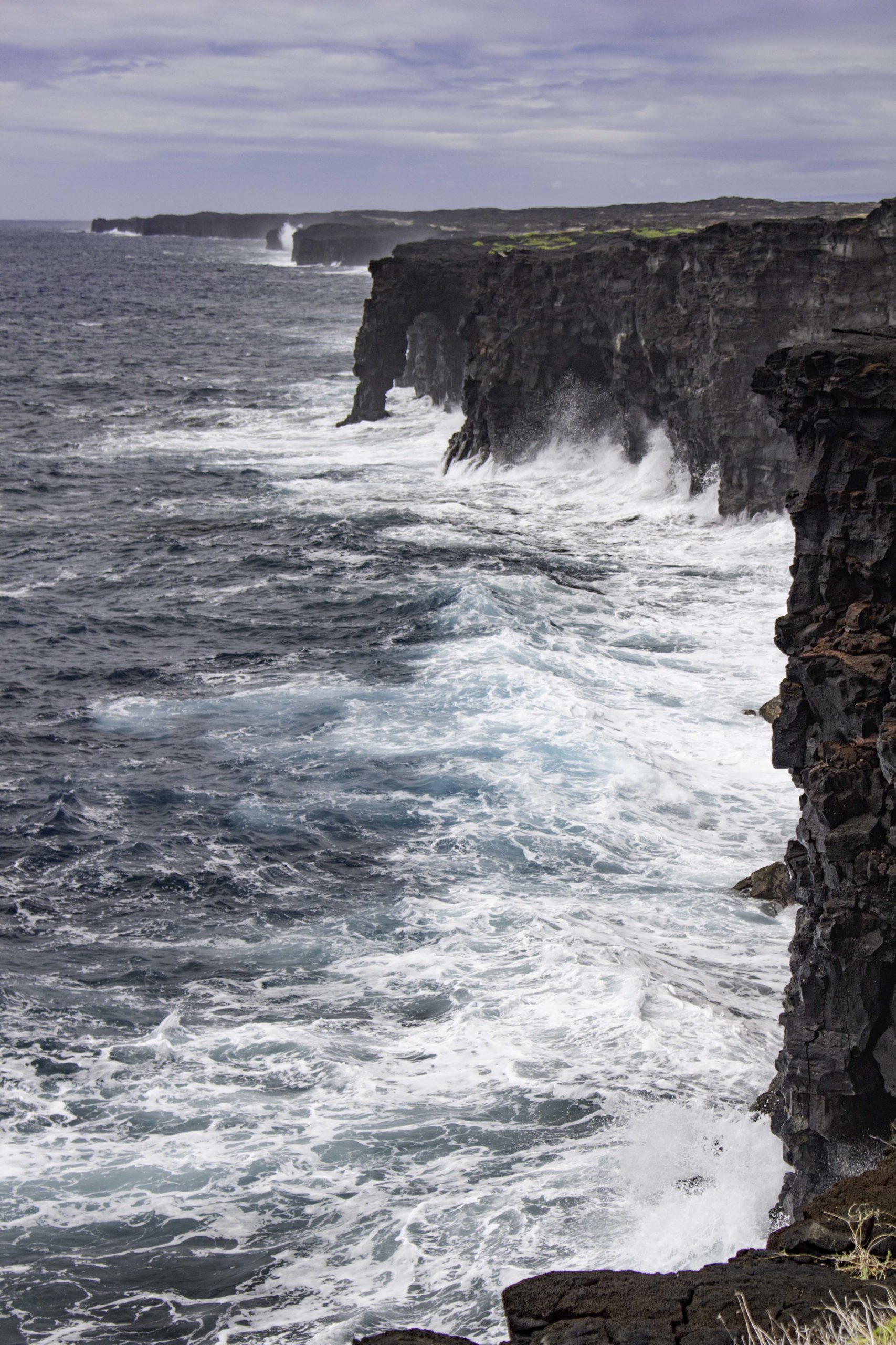
At the end of the Chain of Craters road, there was a sea arch we hiked out to.

Our last hike in Hawaii was the short Puuloa Petroglyphs Trail in Volcano National Park.

On our last day in Hawaii, we visited the Arizona Memorial and the Battleship Missouri in Pearl Harbor before boarding a plane that night to take us back to the mainland. This photo is from the Arizona Memorial.

The Hawaii photos were amazing. Thanks for sharing!
Randy,
These photos of your Hawaii trip are amazing. What a wonderful experience for you! I think it is so great that you are in such good shape to do all these hikes and see these landscapes!!! Way to go!!!
What a great adventure. You capture several aspects of the Hawaiian Islands.