Cascade Pass and Sahale Arm Trail – N Cascades Nat Park, Sept 1, 2017
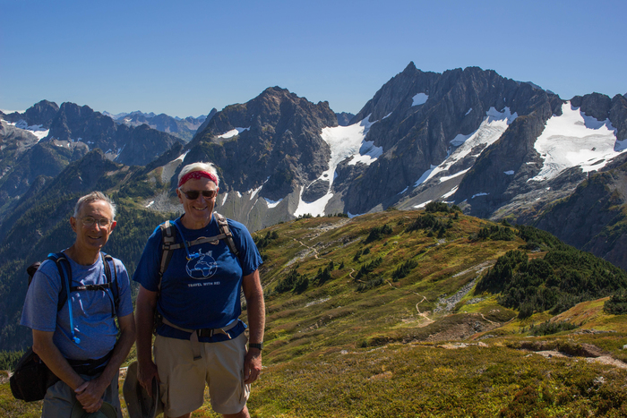
Tom and I are on the way up to Sahale Arm glacier in North Cascades Nat Park. What great views 360 around! Img 60634 Cascadepass Sahalearm n Cascades
Mt Hood Timberline to Paradise Park Trail, Aug, 20, 2017
This hike in the Mt Hood area was our first hike of the trip (12.1 miles, 2,300ft elevation rise). The Paradise Park area was full of flowers. We took the next day off to see the total solar eclipse in Madras OR Img 67359
Narada Falls – Rainier Nat Park, Aug 22, 2017
Narada Falls is right off the road in Rainier National Park. You can see a stone bridge over the Nisqually river at the top of the falls that gives perspective for the 188ft falls. We stopped to enjoy the falls on the way into the park. Img 60049 Rainier Naradafalls
Mt Rainier, Aug 23, 2017
Blue skies and Mt Rainier from the Skyline trail. We were lucky to have the great weather.
Img 60052 Rainier
Broad Left Lupine and Magenta Paintbrushes, Mt Rainier – Aug 23, 2017
Broad Left Lupine (Lupinus articus) and Magenta Paintbrush (castilleja parviflora) at Mt Rainier Img 60124 Rainier Lupine+magentapaintburushes
Rainier and Bear Grass, Aug 23, 2017
A view of Mt Rainier from the Skyline trail with Bear Grass (Xerophyllum tenax) in the foreground. (Bears like eating the blooms) Img 60149 Rainier Beargrass
Low Clouds in Mt Rainier, Aug 24, 2017
The clouds moved in for our second day in Rainier. This was the only sun we saw that day. Img 67493 Rainier
Naches Trail, Mt Rainier, Aug 24, 2017
We hiked in a cloud on the Naches trail and never saw the vistas but did enjoy the flowers (Cascade Aster –Eucephallus ledophyllus) in the mystical fog. Img 67494 Rainier Nachestrl
Naches Trail Bridge – Aug 24, 2017
One part of the Naches trail was also the Pacific Crest Trail (PCT) and had this foot bridge over the road. We met several PCT through hikers on the trail and they were asking us about weather reports, news, etc. Img 67502 Rainier Nachestrl
Tom Foraging Blueberries, Naches Trail Rainier, Aug 24, 2017
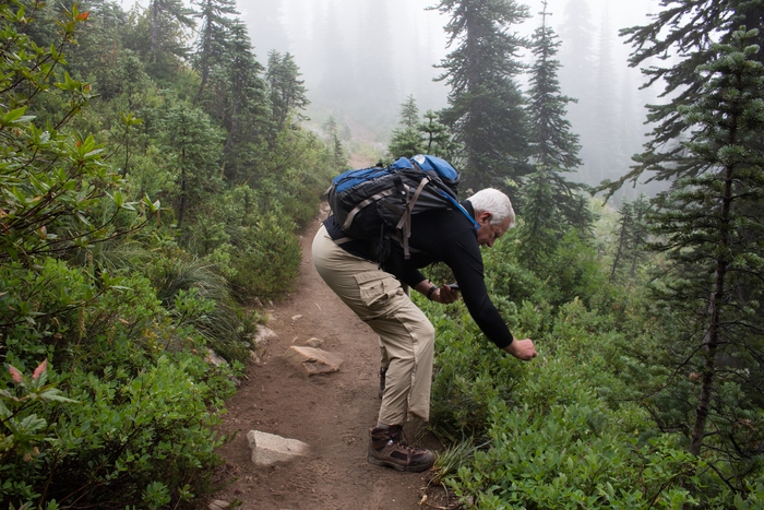
Lots of tasty wild blueberries along the trail. Img 67545 Rainier Nachestrl
Hidden Lake, Rainier, Aug 24, 2017
Climbed up to this nice alpine lake in Rainier Nat Park. Img 67569 Rainier Hiddenlake
Summerland Trail – Rainier Nat Park, Aug 25, 2017
We hiked up the popular Summerland trail in Mt Rainier Park to Panhandle Gap (12 miles, 2950ft elevation rise). Found this small iceberg floating in a small pond near the top. We had to hike through a fair amount of snow to get to the gap. Surprising to see snow at 6,800ft in August. Img 60050 Summerland Rainier
Mt Rainier from Summerland Trail – Aug 25, 2017
We hiked up the Summerland trail in Mt Rainier Park to Panhandle Gap (12 miles, 2950ft elevation rise). This was the view from the lower portion of the trail. Img 60114 Summerland Rainier
Mt Rainier from Borroughs, Aug 26, 2017
This trail is in the northeastern section of the park and provides vistas of Mt Rainier from a different side. Img 60126 Rainier Mtborroughs
Olympic Range from Mt Townsend, Aug 29, 2017
We hiked up Mt Townsend in the Olympic range (8 miles RT, 3010ft elevation rise). From here you could see the mountains of Olympic Nat Park including this view of the smoky mountains from all the forest fires. Img 60277 Olympic mt Townsend
View from Hurricane Hill – Olympic Nat Park, Aug 30, 2017
When we started the day from Port Angeles, it was very overcast. Hiking Hurricane Hill trail, we were above the clouds. Img 60325 Hurricanehill Olympic
Anderson Lake – N Cascades Nat Park – Aug 31, 2017
Our first hike in North Cascades was Anderson Lake on the way driving from Olympic/Port Angeles. We almost did not do this hike due to time constraints because I insisted that we stop at Whidbey Pies and Cafe for lunch and marionberry pie (it’s not all about hiking!!!). Nice little lake in the mountains. Img 60470 Andersonlake n Cascades
Mt Hood from Anderson Lake trail, Aug 31, 2017
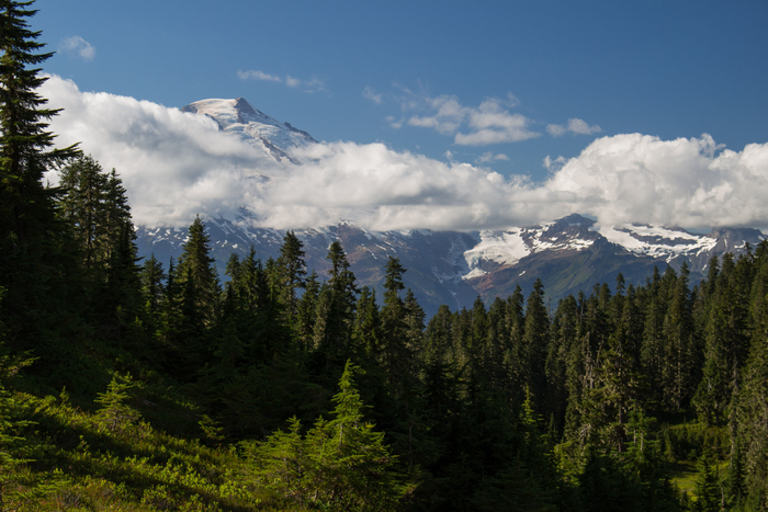
The clouds parted and we got this view of Mt Baker from the Anderson Lake trail. Img 60499 Mthood Andersonlake
Cascade Pass Sahale Arm, N Cascades, Sept 1, 20-17
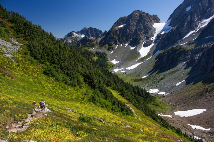
A view down the valley from Cascade Pass and some of the switchbacks up the trail to Sahale Arm. This trail was 12 miles, 4,000ft elevation rise. Great views all around. Img 60655 Cascadepass Sahalearm n Cascades
Maple Pass, N Cascades – Sept 2, 2017
A view of Maple Pass that is above Lake Ann (the trail goes along the ridge at the top) – (7.2 mile loop, 2000ft elevation rise). Img 60714 Maplepass n Cascades
Maple Pass Loop, N Cascades, Sept 2, 2017
A view back at Lake Ann from Maple Pass. This hike is the most popular hike in N. Cascades. Great views of the mountain range and several lakes. Most of this trail is actually in the Okanogan-Wenatchee National Forest, with only the pass and the ridge line being in the national park. Img 60735 Maplepass n Cascades
Maple Pass – N Cascades, Sept 2, 2017
On the way down from Maple Pass you see Rainy Lake with a waterfall dropping into it (the small white ribbon on the right middle of the photo is the waterfall). Img 60784 Maplepass n Cascades
Total Eclipse Sequence, Aug 21, 2017
With a little Photoshop “magic”, we have this collage of the sequence of the photos taken of the August 21, 2017 total solar eclipse from Madras, OR. Img 67610 1
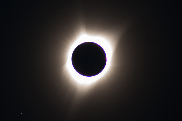
Total Solar Eclipse – Aug 21, 2017
Total eclipse on August 21 from Madras OR. This is a late posting because I have been hiking in WA national parks until Labor Day. The eclipse was really interesting: the light began to dim, and the temperature dropped and then the lights suddenly went out. You could see “sunset” colors 360 degrees on the horizon around you. The total eclipse only lasted 2 minutes but it seemed shorter – busy looking at the eclipse and all around you, then suddenly the lights came back on.
Took this photo of the total solar eclipse (along with 100,000+ others in Madras). Â Tom and I were trapped in traffic heading north out of Madras, OR for 10hrs. The cell towers were bogged down. You could sometimes get text messages but could not send. I have never seen so many people in an “out of the way” spot. Was happy to head for the wilderness to hike and escape the crowds. Img 67610






I have been there! (“Mt Rainier, Aug 23, 2017” photo)