We made our first escape for some hiking since the coronavirus pandemic to Big Bend National Park and Big Bend Ranch State Park. We rented a condo in Lajitas and brought and prepared all our own food to isolate as much as we could.
On our way out west to the parks we stopped to see Stonehenge II west of Kerrville in Ingram TX. This replica is 60% as high and 90% as wide as the original Stonehenge in England . The story is that a Doug Hill had a limestone slab left over from building a patio and offered it to a neighbor, Al Shepperd in 1989. When Al stood it on end, it reminded him of Stonehenge. Shepperd bankrolled Hill to construct plaster and graphite-covered metal mesh and steel frameworks, replicating the mysterious stones of England, in the middle of Shepperd’s pasture. Shepperd added two 13-ft. tall Easter Island heads a year and a half later, after visiting Easter Island. The heads stand away a respectful distance on either side of the Henge. Shepperd passed away in 1994 and the property was sold in 2010. The new owners reportedly wanted to knock it down, but in the nearby town of Ingram, the Hill Country Arts Foundation bought the monument (including the Easter Island heads) and trucked all 75 pieces eight miles east. In 2011 Doug Hill’s creation debuted in its new home, near a small river and some softball fields in town.


Only in Texas do you have the combination of Stonehenge (3000BC) , Easter Island Heads (400-1500AD), and mesquite trees and a display of this year’s pumpkins in the background…

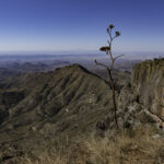
Our first trail in Big Bend was a new one to me and is not on the park trail maps: Cattail Falls. We knew there would be minimal water at the falls (past the rainy season) but we were looking for new trails with less hikers. The trail starts in the desert and heads toward foot of the Chisos mountains below the basin “Window”.

After a short walk down a dirt road the Cattails Falls trail begins near some cottonwood trees watered by the basin Window (the “V” notch at the left). The leaves were changing to their autumn color.
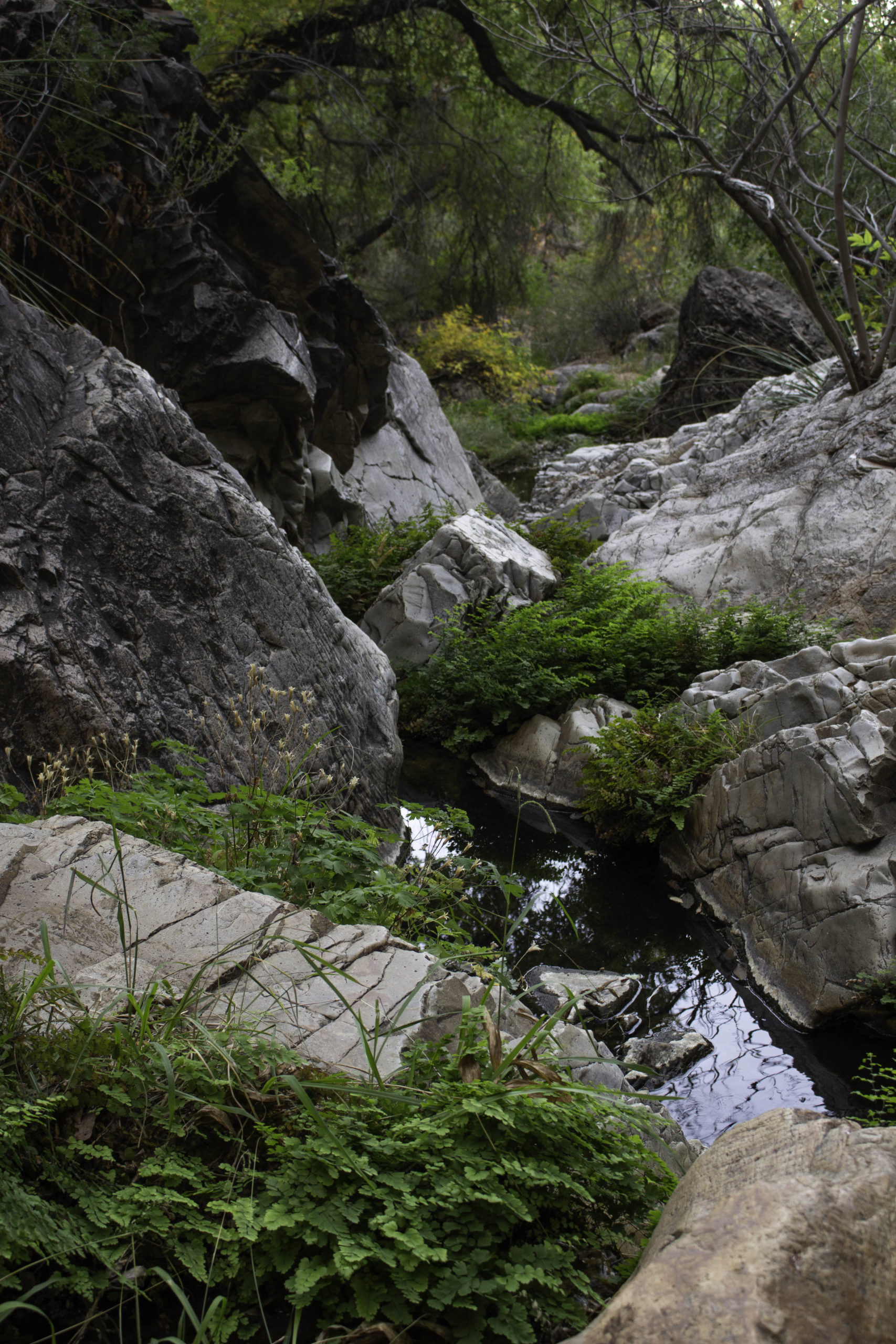
At Cattail Falls, the dry desert was replaced with the lush greens of trees, maidenhair ferns, and columbines. There was a small trickle of water sliding down the falls keeping the pools of water full for the trees, plants, and animals. Unfortunately, there were poison oak vines everywhere so you really had to look where you walked and placed your hands.

This is the bloom of the Agave Lechuguilla, a small cactus (about 1 foot tall by 1 foot wide with a 8 foot bloom). The bloom opens near the bottom and continues to open further up the stalk over time. The two dark red open blooms in the photo are about 9 inches long and 3 inches in diameter and the stalk is over 8 feet. The paper wasps, flies, and other insects were really working the bloom. This agave was not well liked by the early settlers because the razor sharp edges could cause severe cuts on the feet and legs of both people and horses that came too close. There is a photo of this agave plant further down in this post.

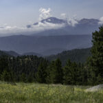
The next trail, Mesa de Anguila, was near our rented condo but one of the most remote of the Big Bend trails. The trail leaves the Lajitas golf course and cuts across the desert for a mile before a steep climb to the more level mesa. This photo looks back at Lajitas (green patch in the upper left of center) and you can see the trail across the desert in the middle. The leafless “sticks” on the near left side is an Ocotillo – there is a photo of the bloom later in this post.
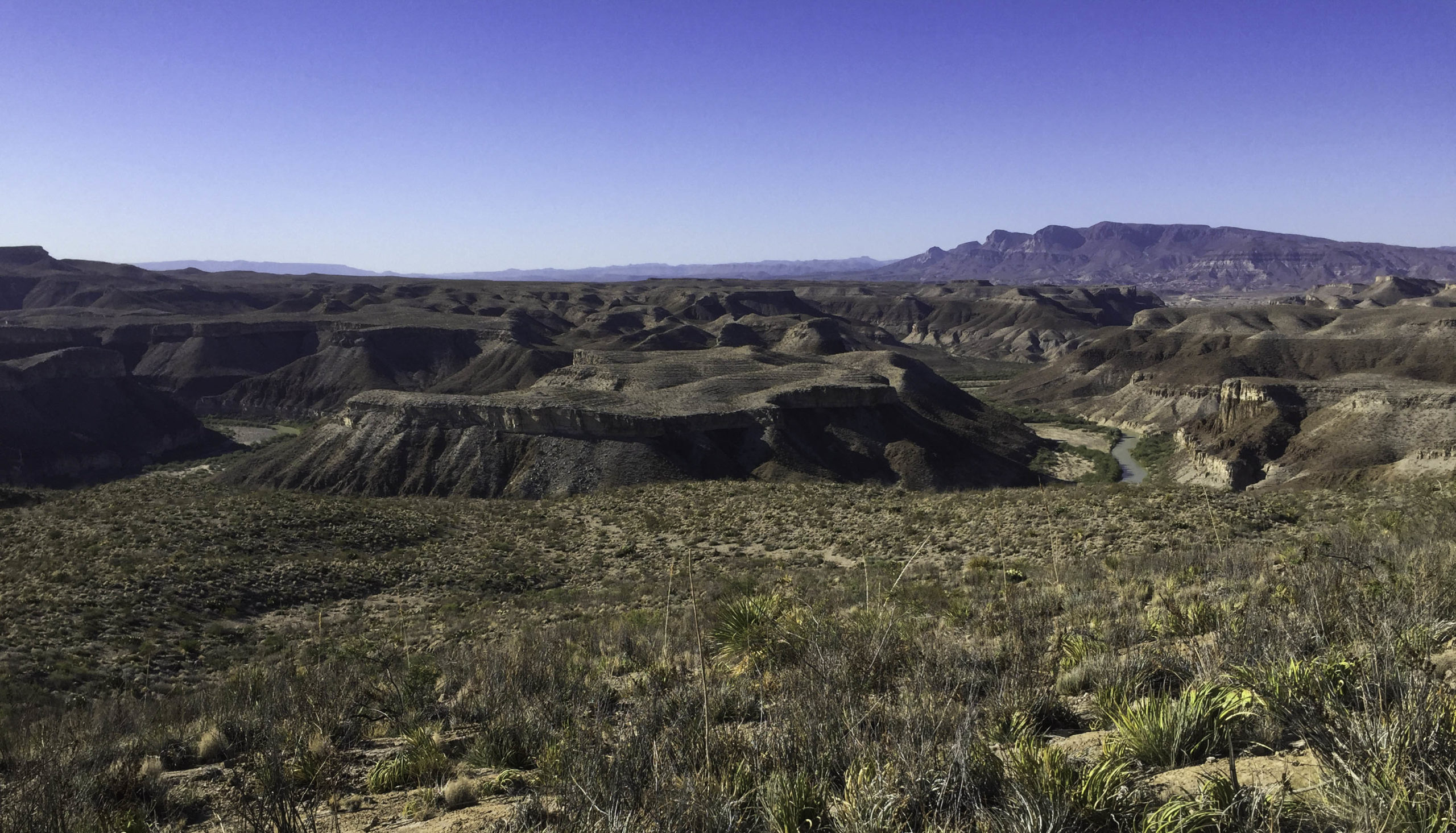
The Mesa de Anguila complex is a strenuous backpackers only maze of trails that extend all the way to the top of Santa Elena Canyon. We just made a day hike of a small portion of it and caught this view of the Rio Grande River. Further down, the river has cut a 1500 ft. deep canyon. You can see the river on the left and right side as it loops around the mesa in the center. Remember the dark red blooms of the Agave Lechuguilla? – the small green plants with the curved spines in the lower right are the Agave that make the tall stalk.

I did hike by myself one day on the more popular Chisos trails to the South Rim. The desert floor is a shear drop 2500ft below the Rim that provides great views. It was a bit hazy but you could still see 20 miles across the park and into Mexico (the ridge below the horizon is the Mexico side of the Rio Grande river). In the upper right you can see a red dot that is one of two other hikers on the rim that are close to where I had my lunch. The round trip is about 13.5 miles of hiking with an elevation rise of 2000ft. I have been doing this hike about every 5 years or so since my first time in 1987.

Another view from the South Rim towards Mexico.
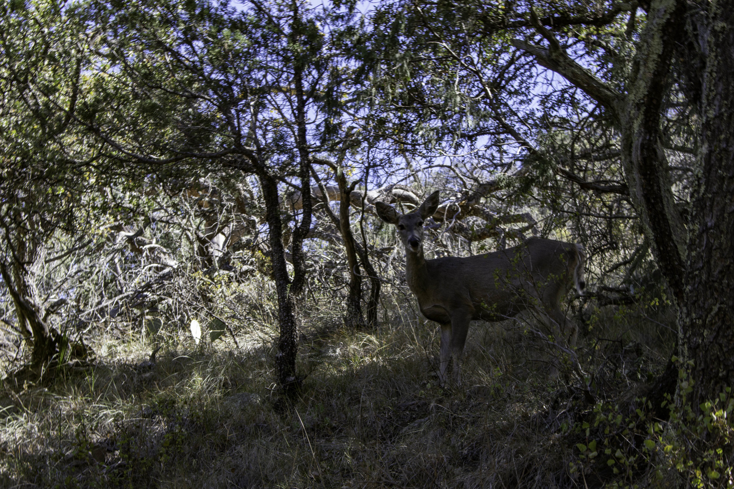
Saw this deer returning from the South Rim on the Boot Canyon trail. It was about 10ft away and the deer had no fear of the hikers passing by. The deer in the Chisos mountain range are a small isolated herd and are really tiny, likely an adaptation to the limited available food.

I always enjoy hiking in Boot Canyon in the fall when the Big Tooth Maples are changing color. This canyon is just about the only area in the park where there is enough moisture and low enough temperature for the trees to grow. This trail is part of the journey back from the South Rim.

These maples are on the steep Pinnacles trail coming down from the South Rim.

Near the end of the 13.5 mile loop from the South Rim, you get this view of the “V” notch Window of the basin (which was seen from the desert below in one of the Cattail Falls trail photos).

We decided to try a few short trails in the Big Bend Ranch State Park that is north of Big Bend National Park. This short trail is appropriately named Hoodoos. The Rio Grande River flows in the green “ribbon” behind me.

The Rio Grande River as seen from the Hoodoo trail.

Remember the Ocotillo “sticks” in the Mesa de Anguila photo earlier? This is a photo of the Ocotillo bloom. The limbs of the plant are covered in thorns and when there is enough water, there are small leaves along the limbs. The early settlers would weave these limbs together to form a thorny fence for livestock.

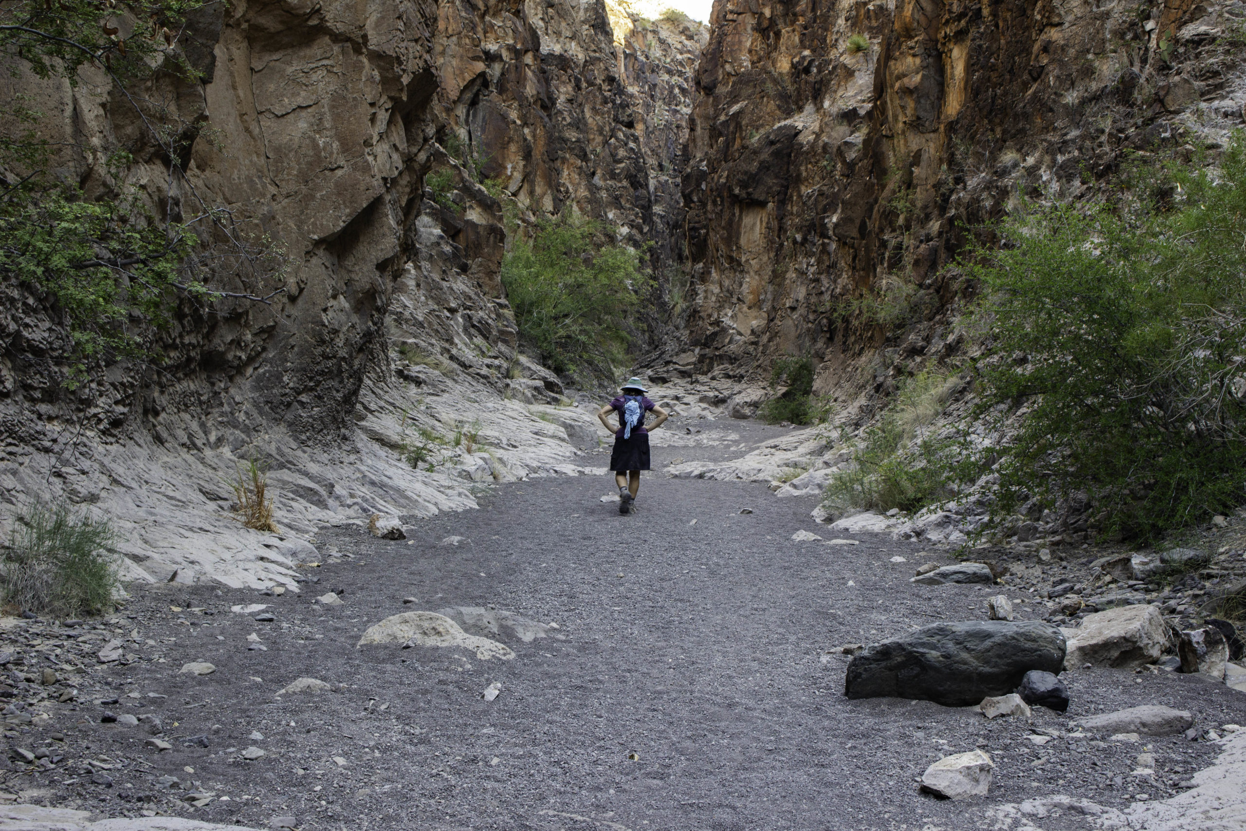
Our last hike was a short one into Closed Canyon in Big Bend Ranch State Park.

Closed Canyon has a pour off into the Rio Grande River, but the trail ends before the pour off for safety reasons. It was a cooler place to hike than the desert.
Heading out of Closed Canyon

For our last night in Lajitas we were rewarded with a nice sunset over the mountains in Mexico. If you remember, the first night we arrived in Lajitas, we had a spectacular sunset.
Very nice Randy. Hope you are all well.
Keep up the wonderful photos.
Steve
Nice Pics Randy! I did not realize there was so much vegetation in that neck of the woods. I also didn’t think the Rio Grande would be so small at that point, knowing how much flow there is further upstream. I guess many towns In New Mexico and Texas use water from it. It’s Alan Lau aka Mr. Bean from Honolulu (friend of Oscar “Tejano”).
Thanks Alan! Oscar told me he was sending you a link to my photoblog.
Most of Big Bend is desert but there are springs, the small amount of high country and the Rio Grande that provide small oasis of green. The Rio Grande often is just a trickle by the time it reaches the Gulf of Mexico due to all the water pumped out for humans/agriculture. Like many rivers that cross desert areas, the river changes with the brief flash floods. Many years ago, I took boy scouts on a canoeing trip starting in Big Bend and down the Rio Grande to outside the park. I was worried that there would not be enough water and was watching the level at the put-in point. If it dropped below 2 feet, then we would be dragging canoes in some areas due to low levels. Fortunately, there was rain upstream right before we arrived and the level increased from about 2 feet to 9 feet. By the time we were off the river, it was down to 3 feet and dropping.
I was really sorry we did not get the chance to hike in Hawaii in Sept – maybe next year (or the next).
Randy
Great pics as always.