Tom, Oscar, and I hiked in the state of Washington for about 4 weeks starting mid September. The original plan was to hike around Lake Tahoe, Mammoth Lakes, Lassen and Yosemite National Parks but the trail closures and air quality issues associated with the California wild fires prompted a last minute change to the Pacific Northwest. Normally, Washington would be not too wet and cool this time of year but there was more rain than expected. Still, we hiked 116 miles of day hikes and climbed a total of about 33,000ft in elevation in addition to seeing some sights in the area. We started in North Cascades based on last minute accommodation availability, then moved up to the Mt Baker area, then down to Rainier. Our last area was around North Bend, southeast of Seattle. We skipped Olympic Nat Park because it is typically better in the spring when all the waterfalls are flowing (but likely would have also been nice due to the rain)Â Tom and I had hiked in North Cascades and Rainier but not in the Mt Baker or North Bend areas. It was all new to Oscar. It was a great trip for us!
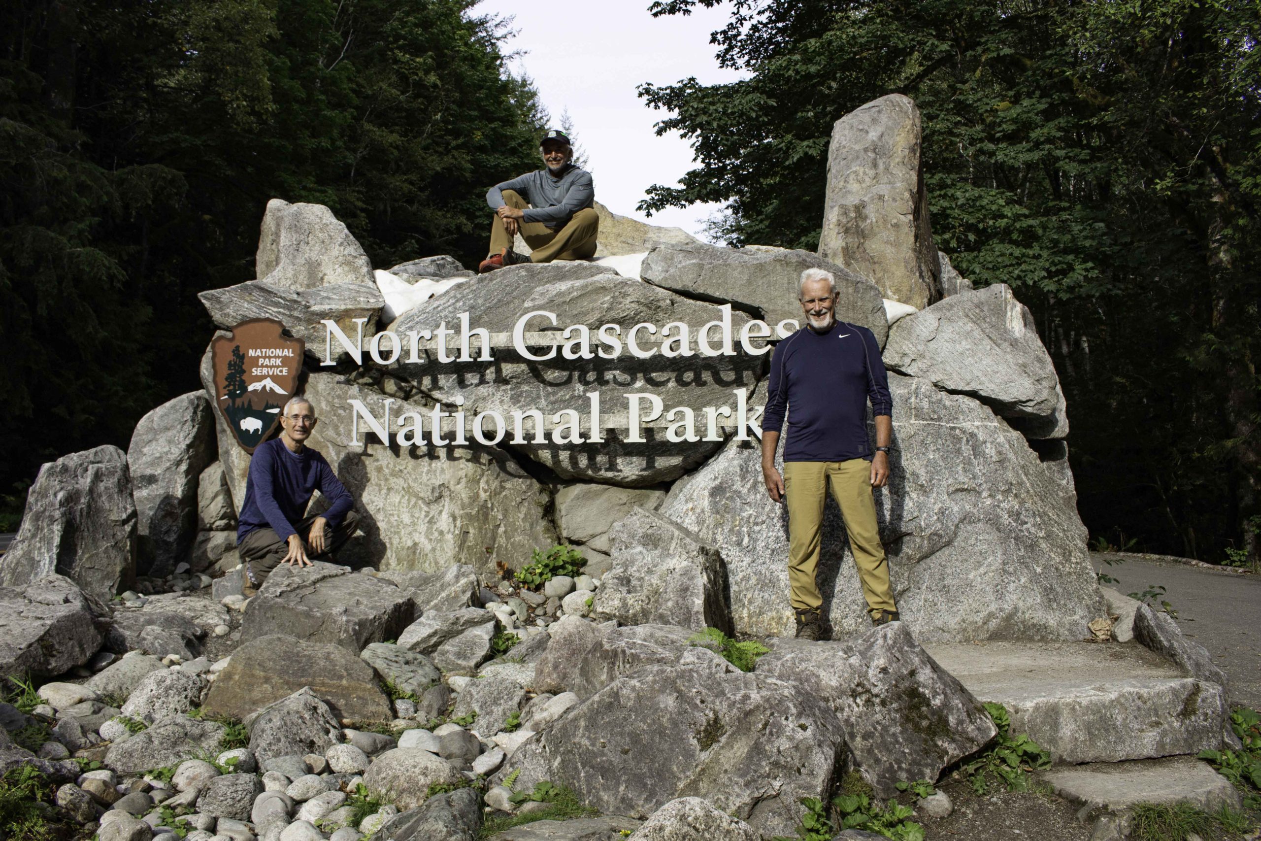
Managed to get our photo on the North Cascades sign on a day without rain.
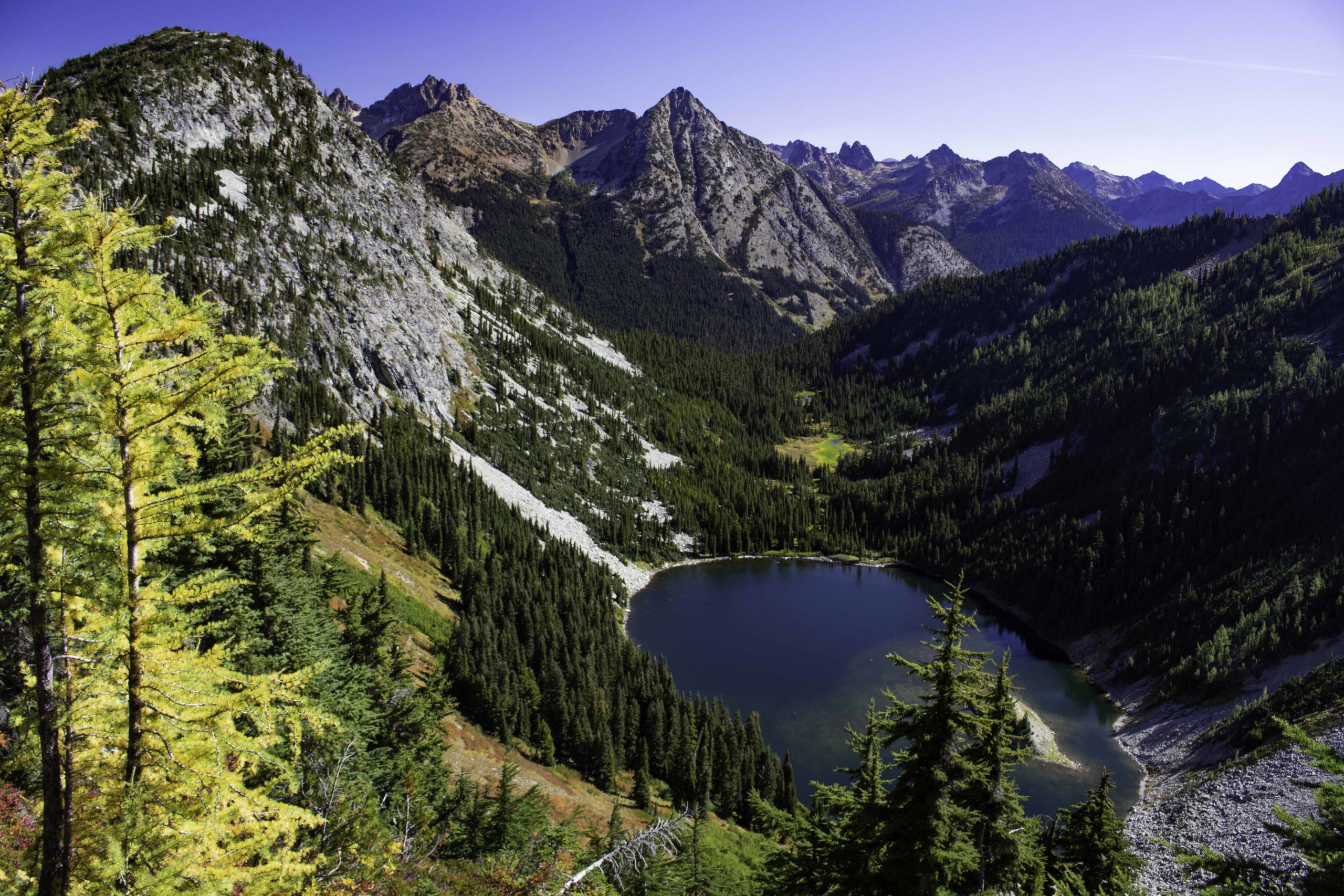
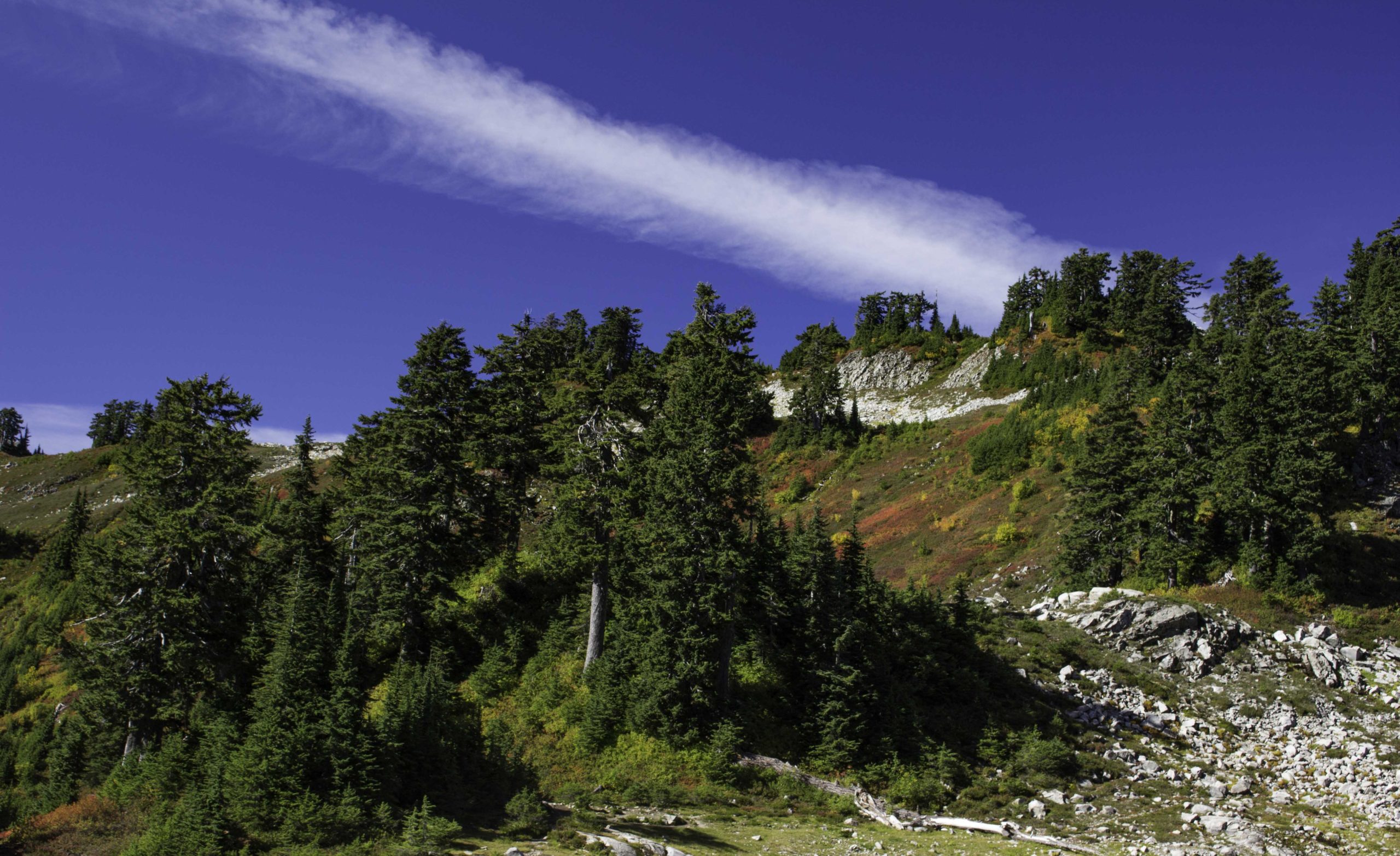
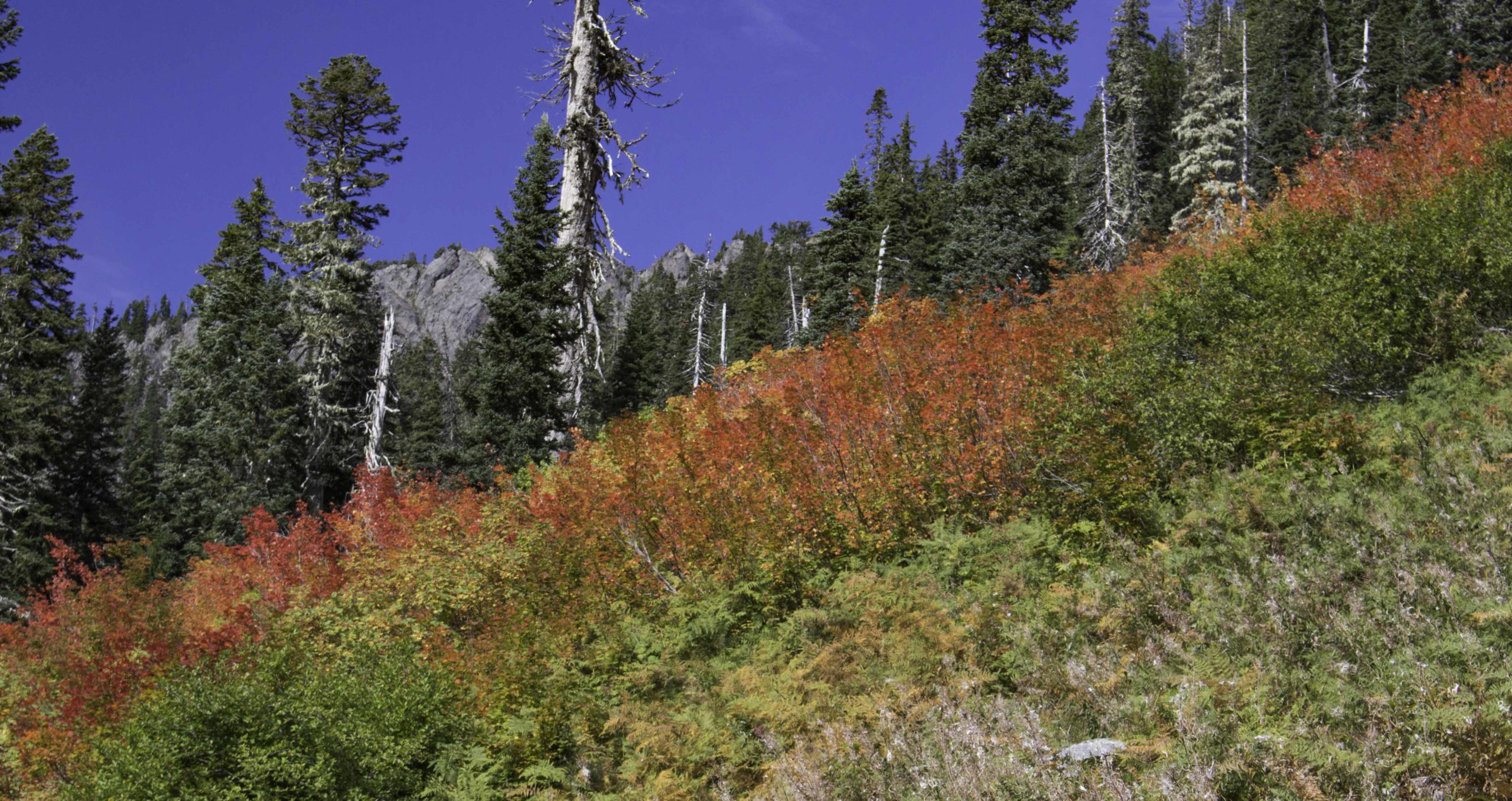
This is a view of Lake Ann from near Maple Pass. There are two hikes in the Marblemount area of North Cascades that are my favorites: Maple Pass loop and Cascades Pass (unfortunately the road to Cascades Pass was washed out). Maple Pass loop is a 7.2 mile loop with 2kft elevation rise that begins in the Okanogan National Forest. Only the pass is in North Cascades. The trail begins the climb in the forest before breaking out above the tree line and circles Lake Ann along Maple Pass. Great views of the Cascades and the lake below. The treat this time was all the fall colors. The red below are blueberry and huckleberry bushes and the yellow tree on the left side is a larch tree.

Our lunch spot on Maple Pass.
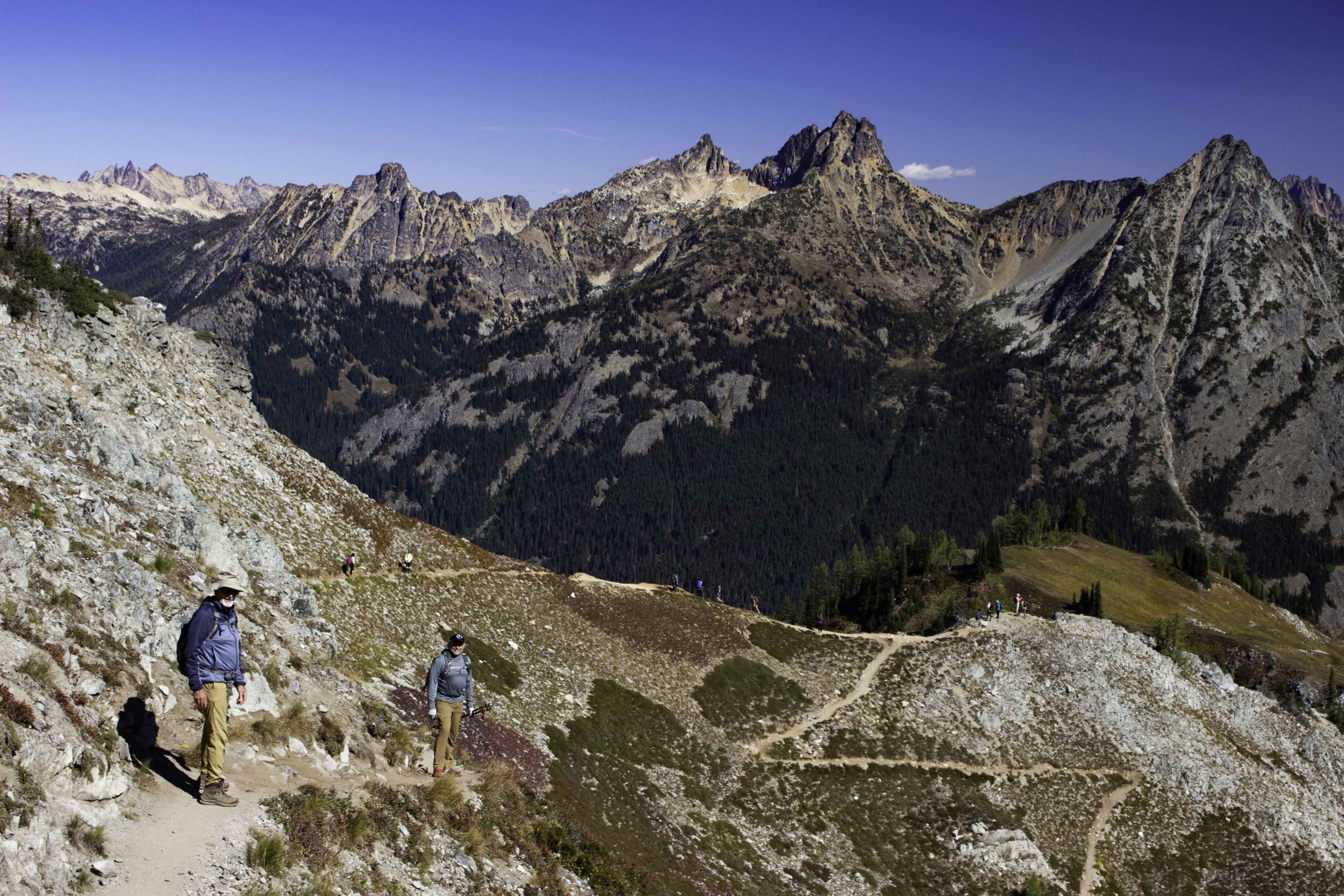
Tom and Oscar are beginning the decent from Maple Pass. Lake Ann is just beyond and below the ridge with all the other hikers. This is a popular trail.
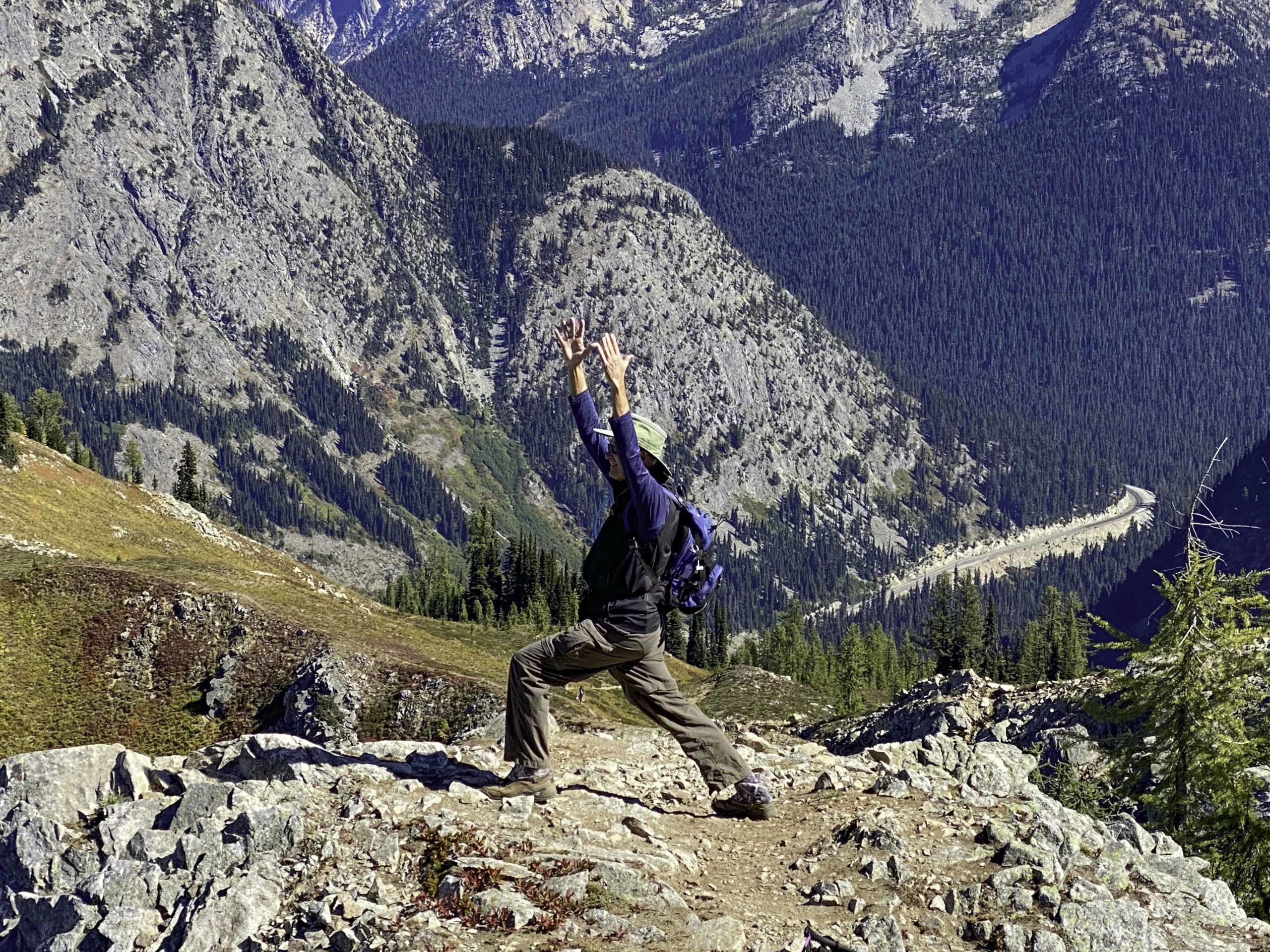
Tom’s iPhone: I was asked to produce a yoga pose on a ridge on the trail

Our accommodations in Marblemount were on the Cascade River. We enjoyed watching the salmon spawn in the shallow water (and enjoyed the wine too…)
We hiked a few short level North Cascade trails when the rain started. Many of the trails in this area are very vertical and the exposed slippery roots make hiking a challenge. The Skagit River loop was a forest loop that also ran along the Skagit River where we watch salmon spawning. The trail exposed us to the temperate rain forest of Washington.
Oscar’s iPhone photo: On the 2nd day of rain, we tackled the Thunder Creek Trail to 4th of July Pass. The creek looked more like a river after all the rain.

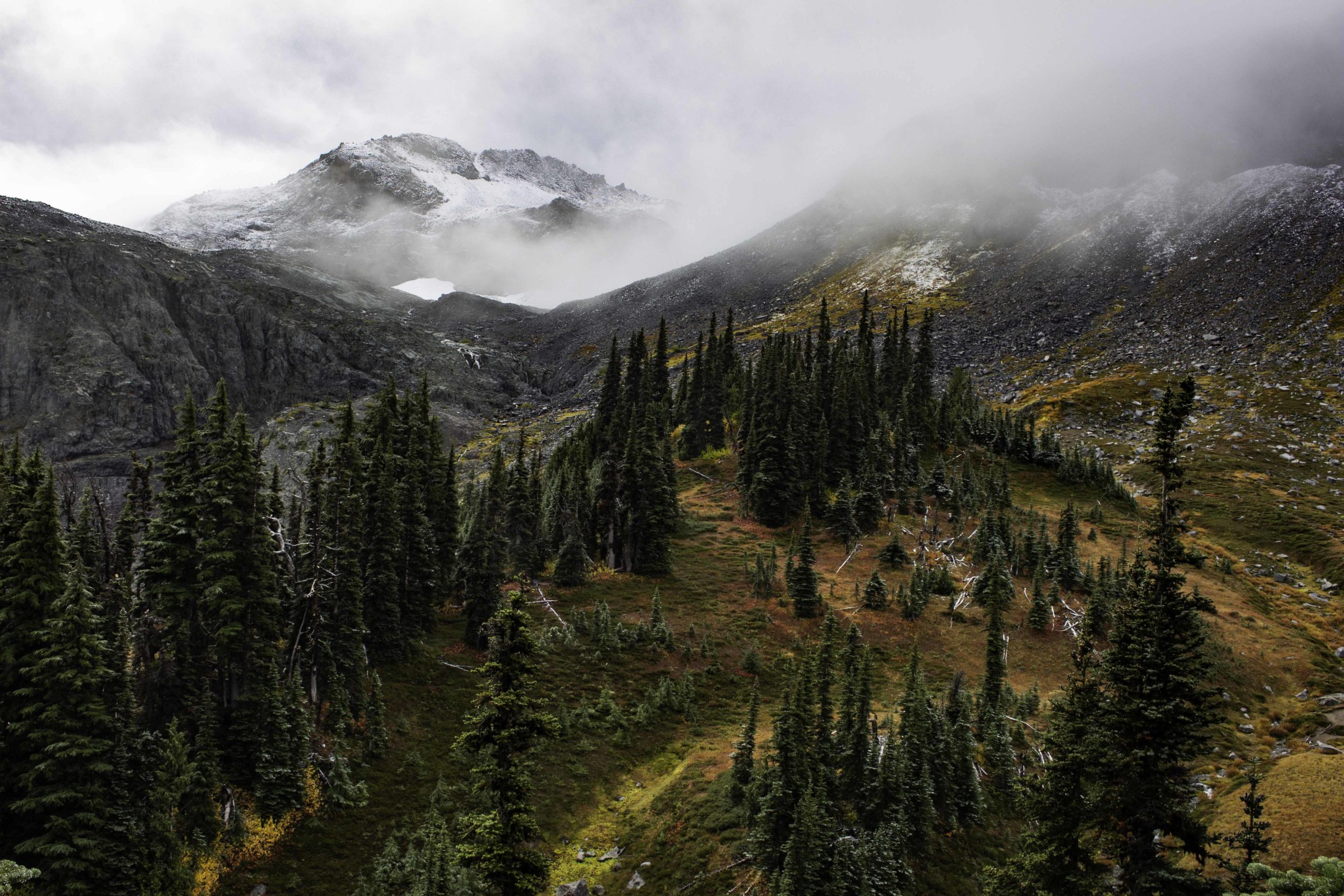
On the 4th of July Pass trail, Oscar startled a black bear that went tearing down the ravine to get away. I managed to see the bear just before it disappeared into the brush. After a while the rain stopped and we made it to the pass and were able to see across to the mountains.
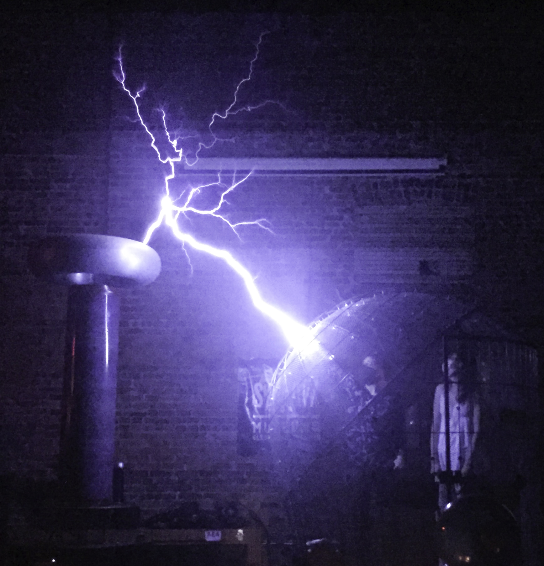

Moving from the North Cascades area to the Mt Baker area, we stopped off at Bellingham for lunch at a local brewery and to visit the Spark Museum of Electrical Invention. It is a great little museum for tech oriented types. We attended a demonstration/show of electrostatic generators, including the “MegaZapper” and the “Cage of Doom”. You can see the two volunteers inside the spherical cage (safely). It was a fun show. (Pardon the image quality – my iPhone in a dark room)
Our first hike in the Mt Baker area was Bagley Lakes Loop. It was raining, low cloud cover, and cold. The next day we walked part of this trail again to get to another loop and the view was quite different.
Took us a while to complete the short Bagley Lakes Loop because we kept stopping to eat wild blueberries.
This was what Bagley Lake looked like the next day. We were hiking the Chain of Lakes Trail that started on the Bagley trail and crossed over Herman Saddle.
On the Chain of Lakes Trail after crossing over Herman Saddle, we saw Mt Baker and Hayes Lake. We hiked through lush, wet meadows down the shoreline of the lake and had lunch before continuing to complete the loop.
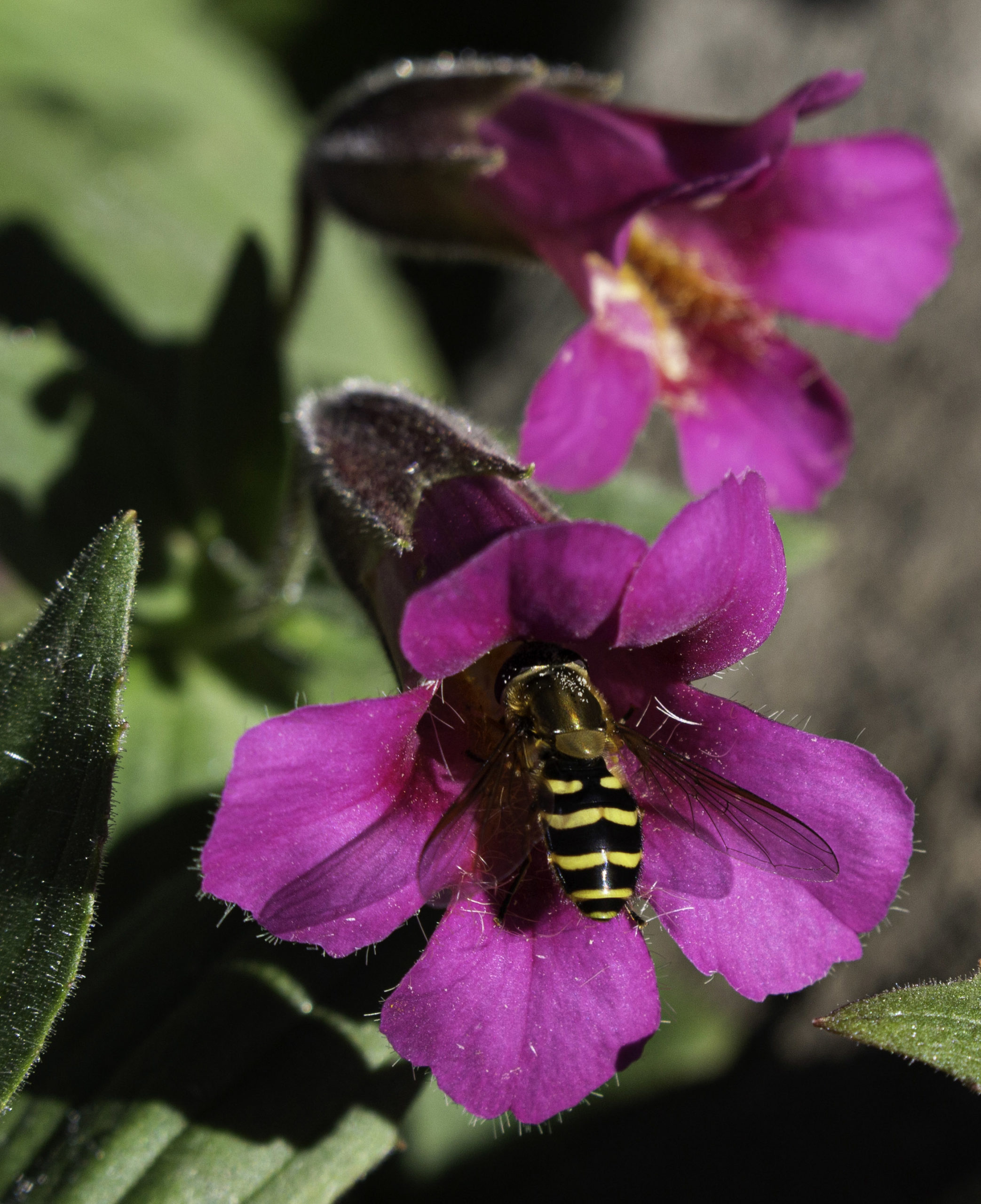
In the fall there were not many flowers but I still found a few. This bee is feasting on a Great Purple Monkeyflower (Erythranthe caespitosa).
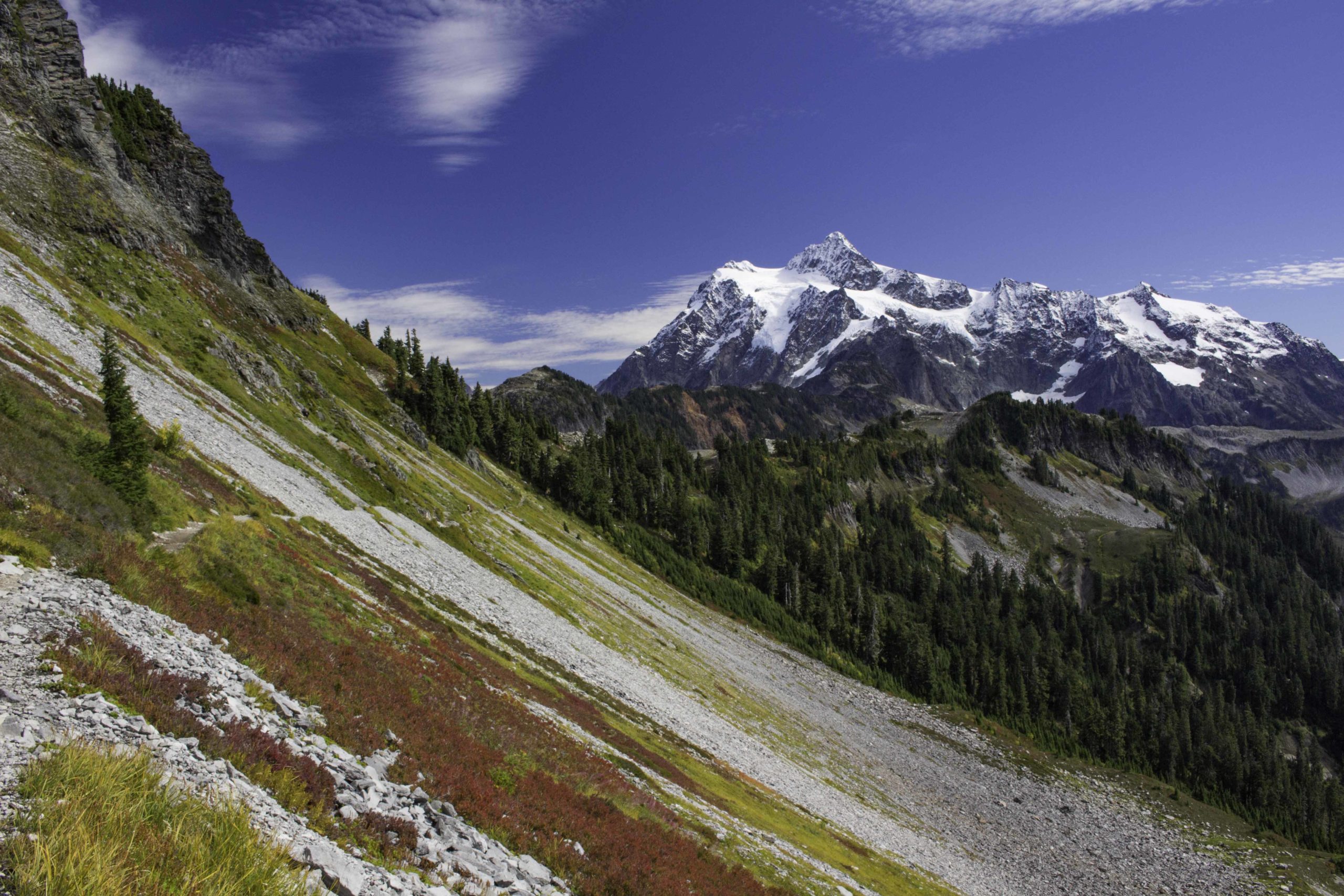
The last part of the Chain of Lakes trail was a shelf trail back to the parking lot near Artist Point with Mt Shuksan in the background. The red low growing foliage were blueberries.
Mt Shuksan from the short Artist Point loop.

After driving 13 miles of a pot holed, rutted, rocky road, we hiked the Skyline Divide trail. After a climb in the forest, we emerged to hike across a series of grassy knolls toward Mt Baker.
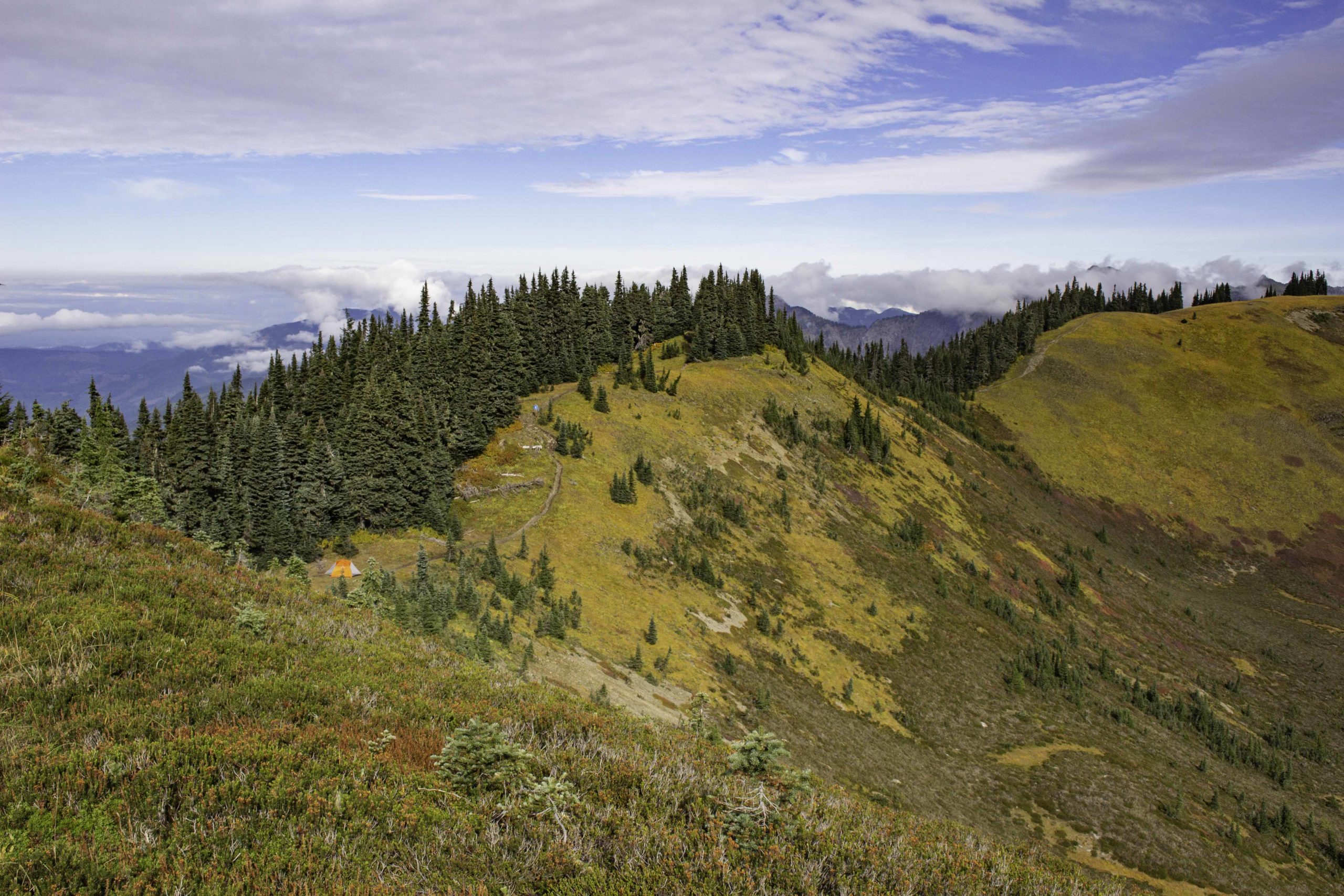
This view was from the 3rd knoll of Skyline Divide looking back. Just a bit left of center of the photo, along the line of trees, you can find a blue “dot” that is Oscar on the trail. There is an orange tent along the trail lower and to the left.

Having lunch on one of the knolls of Skyline Divide.
The saucer shaped cloud above Mt Baker is a lenticular cloud. When the wind flows around and over the mountain top, eddies are created and the circulation captures and corrals a cloud into a disk shape. Tom is hiking back to the Skyline divide trailhead.
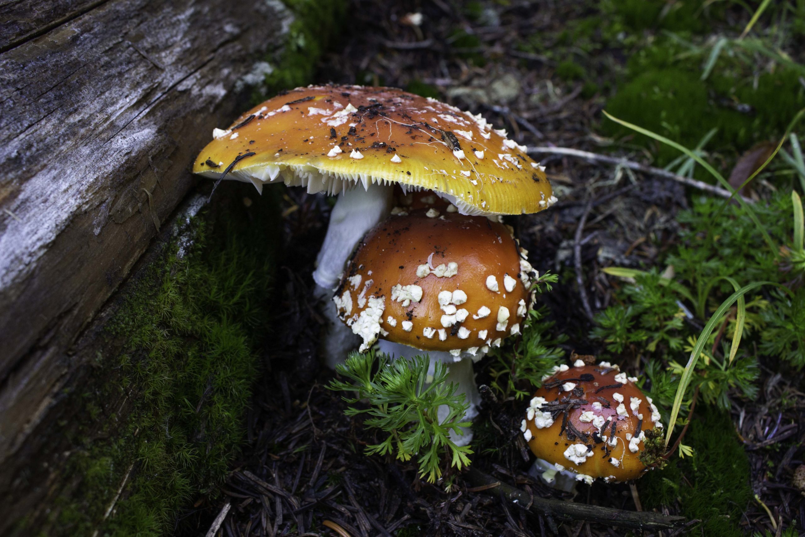
I found several of these Fly Agaric (Amanita muscaria) toxic mushrooms along the trail.

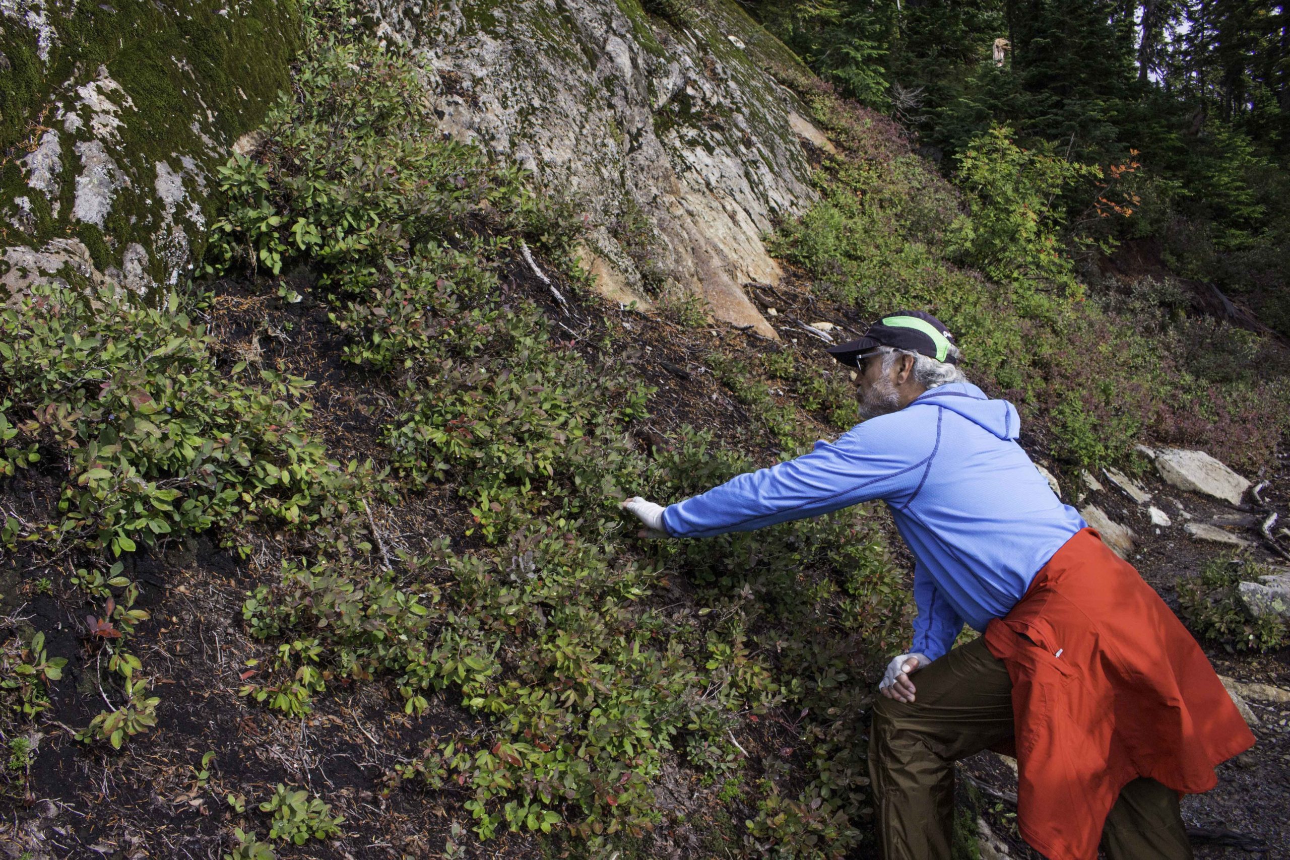
The Lake Ann trail in the Mt Baker area first drops down into a pretty meadow (before climbing to the lake) . The red bushes are blueberries and huckleberries.
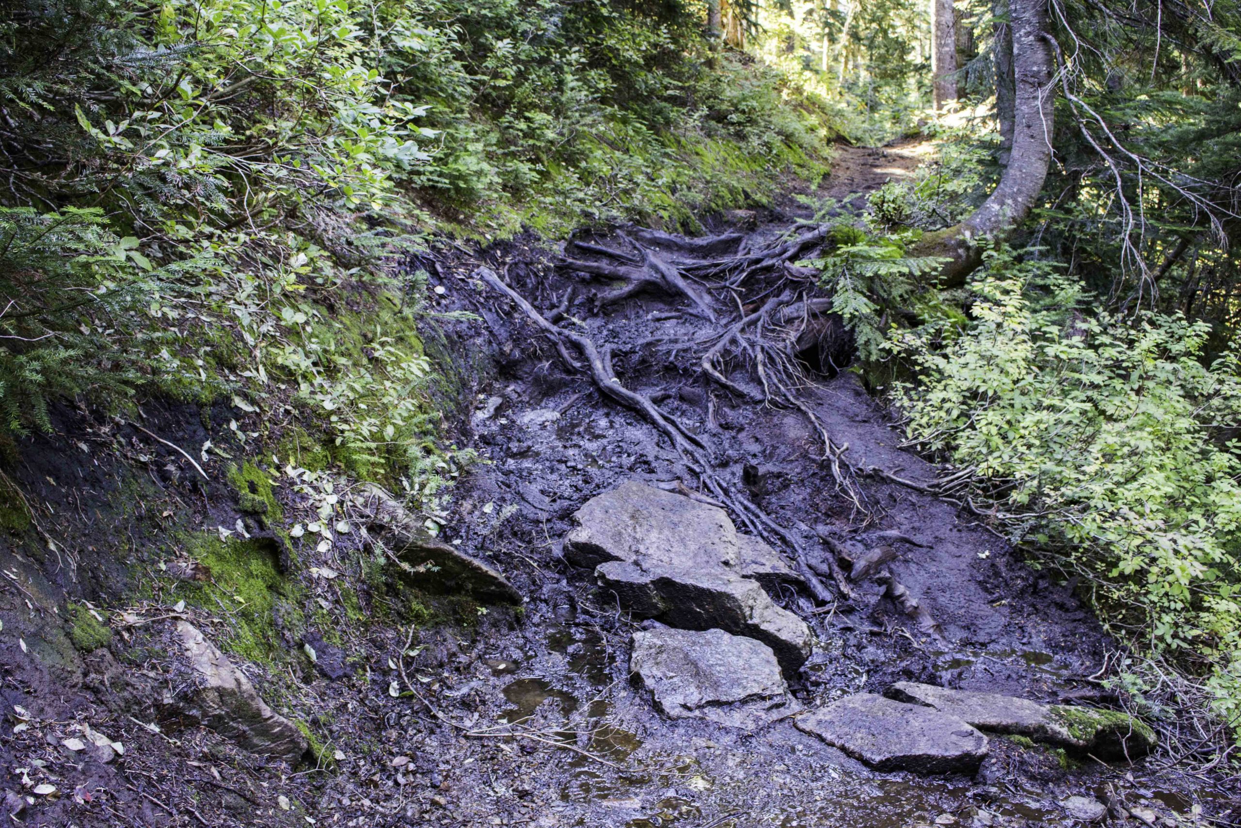
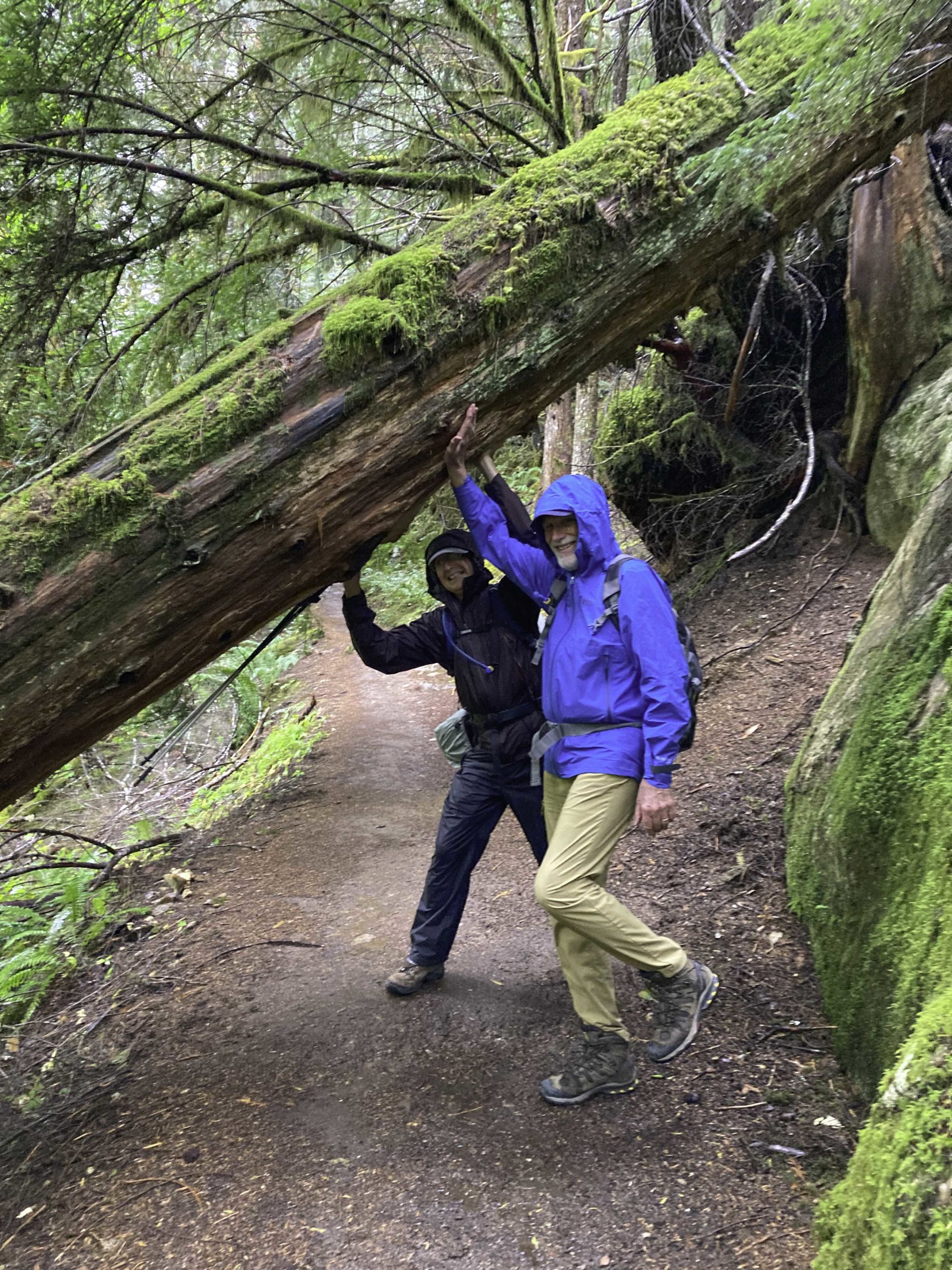
It is not complete to talk about hiking in western Washington without mentioning roots and muck. The Lake Ann trail had plenty of it. The soil is a thin layer, there is plenty of rain and therefore the tree roots are fairly shallow and the trail can be muck. These roots were very slippery and it was best to not step on them to avoid slipping. But as you can tell, that is easier said than done. On this trail, I saw a backpacker slip on a root, trip, and injure his ankle. His only choice was to turn around and limp back to the trailhead (and no more hiking for quite a while). You just had to slow down and exercise caution in these areas.
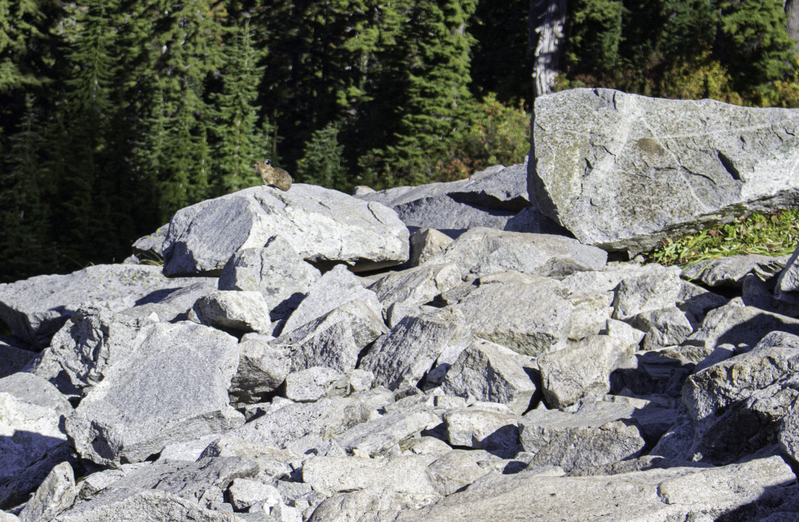
This Pika was guarding it’s scree zone. You would not notice these cute guys except for the high-pitched alarm sound they make. Pikas are related to rabbits and normally are only found at higher altitude rocky scree areas. I understand the Pokemon Pikachu character was based on this animal.
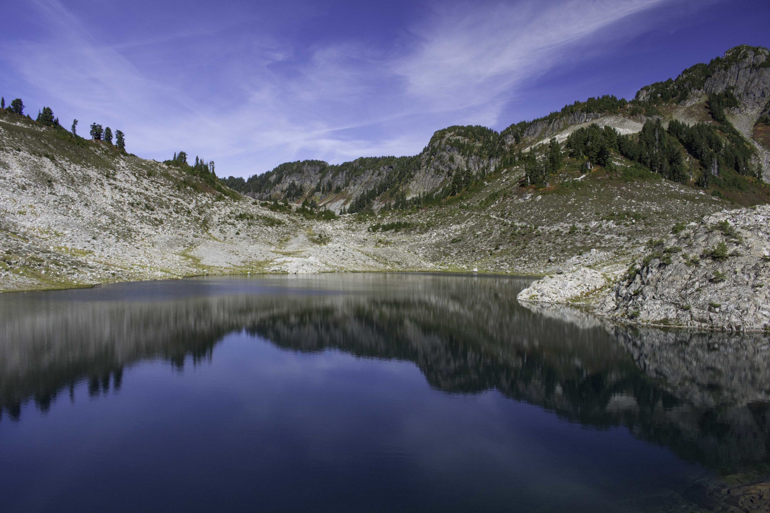
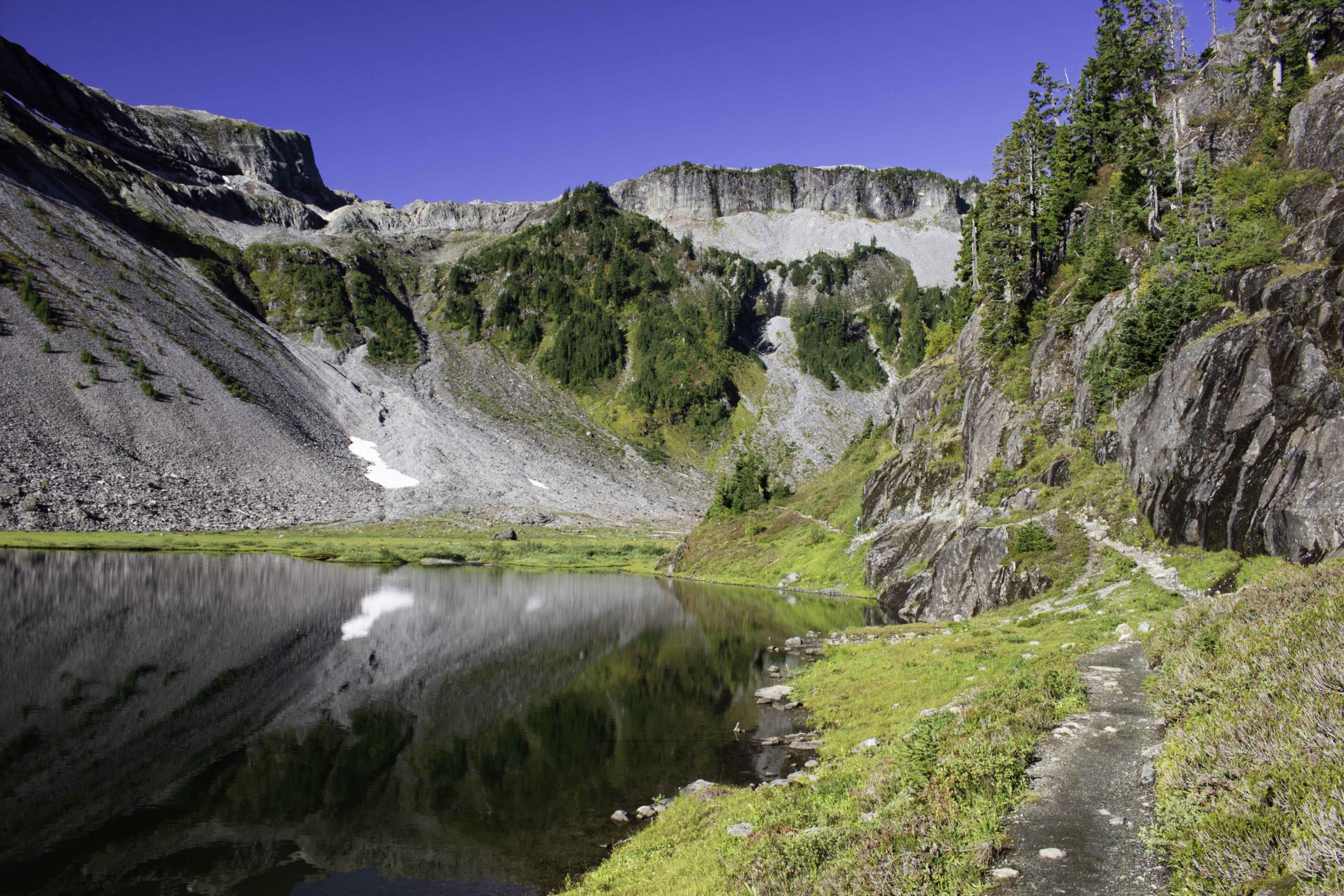
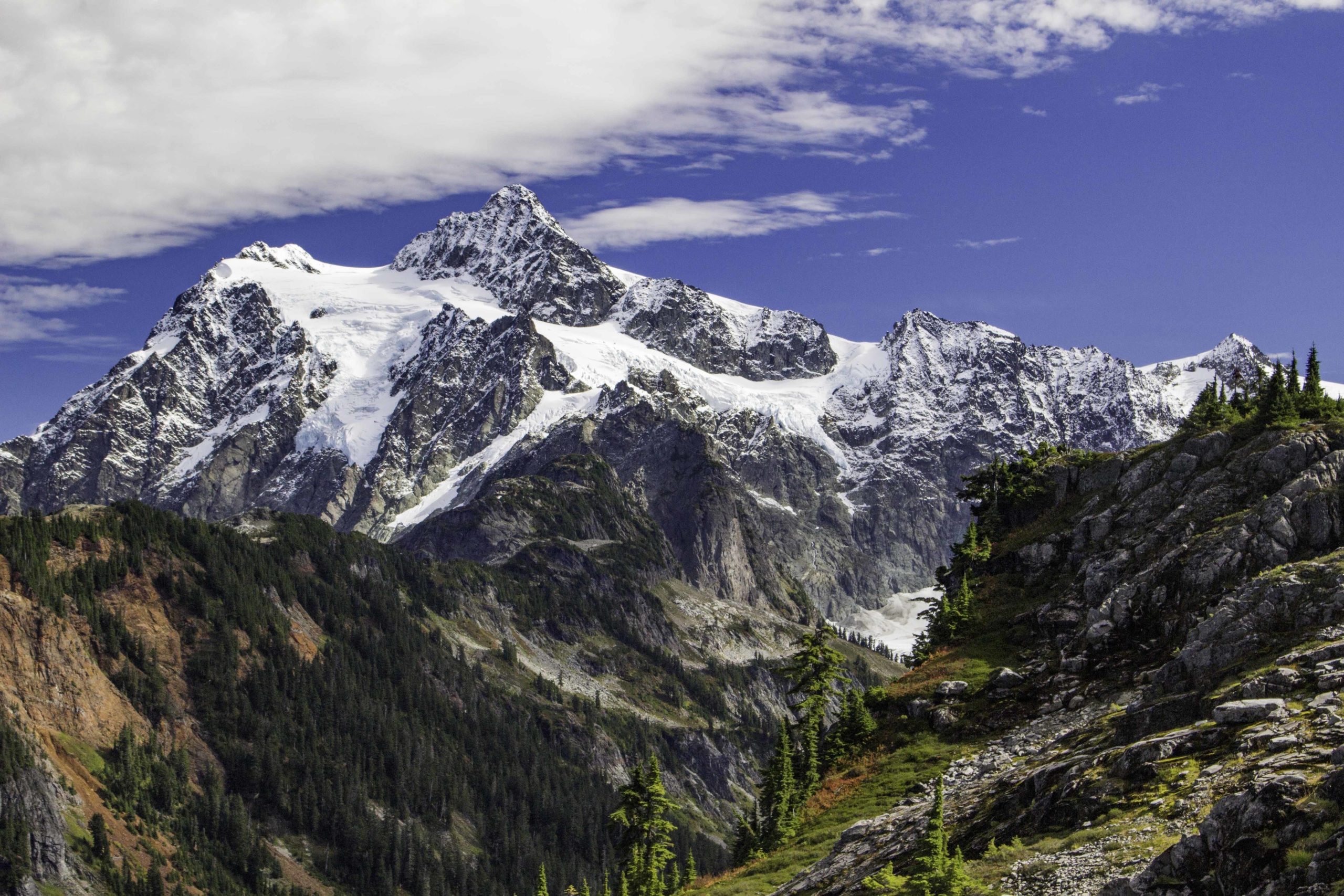
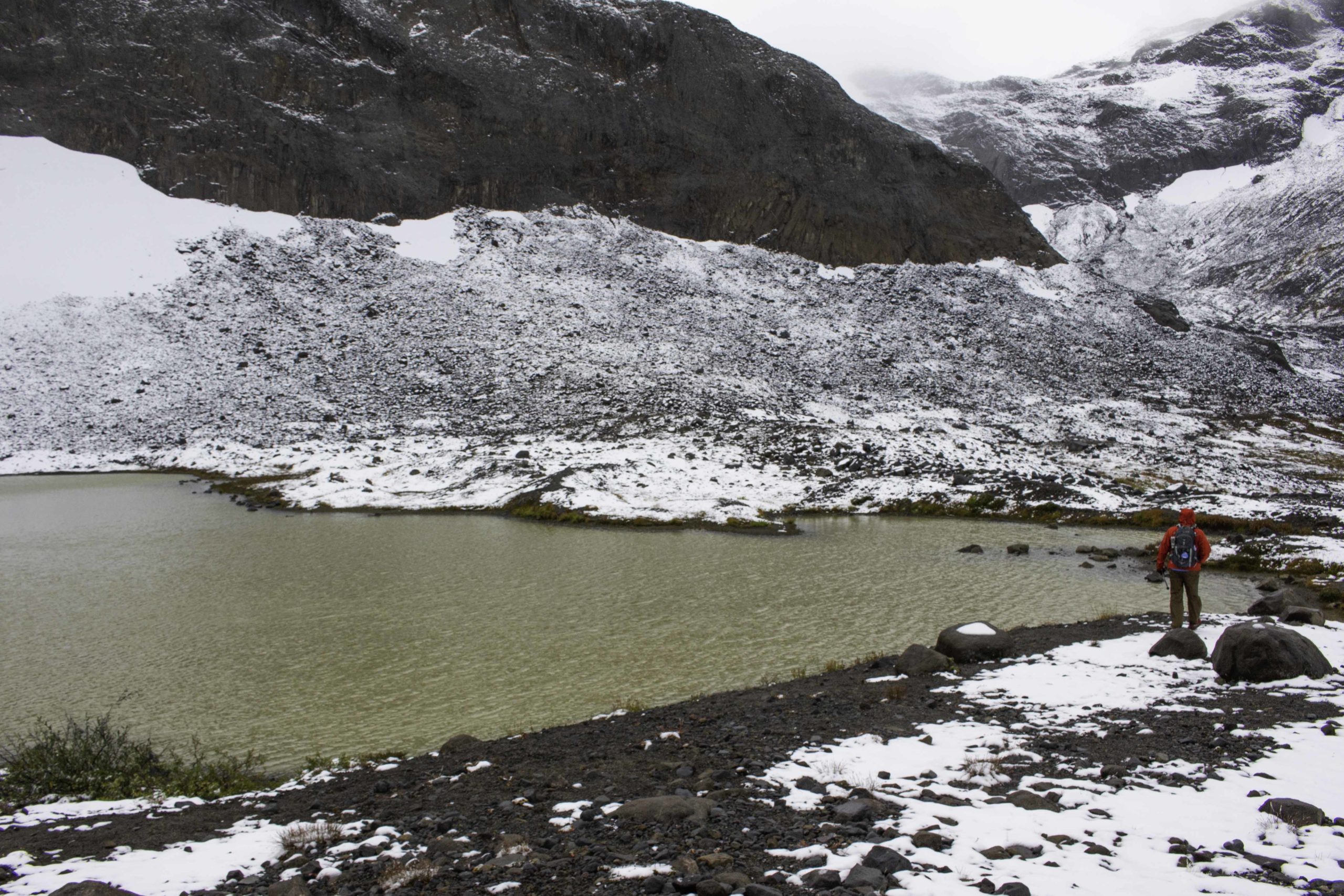
Lake Ann, the destination of the hike. Hard to tell how large this lake was from the photo but the “white dot” on the opposite shoreline a bit right of center is a 3 person dome tent.

Tom’s iPhone: Me, Oscar, and Tom at Lake Ann with Mt Shuksan in the background.

See Tom’s silhouette on one of the glaciers of Mt Shuksan from across Lake Ann
Colorful basin view looking up from Lake Ann
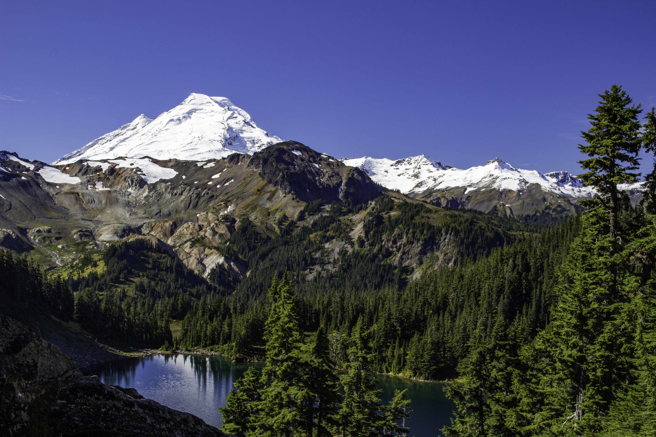
Our final hike in the Mt Baker area was Ptarmigan Ridge. Access to the trail is along the Chain of Lakes trail. The trail climbs along a ridge toward Mt Baker for our closest view of the mountain/volcano.

On the latter part of the Ptarmigan Ridge Trail, there are great up close views of Mt Baker.

And great up close views of the glaciers of Mt Baker
The Green Lakes were along the Ptarmigan Ridge trail and offer camping sites. The red in the foreground were very short blueberry bushes.

On our way from Mt Baker area south to Rainier, we stopped off and toured the Chihuly Museum of Glass in Seattle (after checking out the massive REI flagship store in Seattle). Tom is admiring one of the chandeliers

More Chilhuly
By the way, we do not “rough it” on these trips. We used this VRBO rental in Greenwater as a base to hike in Rainier.

Our first day in Rainier and it was raining again and cold (low 40’sF). We hiked the short Naches Peak trail and were rewarded with vivid fall colors (and blueberries to eat). This was the second time I had hiked this trail and both times it was raining and low clouds. I am told there are great views but I have yet to see them.

There was a herd of elk in our rental neighborhood that liked to get into the garbage. The owner’s system of bungie cord and carabiner worked well to keep them out, but it did not stop the elk from trying for a very long time and pushing the container around the yard.

A second day of rain in Rainier so we hike another short loop trail, Silver Falls

Tom’s iPhone: Silver Falls – It was so much fun trying to shoot photos in the rain……
After 2 days of rain in Rainier, the weather cleared a bit and we hiked the popular Summerland trail. It was still overcast and cold. This is a view from the Summerland group campsite looking out toward the pass. We tried to make it up to the pass but there was too much snow, the wind picked up, and it was cold.
Starting to get into the snow on the Summerland trail to the pass.

Tom on his last mile back to the Summerland trailhead

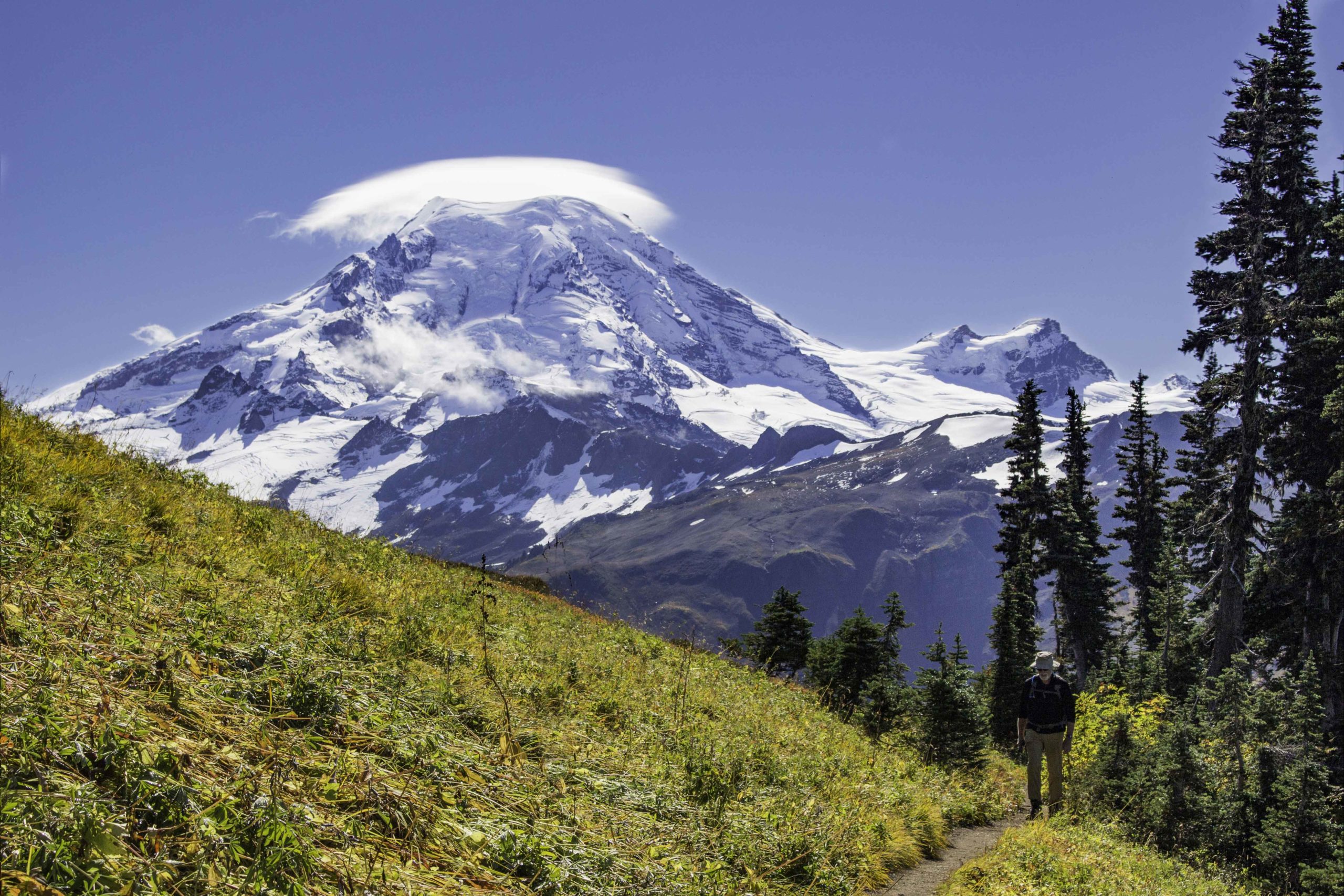
For our last day in Rainier, the sky finally cleared and we headed for the Mt Burroughs trail from Sunrise to get some up close views of Mt Rainier. Here Oscar and I were on our way up to the 2nd Mt Burrough (of three).

Oscar’s iPhone: On top of 2nd Mt Burrough looking at Mt Rainier. Note the ice at my feet
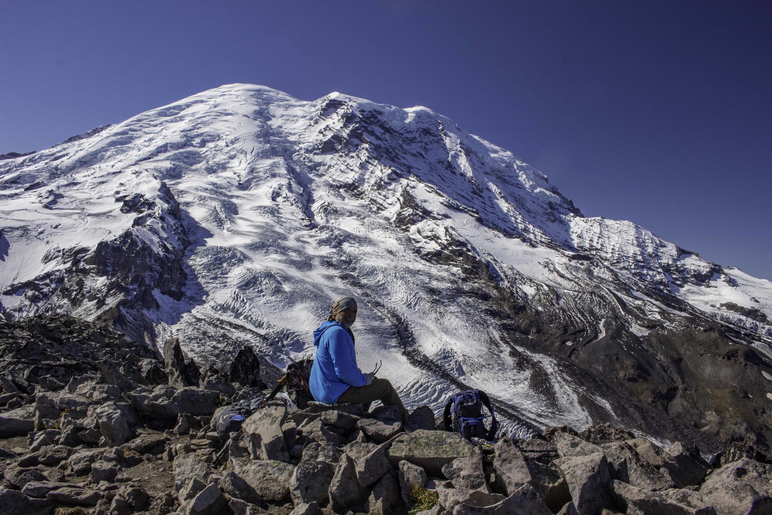
Lunch time on the 3rd Mt Burroughs close to Mt Rainier.

We stayed at an Airbnb on Shadow Lake south and east of Seattle near Maple Valley. This served as a base to explore the hikes in the North Bend area and still have access to the civilized things. This 50’s house was right on the lake and we enjoyed the views and sitting on the deck overlooking the lake.

Sunsets on Shadow Lake were nice also.
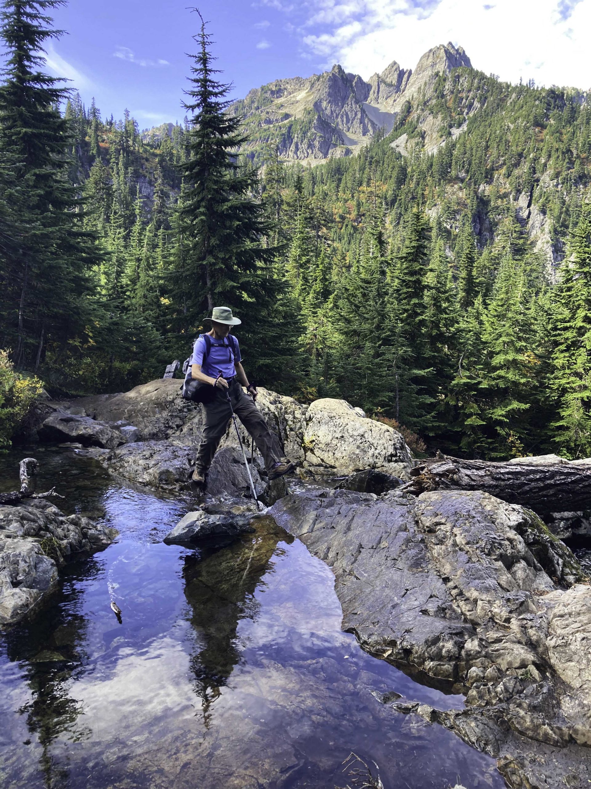
Oscar’s iPhone: I was hopping rocks to get across a stream at Snow Lake.
Nice fall colors at Snow Lake
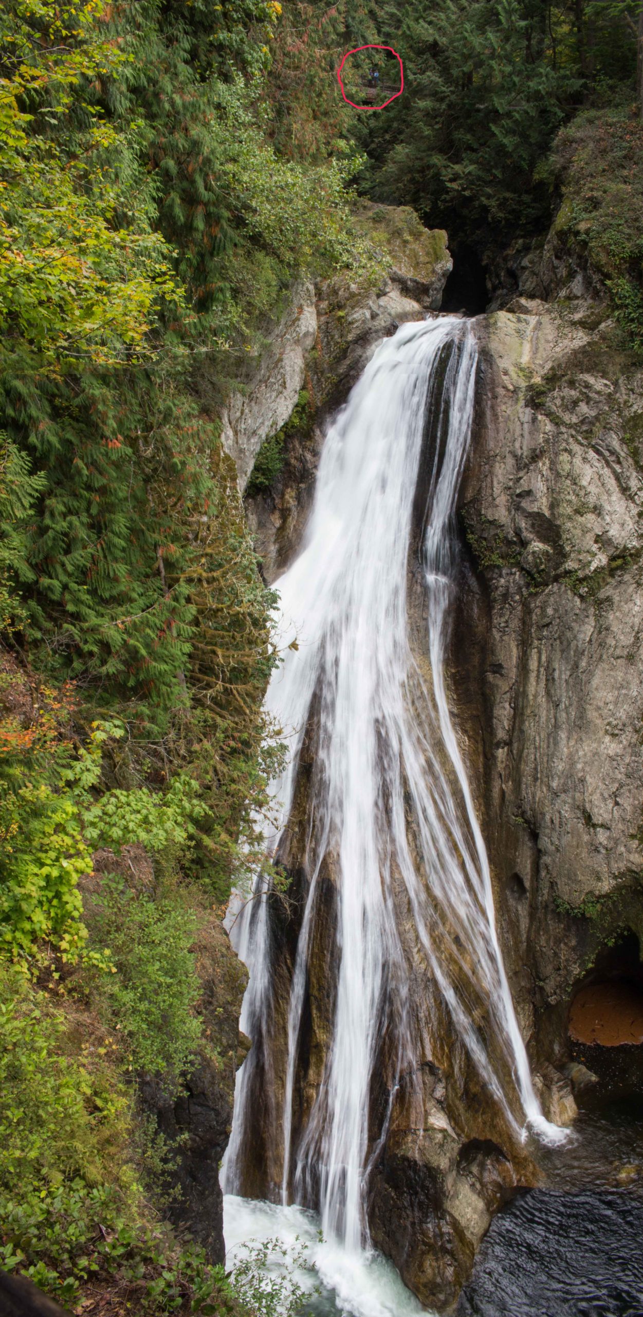
We hiked the short trail to Twin Falls. Scroll up to the top of the photo to the red circle to get an idea of the size of these falls (135ft drop). In the red circle is a blue dot – that’s Oscar on a bridge above the lower falls. There were also upper falls behind Oscar seen from the bridge (not in this photo).

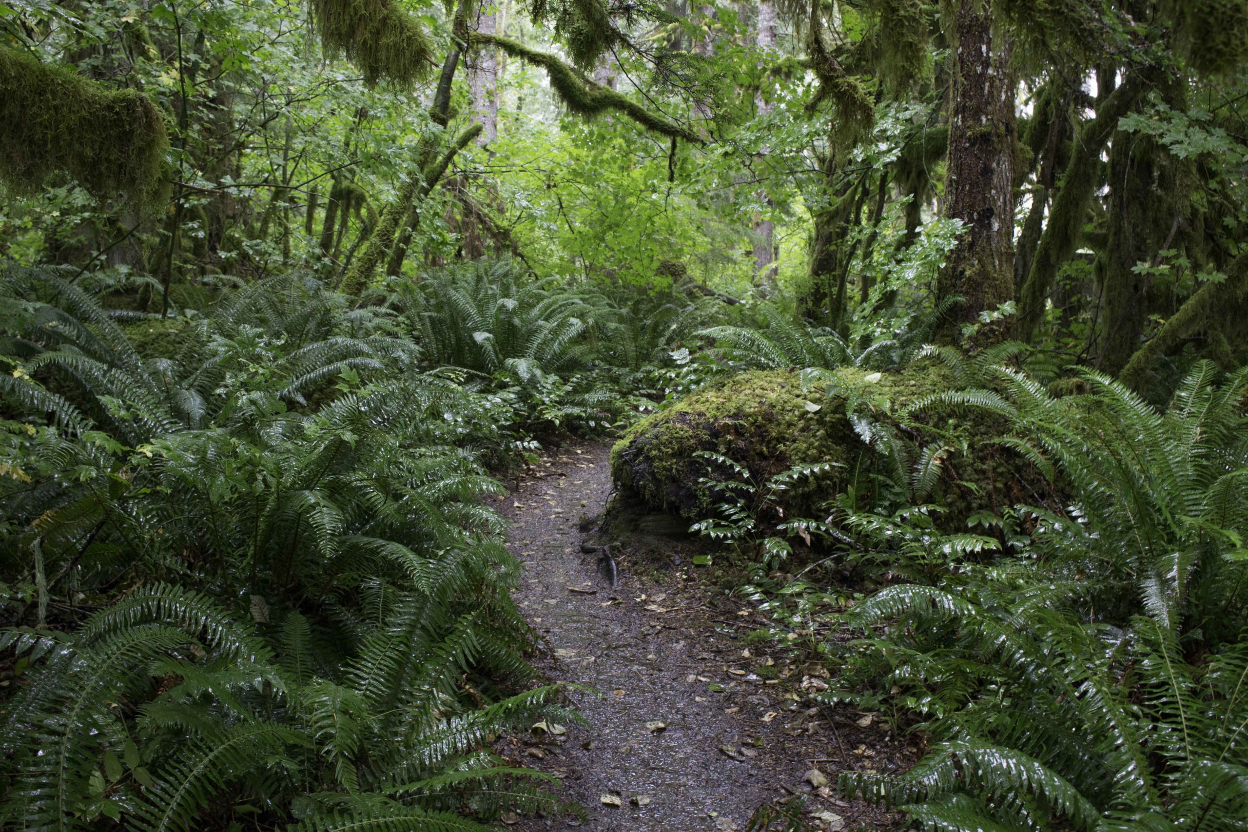
The rain forest in the western part of Washington often has this moss everywhere.
Oscar is taking a break on the 3rd Rattlesnake ledge. You can see the 2nd ledge above and to the left of his knee and the first ledge beyond that. Rattlesnake lake is below. Per the lore: Rattlesnake Lake and Rattlesnake Ridge got their name from Seattle pioneer Arthur A. Denny when the rattle of seed pods on the nearby prairie frightened a road surveyor into thinking he was being attacked by a rattler. (The surveyor didn’t realize that there were no poisonous snakes in Western Washington)

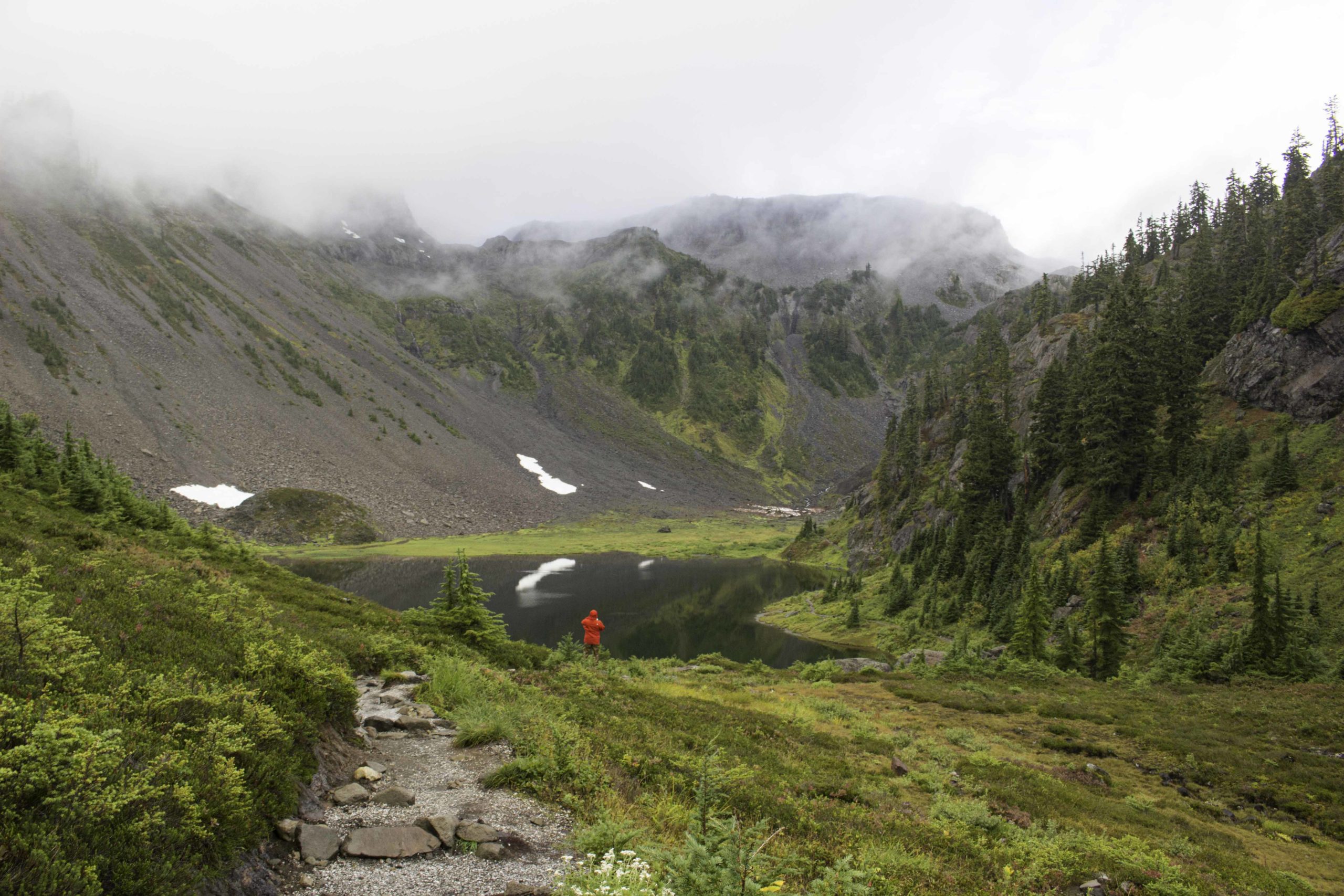
One of the days that it was raining in western Washington, we decided to drive 3hrs to the east, near Leavenworth WA where it was not raining and hiked some of The Enchantments trail to Colchuck Lake. This is a very large alpine lake surrounded by steep mountains. The trail continues up the steep slope on the left of the photo to cross Aasgard Pass (Aasgard Pass is 2000ft of climb in 3/4 mile….Maybe some other day…).

Fall colors along the trail to Colchuck Lake
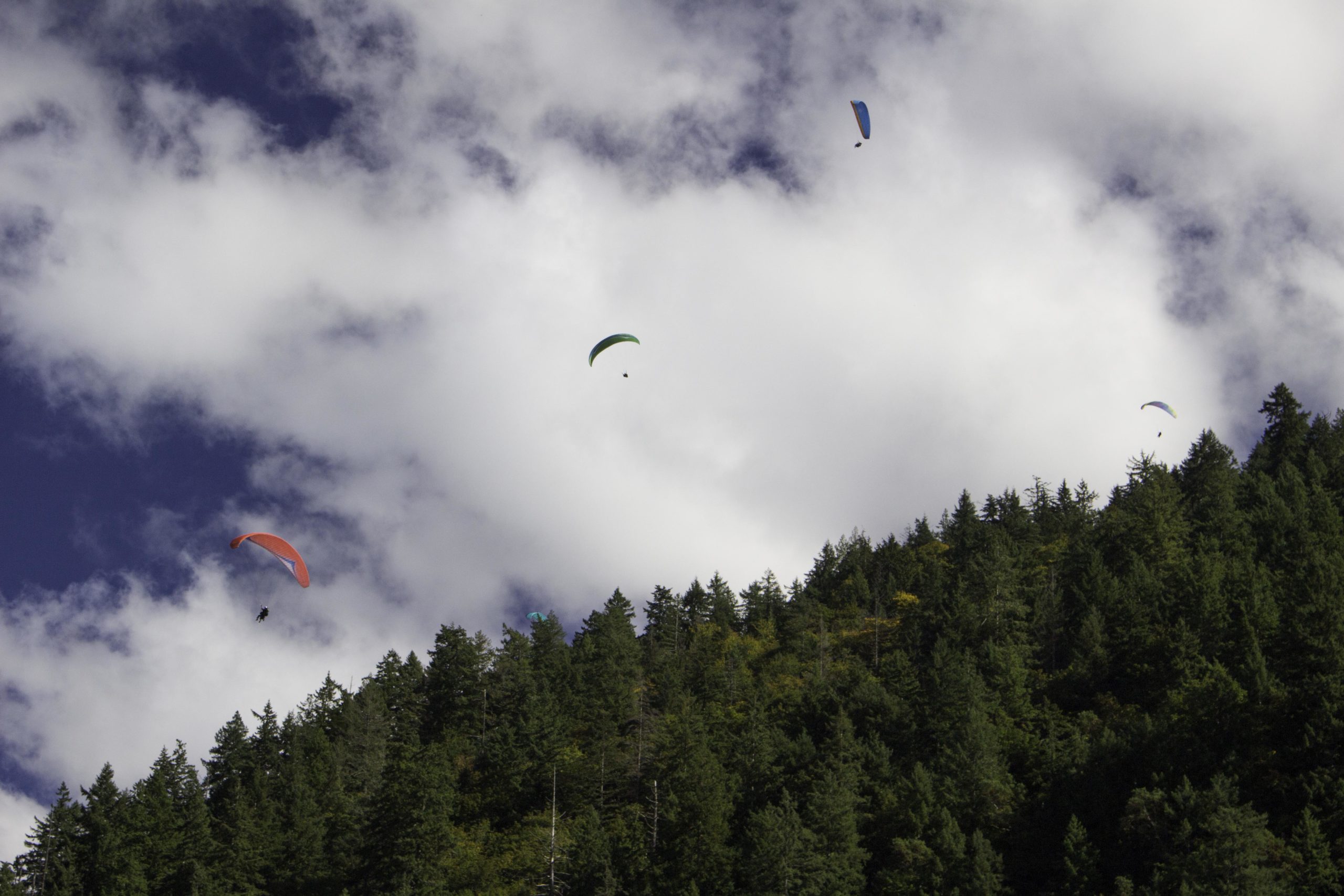
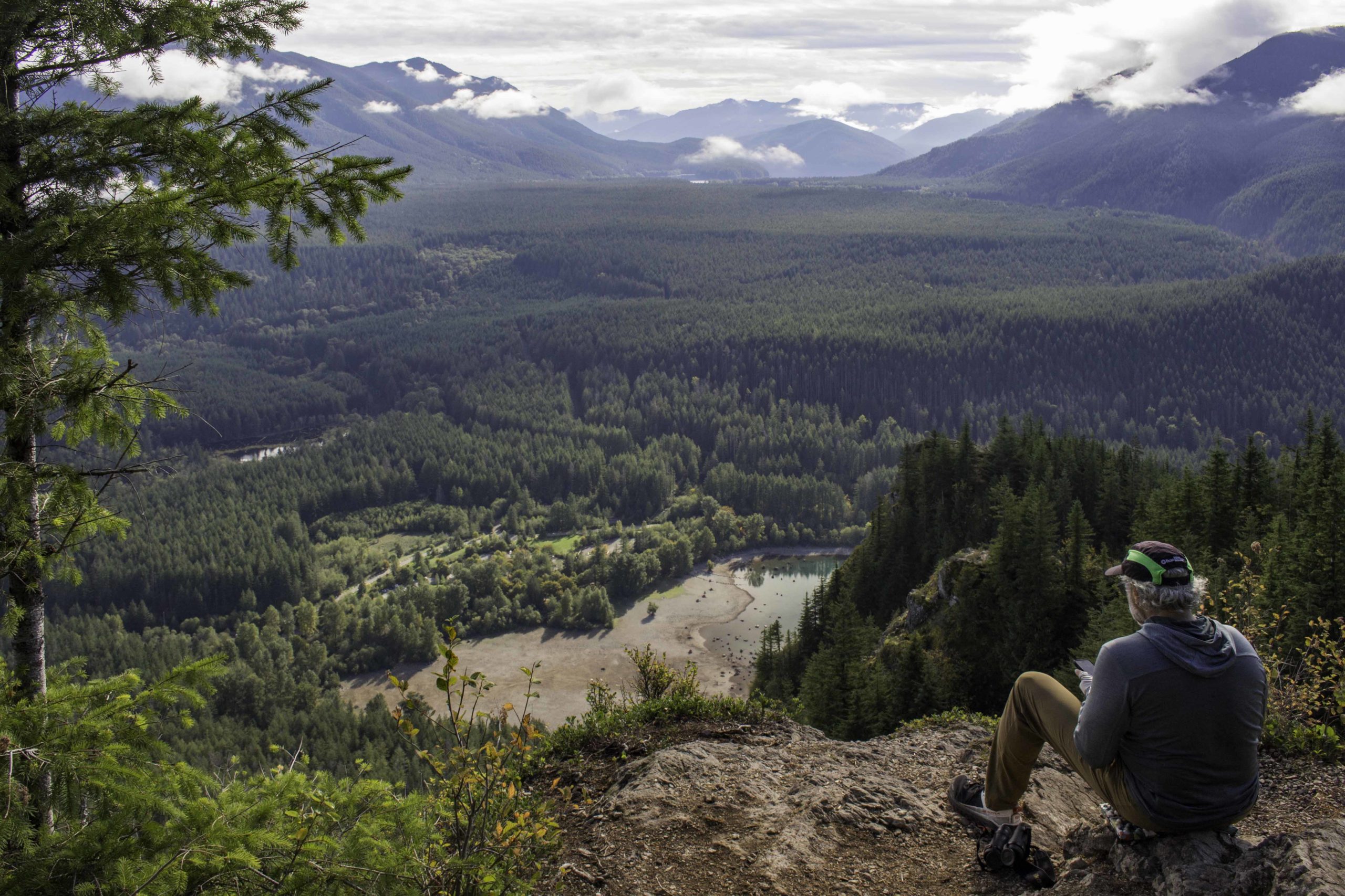
We hiked up to Poo-Poo point hoping to see paragliders launch off this popular site but were too early. Once we were down, we looked up and saw them gliding above us.
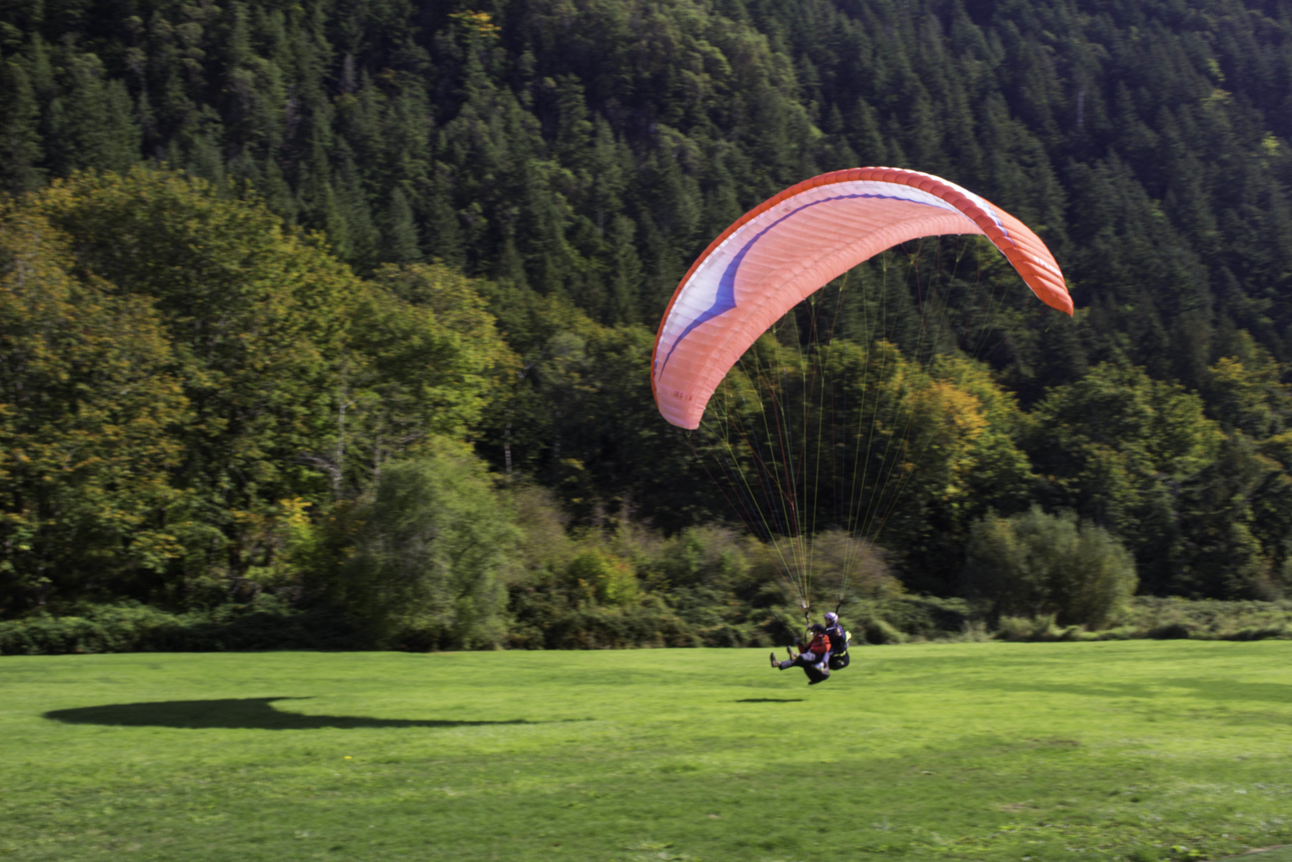
The paraglider landing area was at the trailhead. This duo was a service that takes inexperienced people up and gives them a taste of the flight. Also there were individuals who were gliding alone.

Thanks for sharing your fabulous photos! It looks like you guys had a good time, as usual. It was too wet and cold for me!!