Karin and I missed going to Lake Tahoe in 2020, the first time we missed a year in 10+ years. This year we returned to Lake Tahoe. Besides hiking and enjoying the cooler/dryer air we always enjoy the Sierra Nevada wildflowers in the spring. There were less flowers because of below normal snow fall over the winter (therefore dryer) and the temperature in Tahoe was warmer (set a new record high). We just hiked earlier in the day at higher altitudes and were rewarded with wildflowers (and some nice views). I hiked about 93 miles total,

Our first hike in the Tahoe area in 2021 was Sagehen Creek Trail north of Truckee, an easy lower altitude hike in meadows that follow Sagehen Creek. Here Karin walks among the Woolly Mule Ears (Wyethia mollis) that are so abundant in the northern Sierra Nevada. Some Native Americans used the roots to prepare a medicine for sores, burns, and rheumatism. Notice Karin has long sleeves – we had some cool mornings before the heat wave.

This view is looking southwest toward Sagehen Creek from the grassed over section of the massive Stampede Reservoir. On a previous year’s hike, this area was underwater but due to the drought, the reservoir retreated from the “normal” shore that you can see at the base of the line of trees.
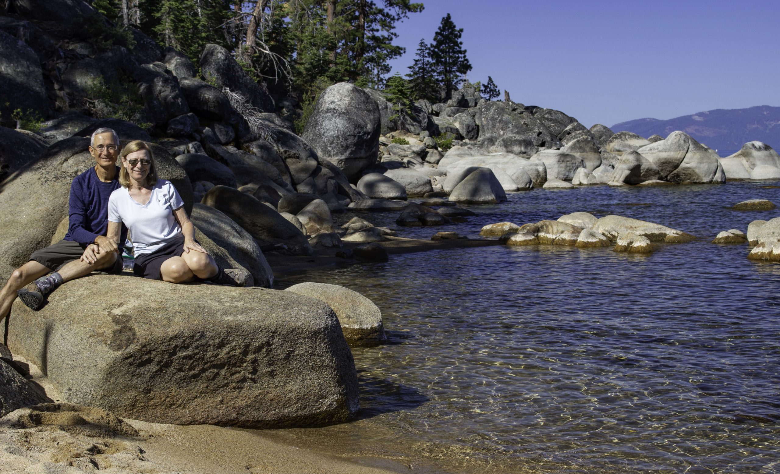
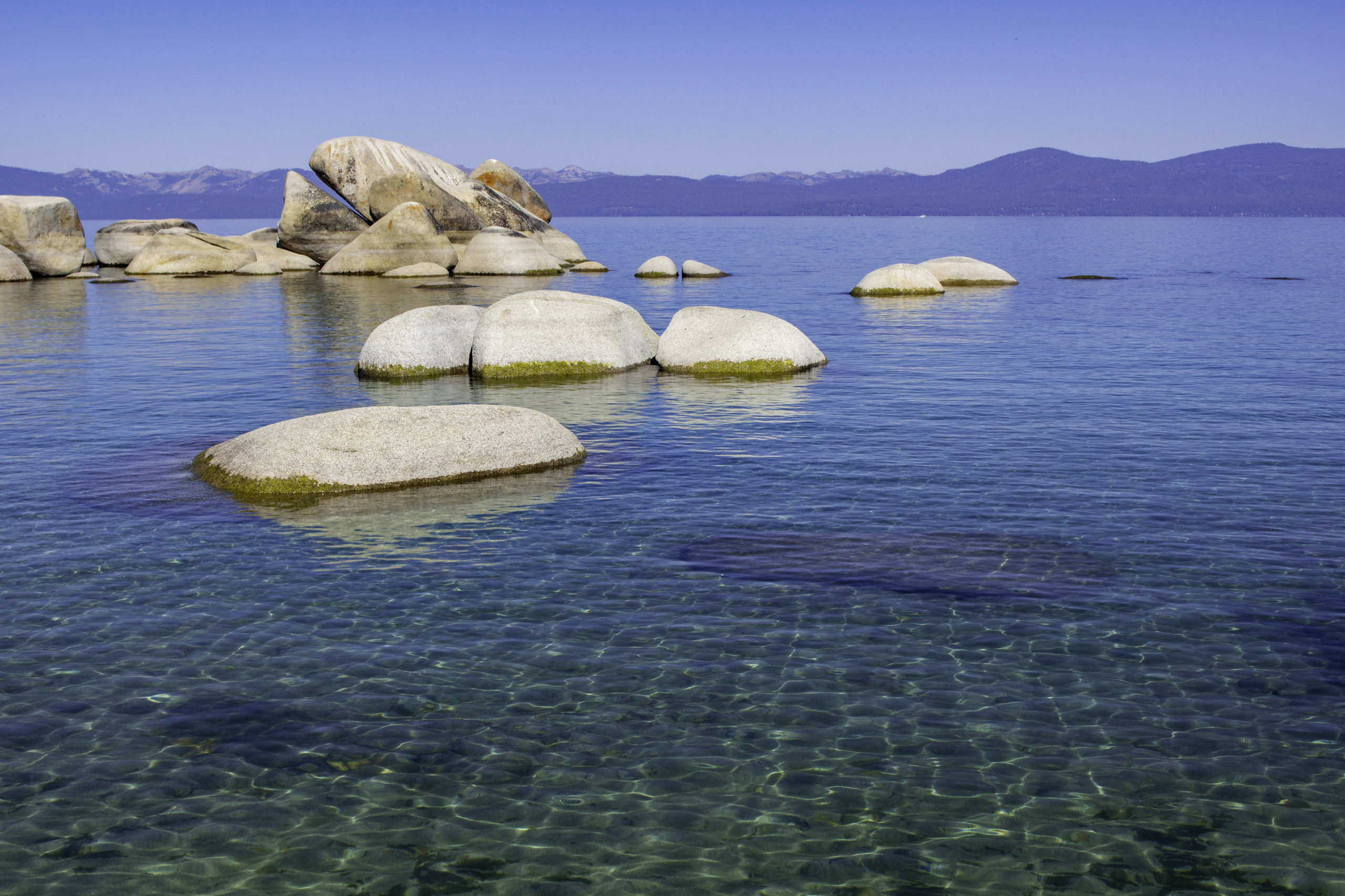
We hiked down the east shore of Lake Tahoe to Whale Beach to enjoy the clear waters, white sand beaches, and granite boulders of the east shore. The rock we are sitting on would be underwater at “normal” lake level but the lake is very low due to the reduced snow fall during winter. About 40% of the recharge of Lake Tahoe comes from mostly snow that falls directly onto the lake, the rest from melting snow in 60+ small creeks and a few springs that drain into the lake. There is one outflow from the lake, the Truckee River, that flows to the city of Truckee then to Reno and then ends north of Tahoe at Pyramid Lake. All the water is lost to evaporation (and some use by man). The evaporation lost directly from Lake Tahoe is greater than the typical outflow in the Truckee River.

A bit of yoga on the beach

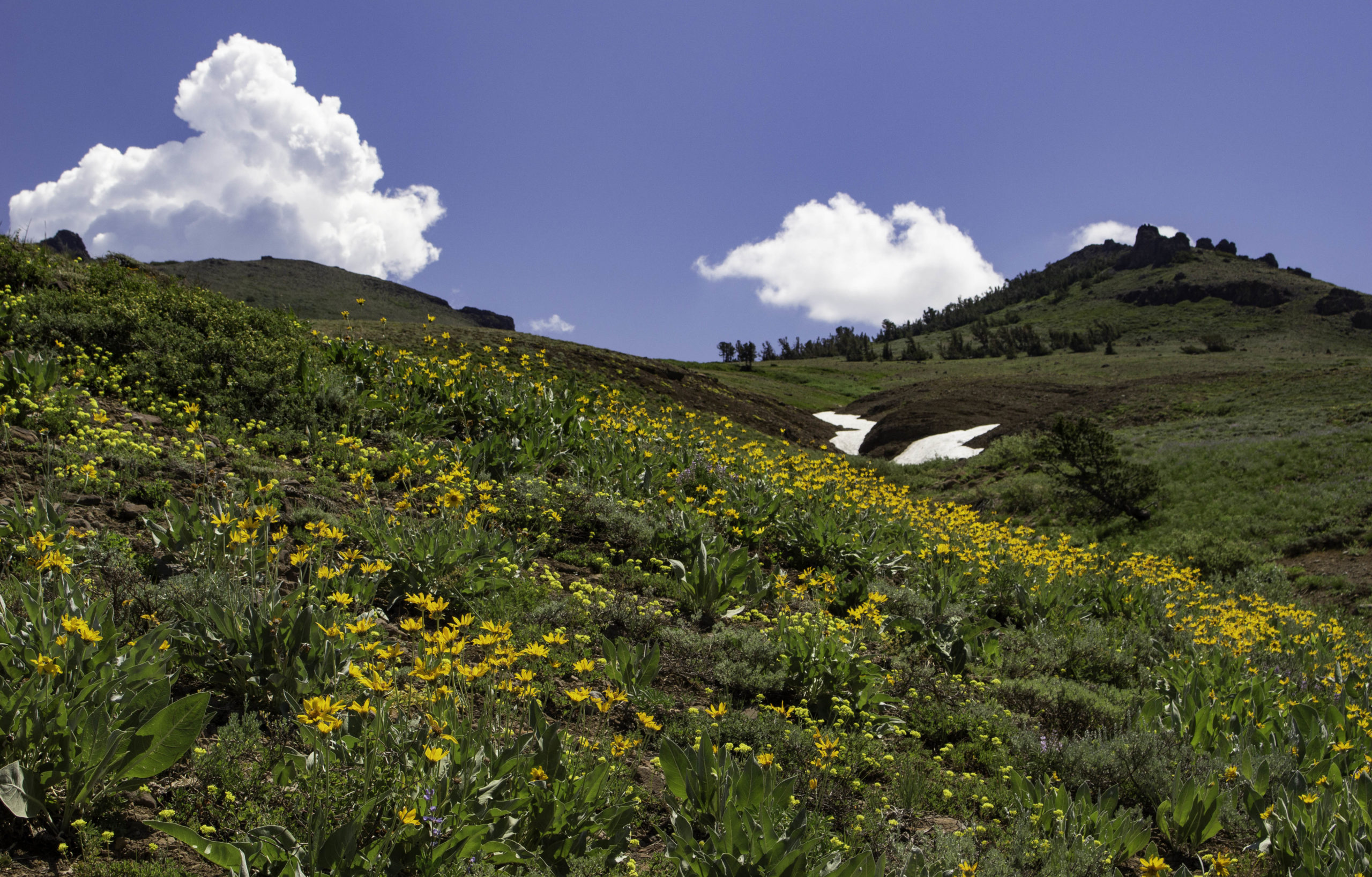
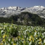
In search of flowers at higher altitudes, we hiked a portion of the Tahoe Rim Trail north of Barker Pass. The foreground is full of Mule Ears and in the distance, the mountains are part of Desolation Wilderness.

Sunlight illuminating lupine at Barker Pass. There are so many lupine species in the Sierra Nevada, sometimes I have difficulty identifying them….

Fritillary butterfly on a Coyote Mint (or Pennyroyal, Monardella odoratissima) next to the blue Velvety Stickseed (Hackelia velutina). Not sure which Fritillary species the butterfly is…maybe the Great Basin Fritillary. The photo was taken on the Tahoe Rim Trail near Barker Pass.

Karin enjoying the Mule Ears along the Tahoe Rim Trail near Barker Pass.

Bubble Bee on Coyote Mint/ Pennyroyal (Monardella odoratissima). You can typically find Coyote Mint all along the trails. If you rub your hands on the foliage of plant, you get a really refreshing mint scent on your hands, but you do need to look before you touch as the bees and wasps are frequent pollinators.
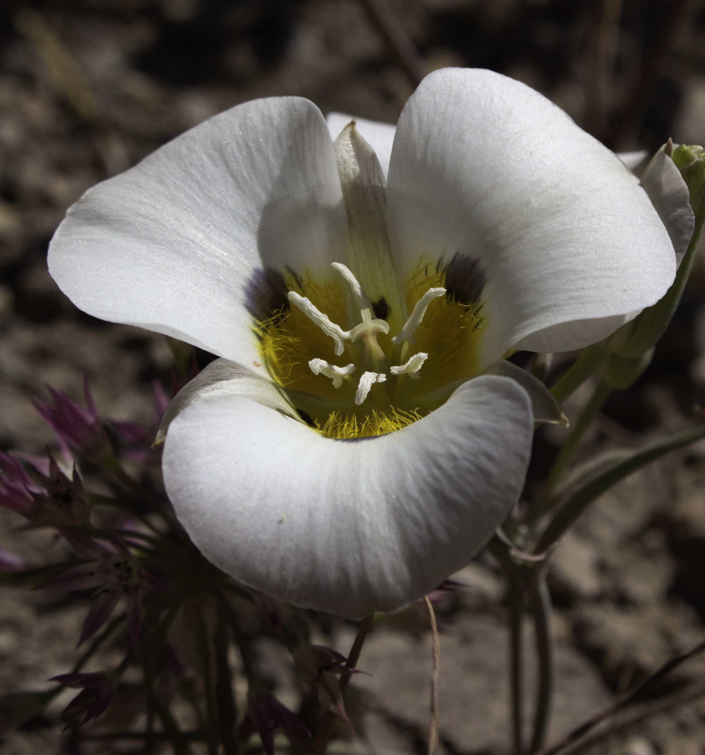
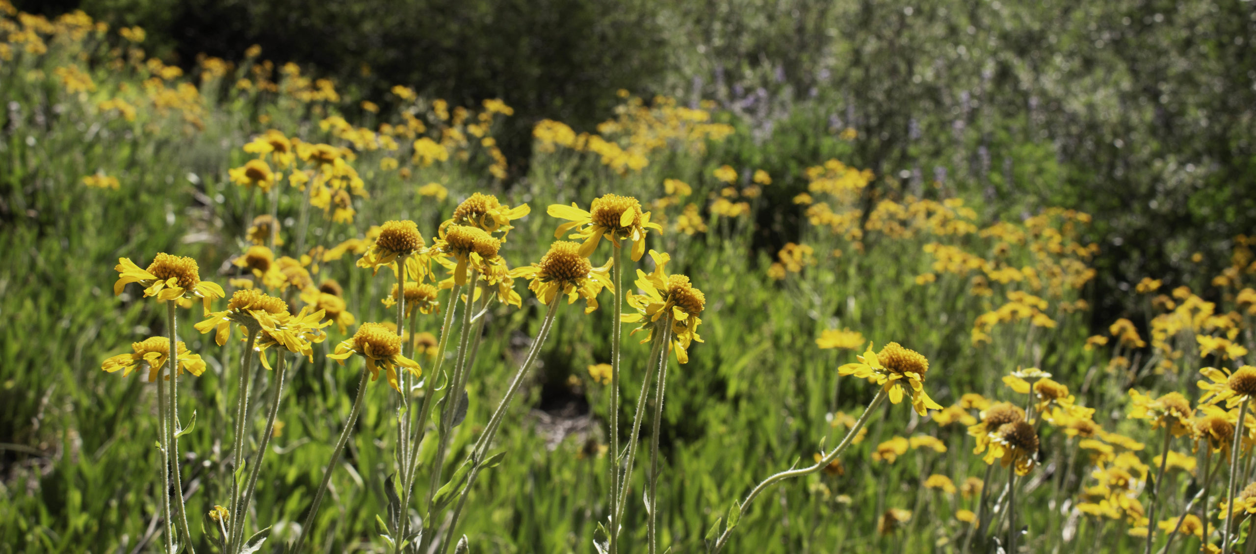
This year there were tons of Leichtin’s Mariposa Lilies (Calochortus leichtinii) blooming – In the past you would see just a few scattered about, but this year there were thousands. The roasted bulbs of this plant were an important food source for Native Americans. There is a Sierra Onion (Allium campanulatum) behind the left side of the lily. These were a food source also.

Another higher altitude trail that typically has wildflowers is the Pacific Crest Trail (PCT) from Carlson Pass south toward Meiss Meadows (before the Tahoe Rim Trail joins the PCT in Meiss Meadows). The trail is also sometimes called the Meiss Meadows trail. The flower in the photo is called Pretty Face or Golden Brodiaes (Triteleia ixioides ssp. anilina).
A mixture of Arrow-leaved Balsam-root (Balsamorhiza sagittata), Woolly Mule Ears, and Buckwheat below one of the few patches of snow we saw along the Miess Meadow trail (PCT)

Hoary Buckwheat (Eriogonum incanum) along the Miess Meadow trail (PCT)

Mount Rose with Tamarack Lake below as seen from the Tahoe Rim trail.

Many-Leaved Lupine (Lupinus polyphyllis) near a spring on the Tahoe Rim Trail. (also known as Large-Leaf Lupine).

Alpine Lily (Lilium parvum) growing in a spring on the PCT (Pacific Crest Trail) near Donner Pass, northwest of Lake Tahoe.

Our first time on the Mount Judah Loop Trail off the Pacific Crest Trail near Donner Pass. You can see the edge of the large Donner Lake on the left and the mountains on the north end of Lake Tahoe behind us. The highest peak in the center is Mount Rose.

South of Lake Tahoe, we hiked south from Carlson Pass on the Pacific Crest Trail for a while before diverting off towards Lake Winnemucca and Round Top Lake. Karin is checking out Round Top Lake after we had our lunch by the lake.

Lake Winnemucca from the trail down from Round Top Lake.

Looking across Lake Tahoe to the west from the east trail along the shore. Notice the person on a paddle board in the middle of the photo. Lake Tahoe is 12 miles wide by 22 miles long. Even though there were two large fires near Tahoe, one 50 miles north (Dixie Fire Complex) and 30 miles south (Tamarack Fire), the prevailing northeast winds carried the smoke into Nevada and Idaho. Skies were not perfectly clear, but pretty clear.

Found these Lewis Monkeyflowers (Mimulus lewisii) near a small spring on the fire road down to Incline Lake. We were surprised when we got to “Incline Lake” to find the manmade dam and berm had been removed and leveled out to return this lake into a meadow. I guess we will need to start calling it Incline Meadow…

Not the best photo, but this is the first bear that Karin or I have seen in Tahoe in the 10+ years we have been coming here. We were looking at wildflowers on a fairly unused mountain bike trail off of the old Mt Rose Highway above Incline Village. The trail drops down the terrain. On our way back up, we moved out of the way for a guy on a bike going down the trail. Not long after, we came around a curve and the bear was about 50-60 feet in front of us crossing the trail. The bear saw us and took off away from us. It was startling and hard to believe after the bike had just passed through that part of the trail. I was too busy watching the bear to be sure it was continuing to depart before I thought about photography but managed to get this photo before it disappeared into the woods.
One of the five lakes on the Five Lakes Trail. We hung at the lake for quite a while because the breeze across the cool lake was like air conditioning on the warm day.
We hiked down to the east shore beaches again to enjoy the cool water and view. We have hiked to Whale Beach lots of times but, for the first time, when we looked up and saw the stone formation in the left side of this photo, we “recognized” the open mouth of the stone “whale” breaking the surface. Actually, we later found out there was another massive boulder in the water off this beach that also looks like a whale “floating on the surface” but I like “ours” better….

The wake of a passing boat created some artsy wave patterns around the partially submerged boulder…
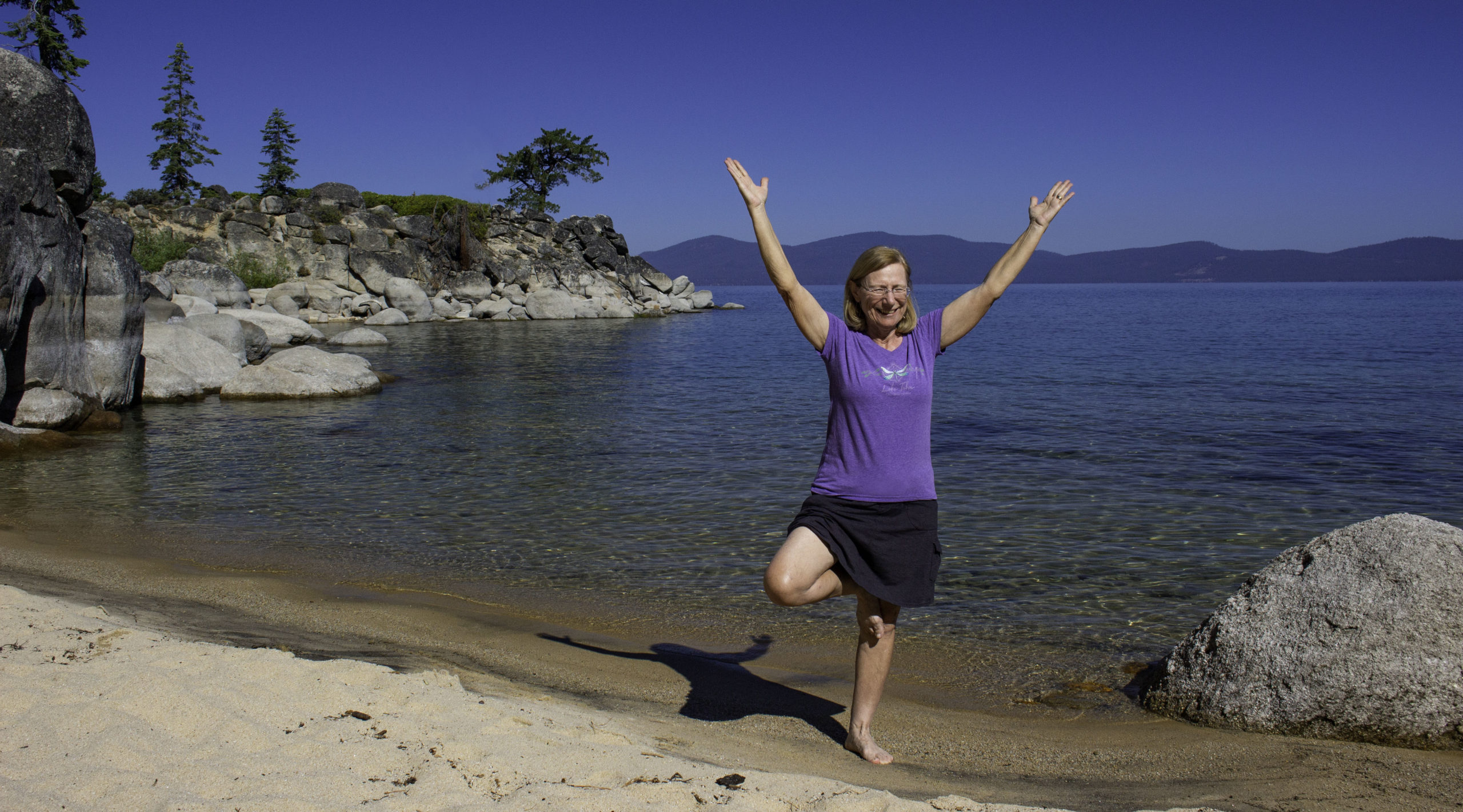
More yoga at the beach – tree pose.
Hoopes’s Sneezeweed (Hymenoxys hoopesii) on the way up to Mount Rose.
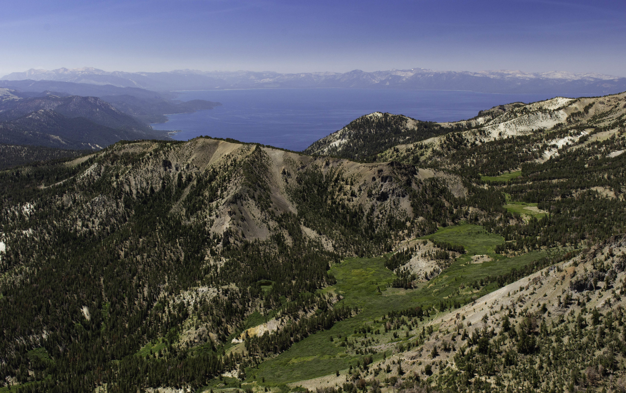
A north to south view of Lake Tahoe from the top of Mount Rose. At 10,785ft elevation, Mt Rose is the 2nd highest mountain in Lake Tahoe basin and is located about 7 miles from the northern end of the lake. Lake Tahoe is 22 mile long (north to south) so the south shore in the distance is 29 miles away. The mountains on the southern end are about another 9-10 miles away, so you can see them about 40 miles away from Mt Rose. You can barely see a portion of the Tahoe Rim Trail (TRT) (a faint line across the middle center of the photo) at the base of Tamarack Peak that links up with the Mount Rose trail across the bottom right. The combined TRT/Mt Rose Trails are 10.7 miles round trip and have 2395 feet elevation rise. I have done the trail two times before, but the last time was in 2013 – 8 years ago. Karin and I often visit the meadows below Mt Rose looking at wildflowers and enjoying Galena Falls, a small, but pretty waterfall.
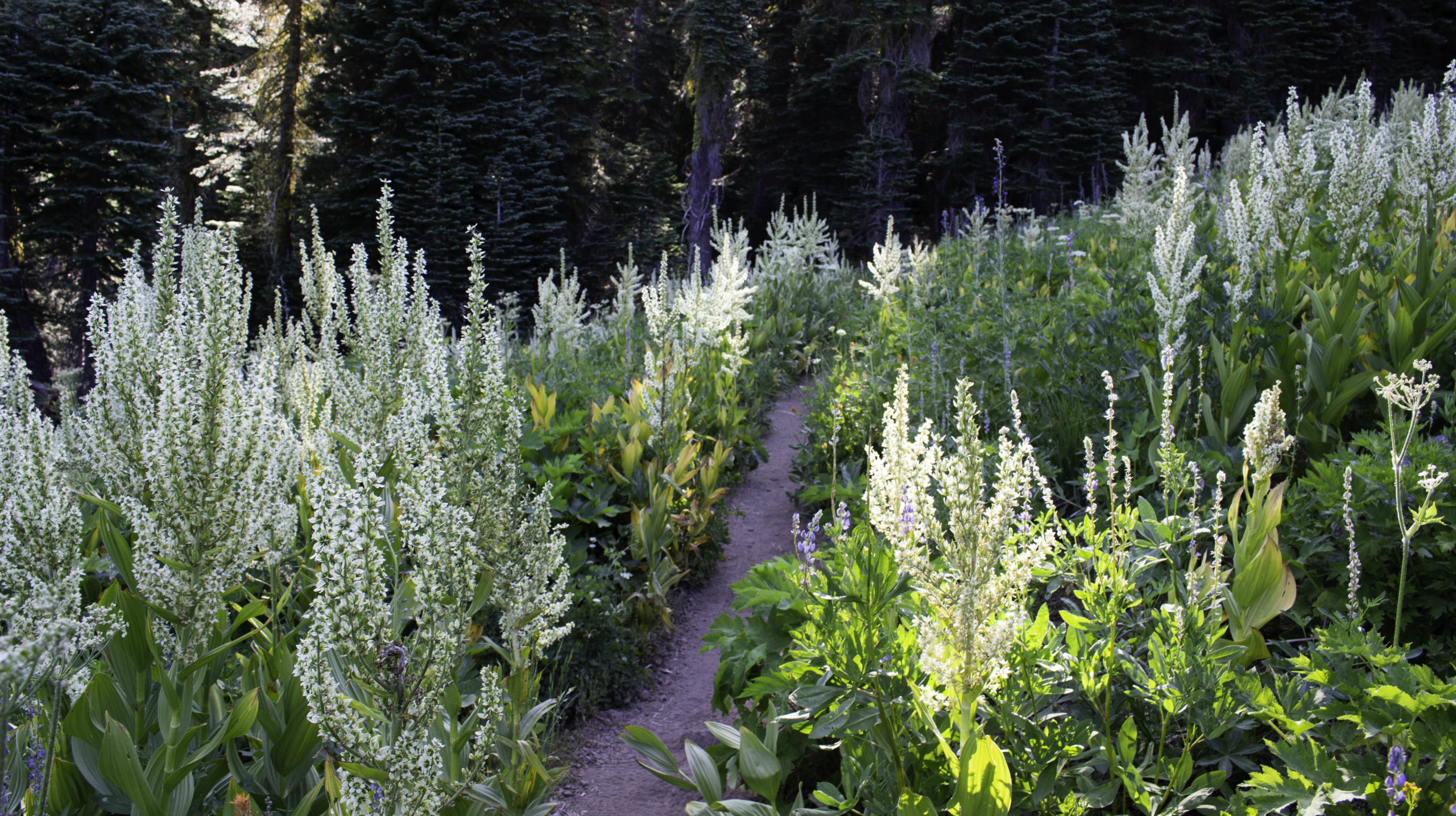
Tahoe Rim Trail south of Barker Pass crossing through a stand of California Corn Lilies (Veratrum californicum). A few years back I decided I would try to hike all of the ~165 mile Tahoe Rim Trail (TRT) by doing segments, one at a time. It can be done, but it is much more total miles as some segments require quite a distance to hike from a road. The 9 mile segment that I completed this time took 16.5 miles to do. I have only 2 segments left to do, each requiring about 15-17 miles to complete the entire loop trail.
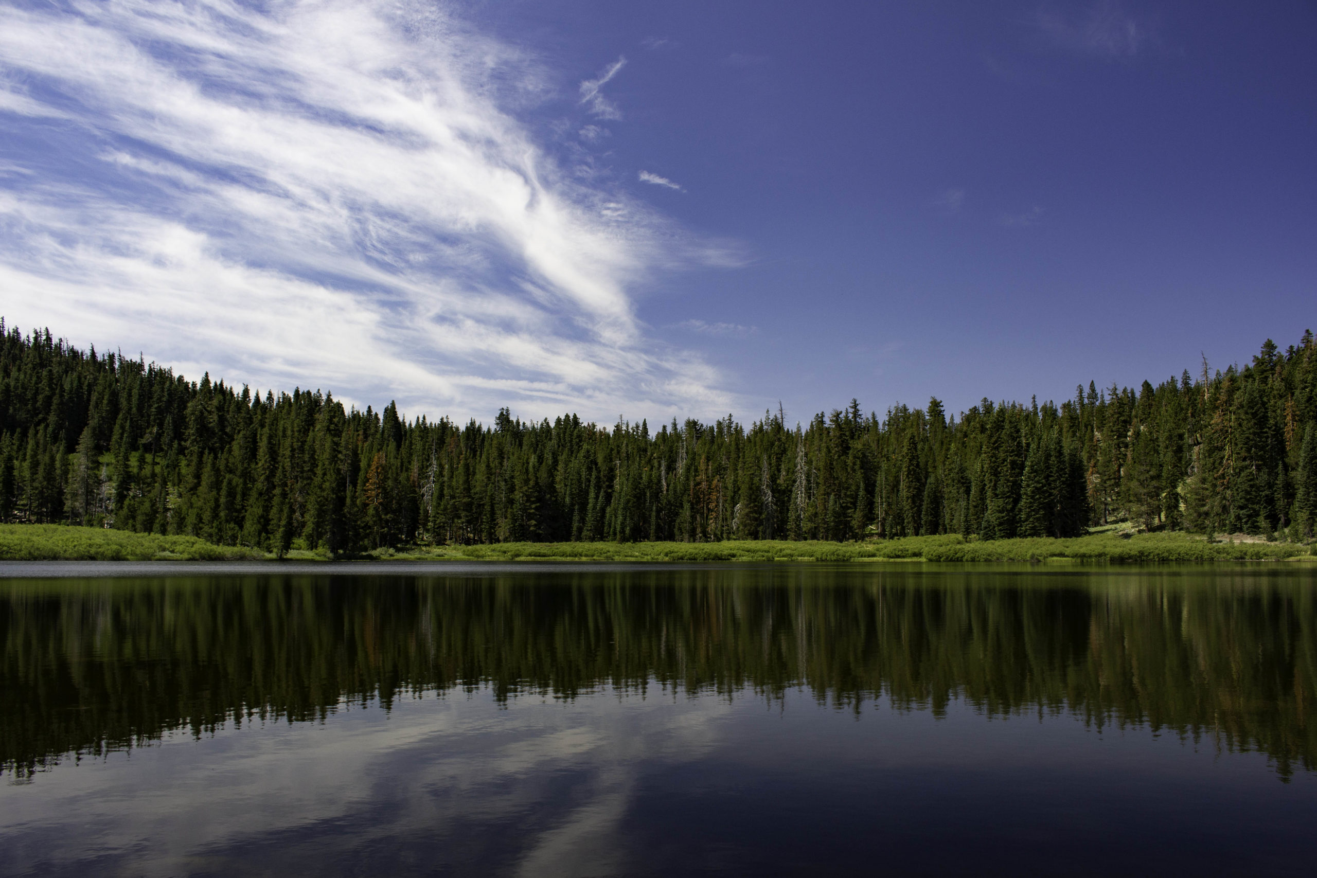
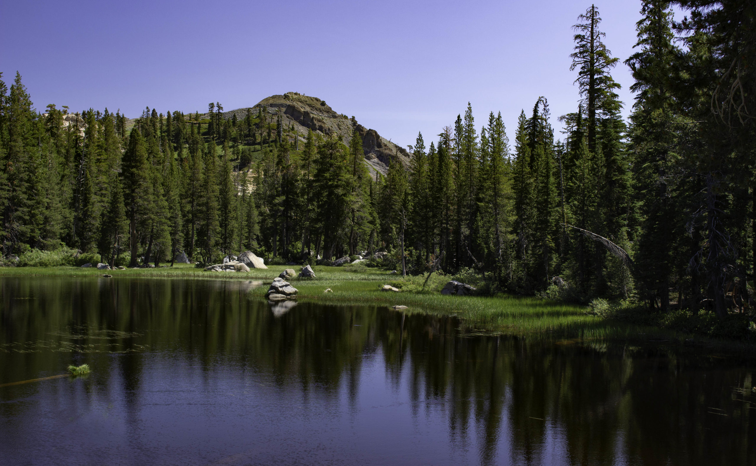
Richardson Lake on the Tahoe Rim Trail south of Barker Pass. I had a nice lunch on the shoreline of this lovely lake.

After 10+ years we are still finding flowers that we had not seen before. This year I found this Yellow Pond-Lily (Nuphar polysepaia) in a pond on the rarely used General Creek trail (I was exiting the TRT to get back to my car via the Meek Creek trail/ Lake Genevieve). The native Americans used the roots of this plant to ferment and grind into a flour for bread or cereal. I was surprised there was water for a pond in this very dry year – must have a spring feeding the pond.

Karin happy to be at the Truckee Farmer Market. We were spoiled getting fresh produce, peaches, and berries. The strawberries this year were soooo good.
Links to other Tahoe Photos:
Awesome! I have never been to Tahoe, but have been thinking about it! NO LONGER —this is a MUST in a hurry.
Glad y’all were not eaten by the bear!
Thanks for sharing.
Thanks for sharing g your beautiful photographs and commentary!