We visited Lake Tahoe about 2 weeks earlier in 2019 because last year it became warmer than we cared for and there was so much smoke from all the California wildfires. This year there was an abnormal amount of snow and it stayed cooler longer. This resulted in some areas still under snow at the end of July. We did get to see some of the early wildflowers we had been missing and tried some new hikes at lower elevation where the snow had melted. I had hoped to complete the Tahoe Rim Trail (TRT) this year but unfortunately was able to complete only 10 miles of the 40 miles I have left The rest was still under snow. (I have completed 140 miles out of the 170 miles of the loop)
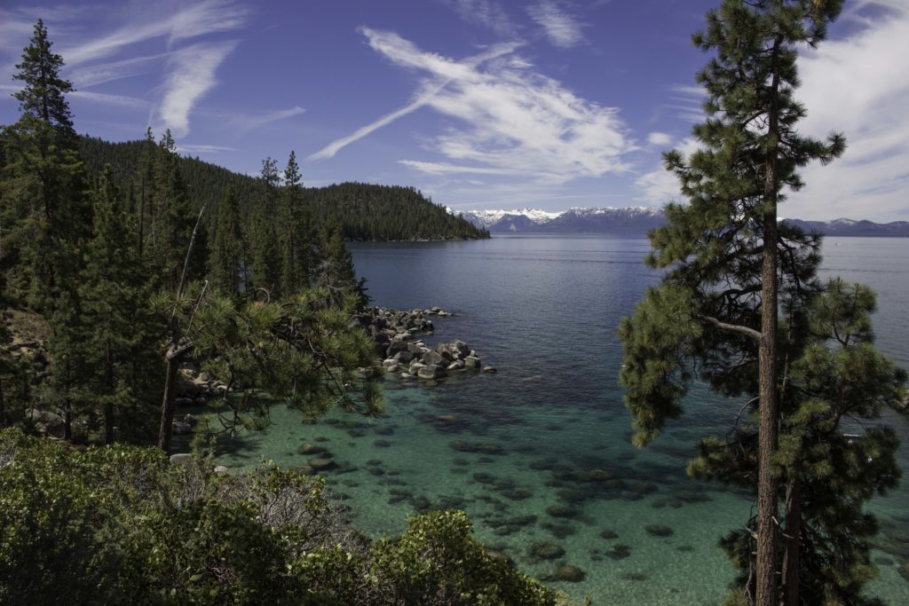
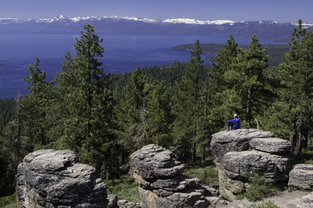
Lake Tahoe from the East Shore
The heavy snow helped fill the lake so there were minimal beaches along the shoreline this year. You can see the large amount of snow on the mountain range across the lake. Lake Tahoe is 12 miles across east to west and 22 miles long and a maximum of 1,645 ft deep (2nd deepest in the USA after Crater Lake and 16th deepest in the world). The state line between California and Nevada runs through the lake. Lake Tahoe has many small streams from snow melt draining into the lake and one river leaving the lake, the Truckee River (elevation 6, 225 ft). The Truckee River flows down out of the basin past Truckee, CA then Reno, NV and then into Pyramid Lake which has no outlet – Most of the water is lost to evaporation (but some is used by the people in the area).
.
Secret Cove – Take Tahoe
Secret Cove is on the east shore of Lake Tahoe and is a favorite spot for swimmers and sunbathers. It is a clothing optional beach. The water in the lake on the surface warms to mid 60’s F during the summer but only a few feet down the temperature is mid 50’s and deeper it stays in the mid 40’s F. Not much swimming takes place…
.
Near Incline Lake
These side by side photos of the same area illustrates how late the growing season was this year. On the left in late June the meadow has just melted out and a few lilies are popping out. Even in late July, the California Corn Lilies (Veratrum californicum) are no where near blooming (but the snow is gone).
.
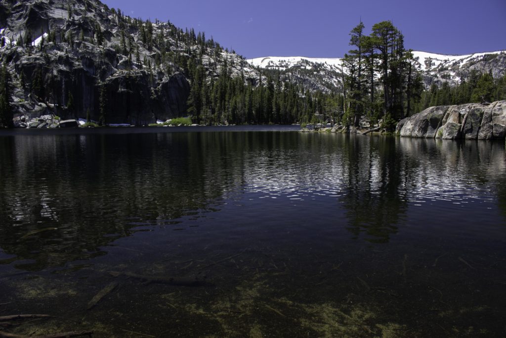
Incline Lake
We visited Incline Lake early this year and found it full with a nice reflection of the mountain. In our past visits this lake was only about 1/3 – 1/2 full.
.
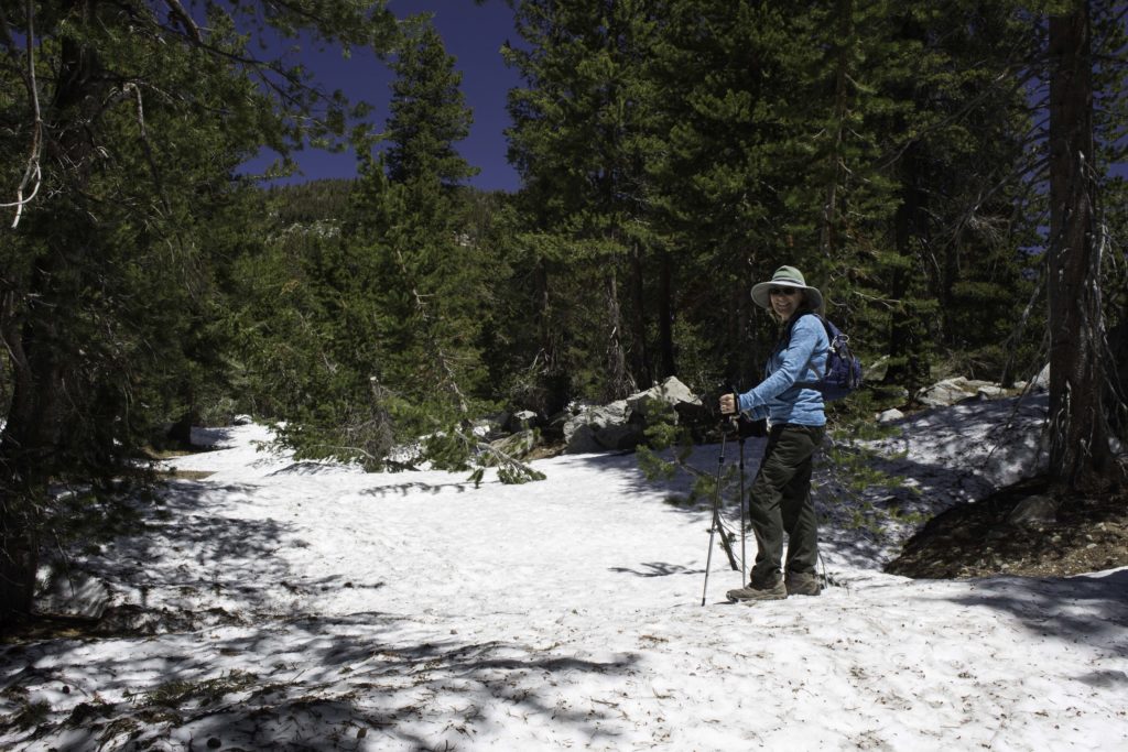
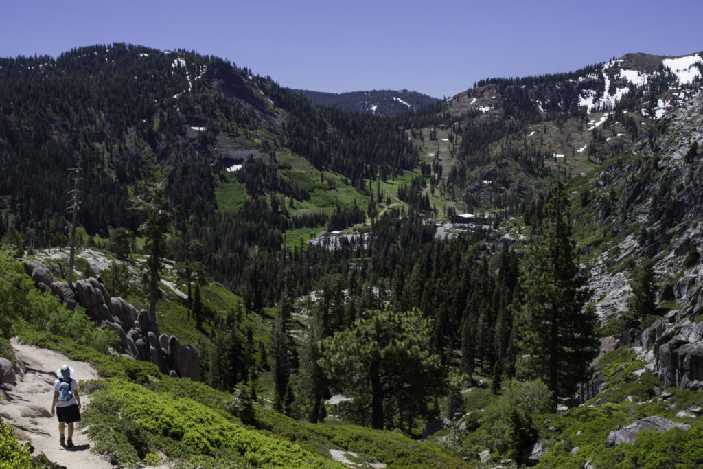
Karin on the Road to Incline Lake
The dirt forest road down to Incline Lake had stretches of snow banks. Glad we had our hiking poles.
.
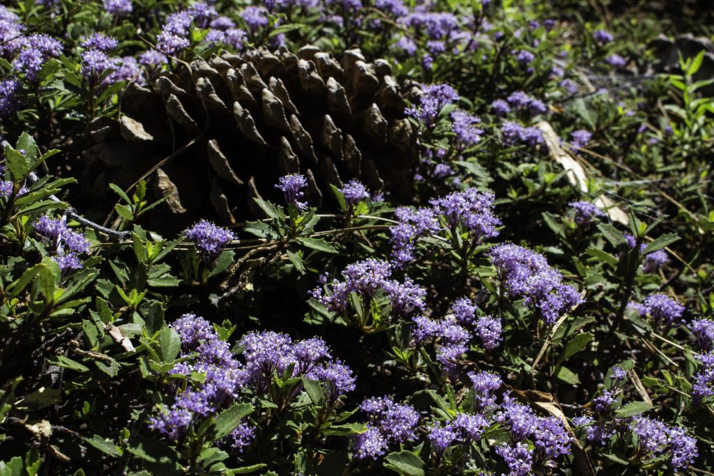
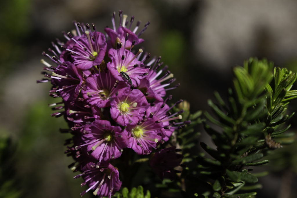
Mahala Mat
We had been seeing this low growing, green “holly like leaf” ground cover all over the place in Tahoe for years but never knew it bloomed. The Mahala Mat (Ceanothus prostratus) is actually an evergreen shrub and has the small purple cluster of blooms, sometimes so thick, it looks like purple carpet. This year we were early enough to see the blooms.
.
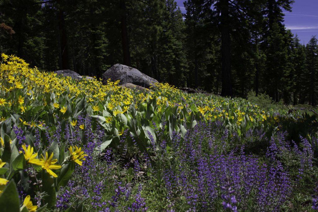
Mountain Mule Ears and Lupine near the Fiberboard Highway. On our way to Watson Lake along the forest road, Fiberboard Hwy, we spotted some Mule Ears (Wyethia mollis) and lupine (Maybe Shaggy Lupine but not sure) in full bloom. This photo was selected by the Tahoe Rim Trail Association for their 2021 calendar.
.
Picnic Rock – TRT. You can see the snow topped mountains around the lake from Picnic Rock off of the Tahoe Rim Trail (TRT).
.
Arrow-leaved Balsumroot Found this large and full stand of Arrow-leaved Balsamroot (Balasmorhiza sagittata), member of the sunflower family. They are very, very yellow! In past visits, it had been hard to find these still blooming.
.
Brown’s Peony – First time we found this Brown’s Peony (Paeonia brownii). The bloom is about the size of a quarter and hangs pointing down toward the ground on a plant that is only 5-6 inches tall (I propped this bloom up for the photo). You can see the ant visiting the bloom for something. Later, we could find others after the bloom went to seed – the 3 green cones in the center become large seed pods.
.
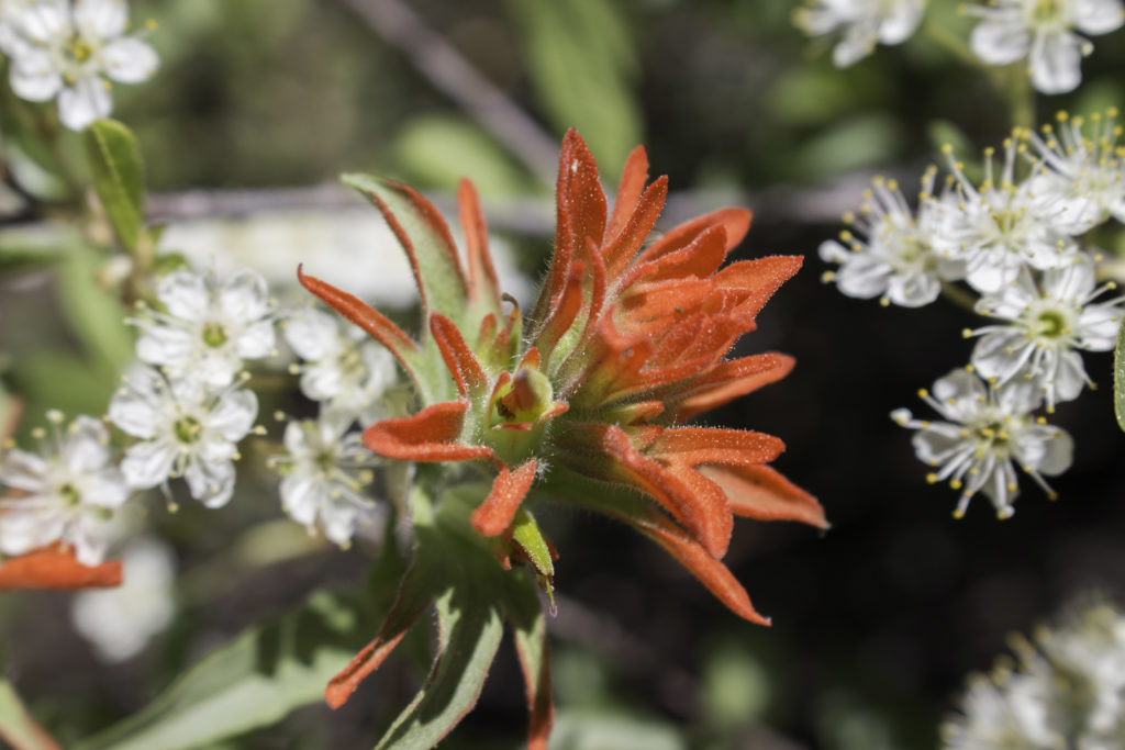
Paintbrush and Bitter Cherry – Found this paintbrush blooming in between the blooms of the bitter cherry (Prunus emarginata) in the background. Most of the shrubs and bushes in the forest were blooming which we had never seen.
.
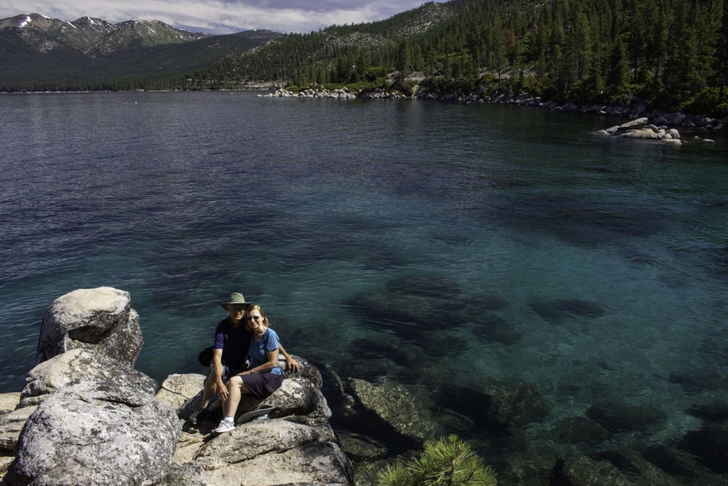
Lake Tahoe East Shore – Randy and Karin on the east shore of Lake Tahoe – found someone to take our photo together.
.
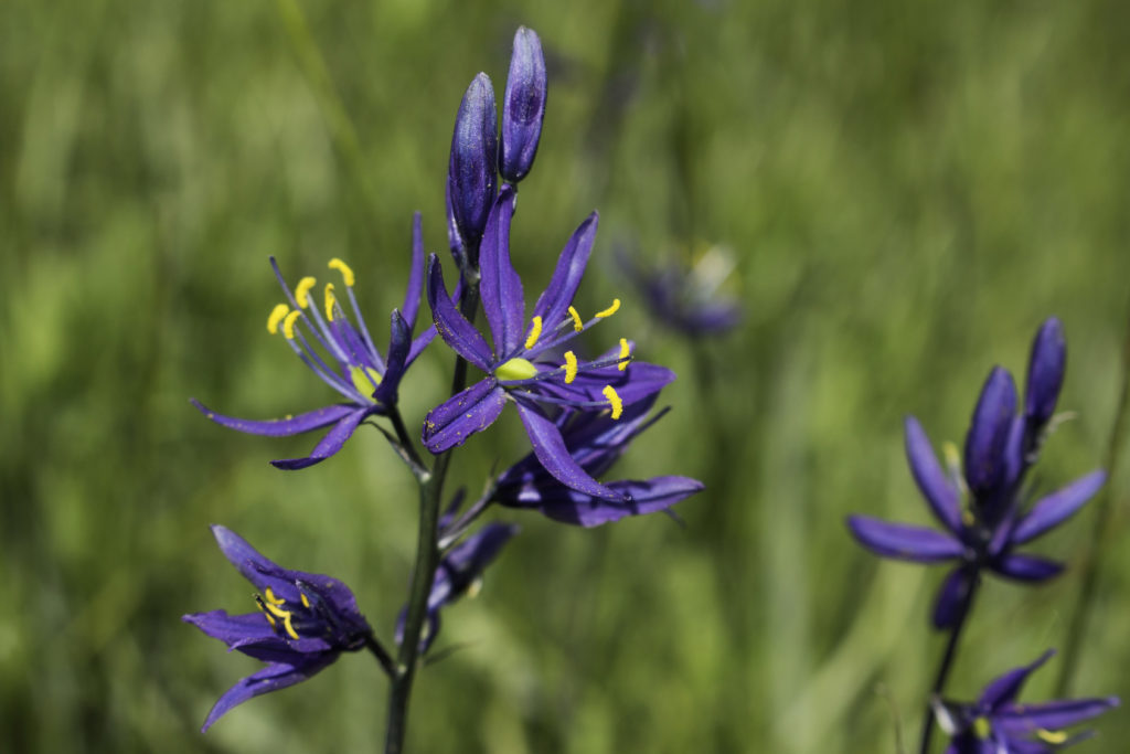
Camas Lily – We visited Page Meadows knowing we were early and might not see many flowers but were surprised by tons of Camas Lily (Camassia quamash). This was the first time we had seen these and understood they normally come in late May and are gone by mid June. Unfortunately, we did have to share the meadow with mosquitoes. While the bulbs of these flowers are edible we also found some Death Camas (Toxicoscordion venenosum) which has a white flower and is deadly toxic.
.
Dardanelles Lake – We went to Big Meadows looking for wildflowers and wound up hiking out to this lake for the first time. Beautiful alpine lake surrounded by granite. Our planned stroll out to Big Meadows (no flowers) turned in to a 7 mile hike but we did see many more flowers on the way up and enjoyed a nice lunch overlooking the lake.
.
Snow Plant – There were lots of Snow Plants (Sarcodes sanguinea) popping out in the woods. The Snow Plant does not have chlorophyll to make sugar from sunlight – this plant is a parasite on soil fungus that is feeding upon decomposing matter in the soil. The soil fungus gets sugars from connections with green plants in exchange for nutrients and the Snow Plant is a freeloader taking some of the sugar.
.
Granite Chief Wilderness – Karin is heading down the trail after visiting the Five Lakes in the Granite Chief Wilderness area.
.
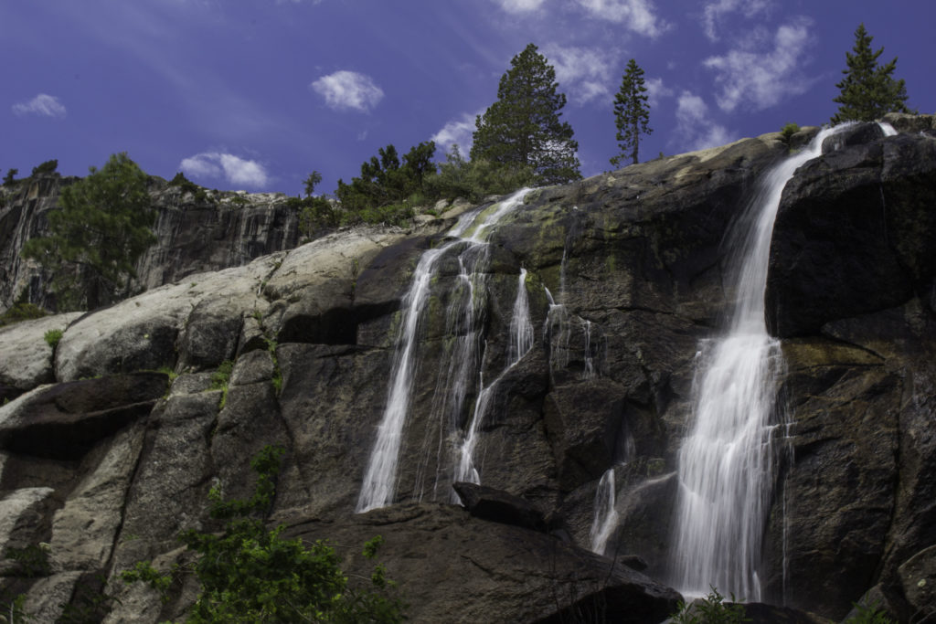
Shirley Creek – Karin and Randy posing in front of one of the numerous waterfalls on Shirley Creek in the Squaw Valley (home of 1960 winter Olympics). The water was really flowing from the heavy snow melt.
.
Shirley Creek – The run off from the heavy snow melt created waterfalls in places I had not seen before.
.
Third Creek Falls – I saw a photo of a waterfall on a tributary of Third Creek that runs through Incline Village on Lake Tahoe so we went looking for it and found this ~20 foot waterfall just a hundred feet from houses in a subdivision.
.
Meiss Meadows Trail – This trail is actually part of the Pacific Crest Trail (PCT) heading north from Carson Pass. Normally we hike north from Carson Pass to see wildflowers and mountain views toward Lake Winnemuca but this area was just melting out of snow so we tried a lower elevation path and were rewarded with excellent views and flowers. The mountain in the background is Round Top Mountain. Meiss Meadows was settled by the Meiss (pronounced (Mice) family from Germany and there is still a cabin there from the 1880’s.
.
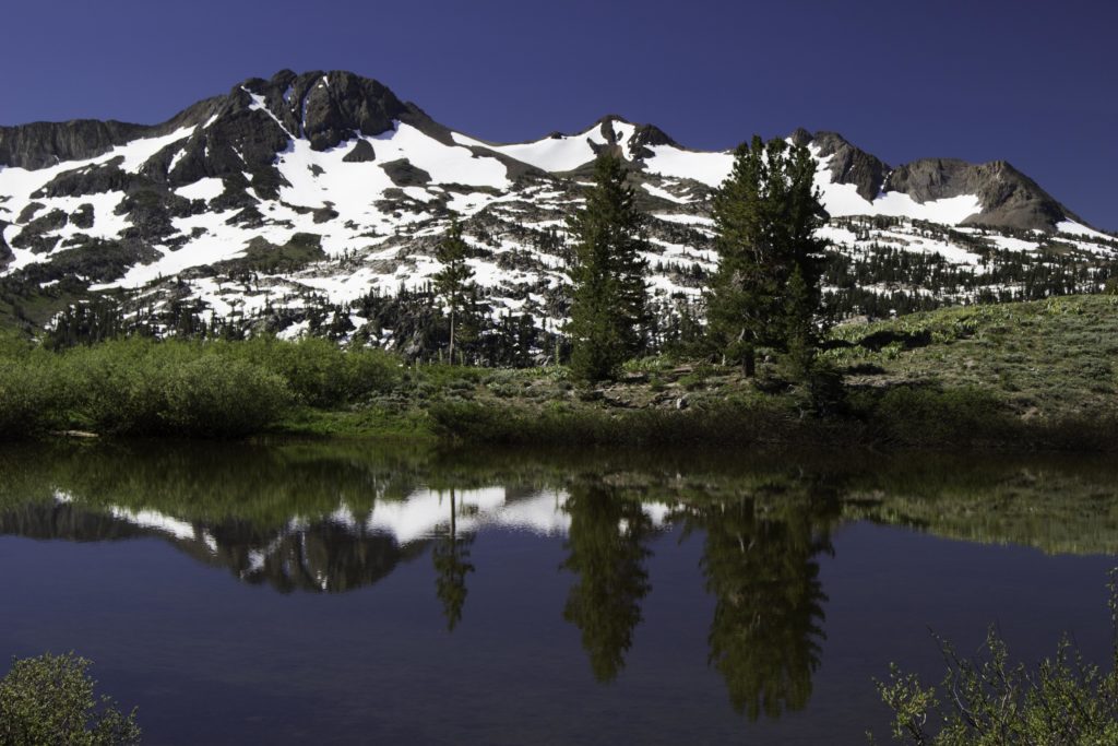
Round Top Mountain – A view of Round Top Mountain from the PCT near Meiss Meadows.
.
Mountain Heather – Toward the end of our stay we found some Mountain Heather (Phyllodoce breweri). In previous years we would find the small bush but rarely any flowers.