
Delicate Arch – Arches Nat Park, Apr 21, 2016
Delicate Arch in Arches National Park with the La Sal mountains in the background. Img 56839 Delicatearch Arches

Delicate Arch – Arches Nat Park, Apr 21, 2016
Randy and Karin after the 1.5 mile trip out to Delicate Arch. You can see the La Sal mountains on the Utah-Colorado border in the distance. Img 56841 Delicatearch Arches

Delicate Arch – Arches Nat Park, Apr 21, 2016
Steve, Margo, and Karin at the base of Delicate Arch. Img 56861 Delicatearch Arches

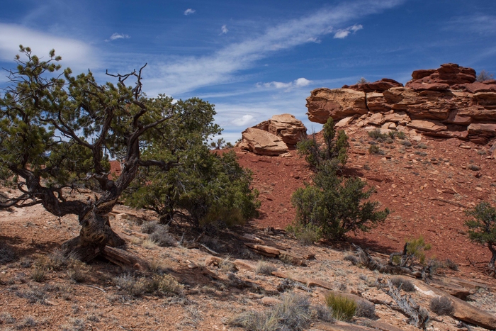
Devil’s Garden Trail – Arches Nat Park, Apr 21, 2016
The sandstone formations in this photo show the stages of how arches are formed. In the center in the distance right below the La Sal mountains, you can see horizontal layers of sandstone that are being eroded from cracks in the sandstone into free standing walls (like the closer one on the left). The wind erosion continues and carves out the center of the wall creating the arch. Erosion eventually wears away the columns and the top of an arch and then it falls. Img 56924 Devilsgarden Arches

Landscape Arch – Arches Nat Park, Apr 21, 2016
Landscape Arch has the longest span in Arches Nat Park (290ft) and can be reached on the Devil’s Garden trail. The commercial jet provided the vapor trail over the arch. Img 56941 Landscapearch Arches2

Corona Arch, Apr 22, 2016
The Corona Arch is on BLM land outside Moab and can be reached on a 1.5 mile trail. The arch is about 140 feet across by 105 feet high. To give you a sense of scale, this photo has a person with a red shirt standing under the arch toward the left side. You can find a photo on the internet of a small plane flying through the arch in the 1980’s (presume it was actually done) Img 57061 Moab Blm Coronaarch
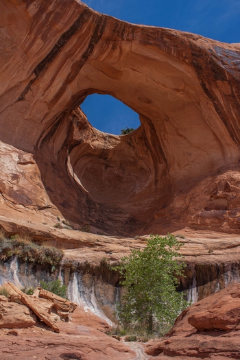
Bow Tie Arch, Apr 22, 2016
Bow Tie Arch is next to Corona Arch and reached by the same trail. Img 57033 Moab Blm Bowtiearch2
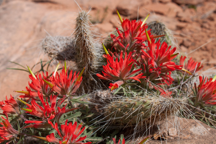
Sliprock Paintbrush, Apr 22, 2016
Sliprock Paintbrush (Castilleja chromosa) mixed in with prickly pear cactus along the Corona Arch trail. Also known as desert paintbrush. Img 57090 Sliprockpaintbrush Moab Blm Coronaarch

Mesa Arch – Canyonlands National Park, Apr 22, 2016
A view under the Mesa Arch out over Canyonlands and the La Sal mountain range. I had intended to get up and take this as a sunrise photo but could not bring myself to get up that early and drive the hour to get to this spot. Maybe next time. Img 57134 Mesaarch Canyonlands
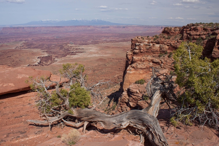
Canyonlands National Park, Apr 22, 2016
A easterly view from the Island in the Sky section of Canyonlands Nat Park. You can see the steep dropoff from the ridge and then a deeper canyon off to the left and the La Sal mountain range on the horizon that is at the border of Utah and Colorado. The hazy sky is from the dust kicked up by the 15-20mph wind we encountered. Img 57156 Canyonlands
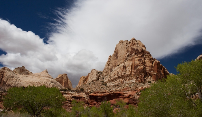
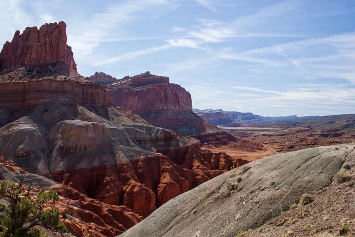
Capitol Reef Nat Park, Apr 23, 2016
Photo from Hwy 24 coming into Capitol Reef from the east. Img 57193 Capitalreef

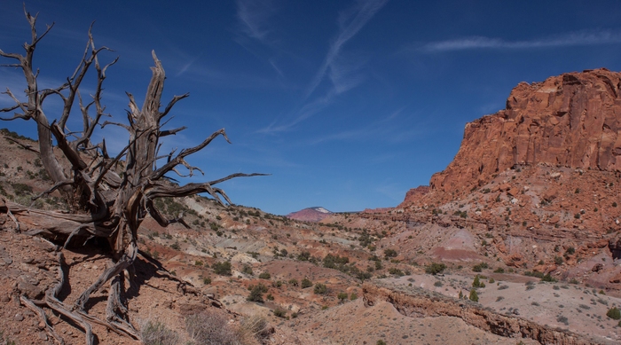
Chimney Rock Loop Trail – Capitol Reef Nat Park, Apr 24, 2016
A view westward from the high point of the Chimney Rock loop trail. Img 57308 Capreef Chimneyrocktrail
Chimney Rock Loop Trail – Capitol Reef Nat Park, Apr 24, 2016
This back side view of the Castle shows the layers of sedimentary rock exposed in Capitol Reef by tectonic uplift: You can see the fractured pink Wingate Sandstone on top above the grey Chinle, above the red Moenkopi formation. Img 57335 Capreef Chimneyrocktrail
Chimney Rock Loop Trail – Capitol Reef Nat Park, Apr 24, 2016
Img 57347 Capreef Chimneyrocktrail
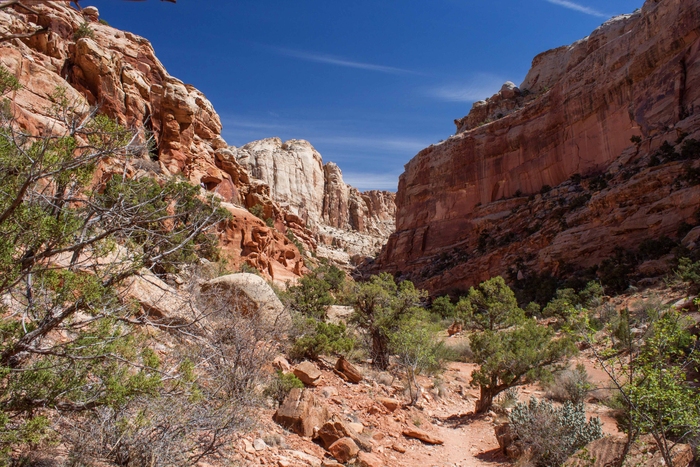
Grand Wash trail, Capitol Reef Nat Park – Apr 24, 2016
One way to get to the Cassidy Arch trail, you have to hike a bit down the Grand Wash trail. This canyon cuts through Capitol Reef from Hwy 24 to Scenic Drive. Img 57371 Capreef Cassidyarchtrail

Cassidy Arch Trail, Capitol Reef Nat Park – Apr 24, 2016
Unusual and colorful rock formations along the Cassidy Arch trail in Capitol Reef Trail. Img 57373 Capreef Cassidyarchtrail
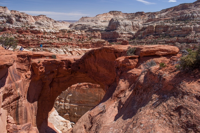
Cassidy Arch, Capitol Reef Nat Park, Apr 24, 2016
Cassidy Arch is about 670feet above the trailhead and spans 133 feet. The arch is named after the infamous Utah native Butch Cassidy, who supposedly hid out in the Capitol Reef area. The arch is quite thick and you can walk across it (I did!). Img 57379 Cassidyarchtrail

Capitol Reef Nat Park – Fruita District, Apr 24, 2016
There is a valley in Capitol Reef National park that once was a Mormon settlement. The valley was sheltered from the wind and had water from the Fremont River. They grew various fruit trees and farmed. The fruit trees are still there and productive. The area was later named Fruita. Img 57416 Capref Fruitadist
Capitol Reef Nat Park – Fremont River Trail, Apr 24, 2016
Img 57442 Capref Fremontrivertrail

Capitol Reef Nat Park, Fremont River Trail, Apr 24, 2016
View back down the trail from near the end of the Fremont River trail. Img 57451 Capref Fremontrivertrail
Links to more photos from this area:
awsome!
love it! (Delicate Arch – Arches Nat Park, Apr 21, 2016″ photo)
Wow! Beautiful pictures.